
All courses held by Research Group Cartography in WS 2013/2014 and SS 2014 are now online at the “current courses” page.
Austrian Map wins in the International Children’s Map Competition
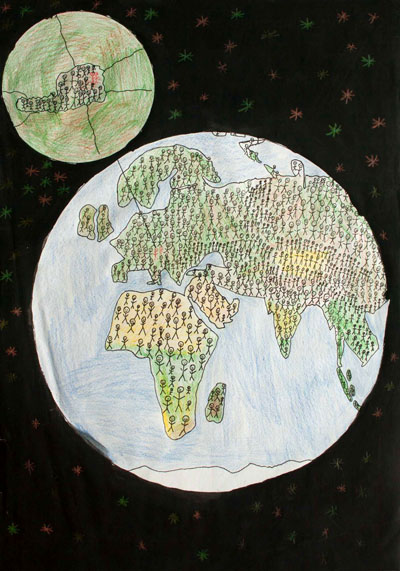
We are happy to inform, that of the five children maps that won in the Austrian round of the Barbara Petchenik Children’s Map Competition and were forwarded to the international round, one was awarded an international prize at the International Cartographic Conference 2013 in Dresden, Germany.
The drawing titled “One Among Many” by Florian Gruber & Lukas Schostal won the 3rd place in the age range 9–12 years. Find all details at the Austrian Petchenik Competition website [in German].
The Austrian round of the Petchenik Competition is organized by Eszter Simonné-Dombóvári and the Research Group Cartography in cooperation with the Austrian Cartographic Commission.
This post was automatically fetched from geo.tuwien.ac.at. Please find the original here.
Ph.D. defense of Haosheng Huang

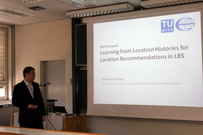
Today, our colleague Haosheng Huang successfully defended his PhD research on the topic of
Learning from Location Histories for Location Recommendations in LBS.
His supervisors were Prof. Martin Raubal from ETH Zurich and Prof. Gartner from our Research Group Cartography. Prof. Pfeifer chaired the examination committee.
Congratulations, Dr. Huang!
This post was automatically fetched from geo.tuwien.ac.at. Please find the original here.
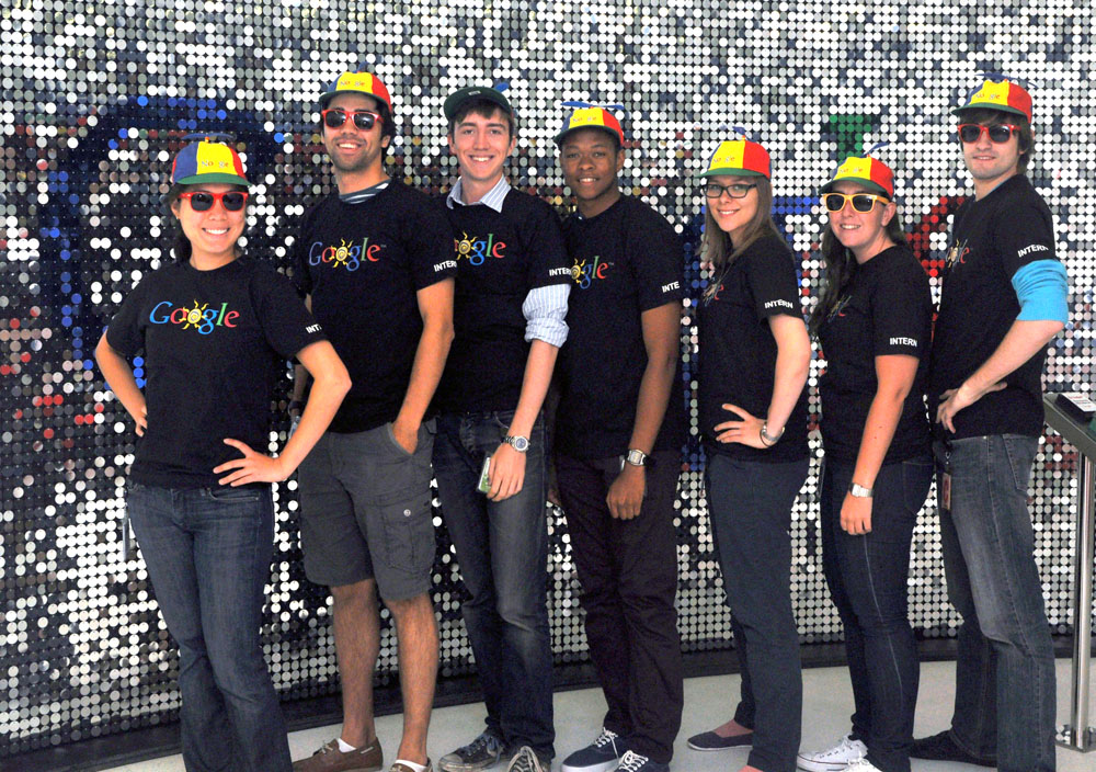
Veronika Priesner bei Google
Veronika Priesner schreibt gerade an Ihrer Bachelorarbeit in der Kartographie.
Dazu befindet sie sich in einem Internship bei Google in London (im Foto Dritte von rechts).
CartoTalk Martin Raubal
We invite you to a CartoTalk by Martin Raubal from the Swiss Federal Institute of Technology on the topic of
Mobile eye tracking for spatial research
Eye tracking has been employed to study people’s visual attention in areas such as psychology or marketing. Interest in eye-tracking technology is also growing in GIScience, for example, when investigating users’ interaction with maps and GIS. In this talk I will introduce the new technology of mobile eye tracking, which allows for a more flexible deployment, such as in outdoor environments. We have used mobile eye tracking both for the combined tracking of an individual’s gaze and position in a spatial reference system to investigate people’s wayfinding behavior, as well as for recognizing their activities on cartographic maps. Our studies demonstrate how such approach can help to tackle research questions on spatial problem solving in novel ways.
Friday, 20 September 2013, 14:00
Research Group Cartography
Erzherzog-Johann-Platz 1, 1040 Wien
Martin Raubal is Professor of Geoinformation-Engineering at the Swiss Federal Institute of Technology Zurich. He was previously Associate Professor and Vice-Chair at the Department of Geography, University of California, Santa Barbara, and Junior Professor at the University of Münster. Martin received his Ph.D. in Geoinformation from Vienna University of Technology in 2001 with honors. He holds a M.S. in Spatial Information Science and Engineering from the University of Maine and a Dipl.-Ing. in Surveying Engineering from Vienna University of Technology. Martin’s research interests lie in the areas of mobile GIS & LBS, spatial cognitive engineering, mobile eye-tracking, and GIS for renewable energy analysis. His teaching includes courses on GIS, cartography, geovisualization, location-based services, temporal aspects of GIS, spatial cognition and wayfinding, and research methods. Martin is currently a council member of AGILE (Association of Geographic Information Laboratories in Europe) and was a board member of UCGIS (University Consortium for Geographic Information Science) from 2008-11. He serves on the editorial boards of Transactions in GIS, Journal of Location Based Services, Journal of Spatial Information Science, and Geography Compass. He has authored and co-authored more than 90 books and research papers published in refereed journals and conference proceedings.
This post was automatically fetched from geo.tuwien.ac.at. Please find the original here.