Season’s Greetings from the Research Group Cartography

Dear friends and colleagues, we would like to thank you for the pleasant collaborations in 2015. We are looking forward to working with you in the upcoming year! Our best wishes for a pleasant holiday season and a prosperous New Year!

christmas_2014
Happy holiday wishes from Haosheng, Florian, Manuela, Violet, Georg, Wangshu and (not in this picture) Edith!

Master thesis presentation on 16.12.2015

On December 16, Francisco Daniel Porras Bernárdez, student of the International Master of Cartography (3rd intake), presented his master thesis on the topic of “Extraction of user’s stays from GPS logs: A comparison of three spatio-temporal clustering approaches”. His presentation is accessible online here.

Haosheng Huang, Francisco Daniel Porras Bernárdez and Georg Gartner after the master presentation


200 cartographers will meet in Vienna

eurocarto_logoNext week will be a very busy week for our Research Group: We will host the 1st ICA European Symposium on Cartography (EuroCarto). From Tuesday to Thursday participants can expect a dense program of cartographic input. Feel free to scroll through the program on eurocarto.org.

Just before the conference, a meeting of representatives of the International Cartographic Association (ICA) will take place at TU Wien. All ICA commission chairs are invited to join and plan their activities for the next years. This will also include a meeting of the Working Group on the International Map Year (IMY).

On Wednesday, the consortium of the Cartography M.Sc. programme will meet to discuss the future of the Erasmus+ Erasmus Mundus Joint Master Degree.

genderatlas.at ist online!

genderAtlas logo

Seit Sommer 2013 arbeitet unsere Forschungsgruppe an dem Projekt genderATlas – einem interaktiven Onlineatlas zur Visualisierung geschlechterdifferenzierter Daten für Österreich. Am 22. Oktober fand die Fachtagung “Warum Gleichstellungspolitik einen genderATlas braucht” statt, in deren Rahmen der finale Prototyp des genderATlas veröffentlicht wurde.

In derzeit 13 Karten werden verschiedene Themen aus den Bereichen Arbeit, Bildung, Mobilität, Politik und Gesellschaft aufbereitet, darunter beispielsweise …

genderatlas-karten

Federführend für die technische Umsetzung des genderATlas war Florian Ledermann. Die im Rahmen des Projekts entwickelte API mapmap.js wurde auf der International Cartographic Conference in Rio im Sommer diesen Jahres vorgestellt [Paper].

genderATlas ist eine Kooperation der Forschungsgruppe Kartographie der TU Wien (Projektleitung, technisch-kartographische Umsetzung) mit dem Institut für Geographie und Regionalforschung der Universität Wien (Inhaltliche Aufbereitung und Evaluierung) und der ÖIR Projekthaus GmbH (Datenpool und Betriebskonzept). Das Projekt wurde im Rahmen der Programmlinie FEMtech Forschungsprojekte des BMVIT gefördert.

Wir freuen uns über das enorme Medienecho, u.a. von ORF Science, ö1 Mittagsjournal, Kurier und dieStandard.

Summary: Over the last two years, the Research Group Cartography worked on project genderATlas – an online atlas of Austria that visualizes data about the life situations of women and men in their regional distribution in an innovative and easily accessible way. The final prototype was published on October 22 at genderatlas.at (German only).

Great student projects, summer semester 2015

After a busy summer semester we would like to showcase a selection of extraordinary projects from the classes Webmapping, Multimedia Cartography, Project Map Creation and Applied Cartography:

Indy Wien Map Guide by Myles Cook, Project Map CreationHiking map for Brdy Hills by Vlach Pavel, Project Map Creation

Tombstone Territorial Park Map by Allie Strel, Project Map Creation

Typographic Map of Vienna by Shuoyan Huang, Project Map Creation

Prater Running Map by Aleksandra Draksler, Project Map Creation

Thematic Map about Vorderland-Feldkirch by Lisa Ertl, Applied Cartography

A huge thanks to all students for their hard work! Enjoy the summer.

Projects from earlier semesters can be found here: summer 2014 | winter 2014 | 2013 | 2012

Farewell to the fourth intake of the International Master on Cartography

The fourth intake of the International Master Programme on Cartography has finished the “Vienna Semester” and is now heading to TU Dresden for the third semester. We organized a farewell session to review the semester and to showcase results of their hard work in this semester. 

farewell_intmaster3

Exhibition of the semester results

farewell_intmaster4

We wish them all the best!

To find out more about the International Master in Cartography, please visit cartographymaster.eu.

CartoTalk Wilhelm Berg: New developments in webmapping with Mapbox

We were very happy to host a CartoTalk by Wilhelm Berg, developer at Mapbox

mapbox

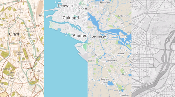
Abstract: Mapbox is a service provider offering map tiles – similar to Google, Microsoft or Apple. However, Mapbox puts a lot of focus on making it easy for developers to design custom maps for the web or mobile.

Mapbox is based on open data (OpenStreetMap) and open software, which is available on Github. Currently, over 470 repositories are offered, which cover a broad spectrum of functionalities from mapbox.js (based on Leaflet), to iOS C++ SDK, Android C++ SDK and Mapbox Studio (map design tool).

The talk will introduce some of the innovative solutions, which are created and published based on this, such as a cloudless atlasLandsat liveMBTiles specificationsUTFGrid specifications and vector tile specifications.

Being a geographer and hydrologist by education Wilhelm Berg has used and programmed GIS since day one of his studies at university. For his company BergWerk GIS he has developed big data solutions ranging from desktop to web and mobile. Since 1,5 years he is partnering with Mapbox to ensure key Mapbox tools (mapnik, osmium, OSRM, Mapbox Studio, …) deliver the same performance and stability on Windows as on other operating systems.

Presentation file

Wednesday, 17 June 2015, 15:00
Forschungsgruppe Kartographie
Seminarraum 126

CartoTalk David Fairbairn: Archaeological landscape characterisation using LiDAR data

We are happy to invite you to a CartoTalk by our guest professor David Fairbairn from Newcastle University. The CartoTalk is organized in conjunction with the research seminar of the Research Group Photogrammetry.

Archaeological landscape characterisation using LiDAR data

Abstract: The contemporary availability of high-resolution, high-accuracy digital terrain models sourced from LiDAR data collection exercises has allowed archaeologists and other landscape scientists to examine landscapes of interest in more detail and in a more quantitative manner.  This talk describes some initial examination of human-influenced (i.e. disturbed) landscapes in northern England from various periods in history, with reference to LiDAR-sourced data, and speculates whether it will be possible to use further non-geometric characteristics of the LiDAR data to derive additional information about such landscapes.  The methods of representation of such disturbed landscapes are also considered.

David Fairbairn has been employed by the Newcastle University since 1978. A wide variety of geospatial data handling issues have been of research interest over that period, including the structuring and presentation of terrain data, the quantification and use of indices of map complexity, the effective visualisation of map designs, the linkage between mapping and navigation, and issues connected to crowdsourcing and cartographic requirements for SDIs.

Tuesday, 26 May 2015, 14:00, Seminar room 122
Gusshausstraße 27-29, 3rd floor, wing CC