Below is a list of possible topics for bachelor’s and master’s theses from our group. In case of interest, please contact the underlined supervisor.
Master: Kartenproduktion mittels unterschiedlicher GIS/DTP-Workflows
Die Anforderungen eines qualitativen Kartenerstellungsprozesses (z.B. für Wander- und Freizeitkarten großen und mittleren Maßstabes) erfordern derzeit noch den Einsatz unterschiedlicher Tools aus GIS- und DTP-Systemen. Mit einem österreichischen Kartenverlag sollen unterschiedliche Vorschläge zur Erhöhung der Effizienz im Produktionsablauf für kartographische Bearbeitungsprozesse erarbeitet werden.
- Besondere Kenntnisse: Vorkenntnisse kartographischer Desktop Publishing Software (lllustrator, OCAD), GIS-Software (ArcGIS) von Vorteil
- Besondere Erfordernisse: enge Verknüpfung mit einem oberösterreichischen Kartenverlag
inkl. eventuellem Aufenthalt erwünscht
- Betreuer: Gartner, Schmidt
Bachelor: Erstellen eines Basiskartenstils nach Vorlage einer bestehenden Karte
Die Stile einer bestehenden Basiskarte sollen zunächst systematisch erfasst (z.B. mit Hilfe von ScaleMaster-Tabellen) und im Anschluss mit OpenStreetMap-Daten umgesetzt werden.
- Besondere Kenntnisse: Erfahrung mit OSM und Webmapping-Kenntnisse von Vorteil
- Betreuer: Gartner, Schmidt
Bachelor: Vergleich frei verfügbarer Verwaltungsgrenzdatensätze
Mittlerweile gibt es eine Reihe frei verfügbarer Grenzdatensätze für Österreich. Von dem weltweit verfügbaren Datensatz Natural Earth über verschiedene aus OpenStreetMap abgeleitete Geometrien, bis hin zu Datensätzen aus administrativen Quellen (BEV, Länder-GIS). In der Arbeit sollen die Unterschiede der Datensätze (Qualität, Aktualität, Lizenz, Provenienz, Verfügbarkeit von Metadaten) herausgearbeitet und einfach verständlich unter CC-Lizenz aufbereitet werden.
- Betreuer: Gartner, Schmidt, Ledermann
Master: Indoor route planning
Route planning is a basic element in navigation, and aims at computing an optimal route between an origin and a destination. Current indoor route planners often provide users with shortest routes. This research will explore methods to provide routes with other characteristics, such as simplicity and fewest-turns. The main building of TU Wien (or other similar public places) will be used as a test area.
- Requirements: Interests in data modelling and analysis
- Supervisor: Gartner, Huang
Master: Indoor semantic wayfinding
Currently, semantic-enriched navigation systems become more and more popular. Instead of providing metric-based route instructions such as “walk straight in 100 meters”, semantic-based navigation systems provide users with semantic-enriched instructions, such as “walk straight, pass the theatre, and walk to the crossing” or simply “cross the park”. This kind of guidance is more natural to users, and can improve users’ navigation performances. However, current literature only addresses semantic wayfinding for outdoor environment, while the applications in indoor environment have not been approached. This research aims at answering some fundamental questions of indoor semantic wayfinding , such as “what is an indoor landmark?” and “what are the direction and motion concepts used in indoor naivgation?” Methodology and approaches (mainly, field user study) from our previous research project SemWay (mainly for outdoor, refer to the following papers for more details) will be reused for indoor environment. The answers to these fundamental questions can be assembled to build semantically enriched indoor navigation systems.
- Requirements: Interest in empirical user studies
- Supervisor: Gartner, Huang
Master: Diagrammatic Maps from OpenStreetMap Data
Rendering diagrammatic and small-scale maps, like depictions of country-wide road or railway networks, requires the generalization of overly detailed geometry as well as the consistent reproduction of network topologies of large geographic extent. In contrast to these requirements, data created in volunteered geographic information (VGI) systems like OpenStreetMap exposes a high level of local geometric and semantic detail, large individual differences in data annotation styles and fragile topological integrity.
The goal of this project is to develop methods for extracting the necessary information to create high-quality diagrammatic & schematic maps from VGI data, to identify relevant use cases and their specific requirements (e.g. road, rail, river networks), to review the literature for suitable approaches and to suggest guidelines for the volunteered geographic information community to improve the data to better support such representations if necessary.
- Requirements: Scripting/Programmierung, OpenStreetMap-Erfahrung von Vorteil
- Supervisor: Gartner, Ledermann
Master: NutzerInnen-Test linearer Zeit-Kartogramme
Im Gegensatz zu Isochronen sind lineare Kartogramme eine selten angewandte kartographische Methode. Mittels NutzerInnen-Test sollen die Stärken und Schwächen der Methode im Vergleich zur Isochronen-Darstellung ermittelt werden.
- Besondere Kenntnisse: Interesse an empirischen NutzerInnen-Studien, Programmierkenntnisse von Vorteil
- Besondere Erfordernisse: hohe Eigeninitiative
- Betreuer: Gartner, Schmidt


 The
The 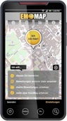 EmoApp (Beta) for Android smartphones and tablet PCs is a on-site tool for reporting your subjective evaluation of the environment. It is part of the BMVIT funded research project