
Our PhD student had his successful defense of his PhD – congratulations!
CartoTalk Michael Peterson
We are happy to inform that on 21 June 2011, Michael Peterson from the University of Nebraska at Omaha will give a CartoTalk entitled
The Internet! Is that thing still around? Core concepts for modern cartography
Please find the English abstract in the invitation pdf [the presentation will be held in German].
This post was automatically fetched from geo.tuwien.ac.at. Please find the original here.
Photos of field course 2011 online
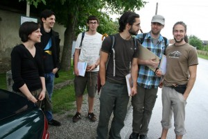 Check out the photo gallery to see our students in the fields.
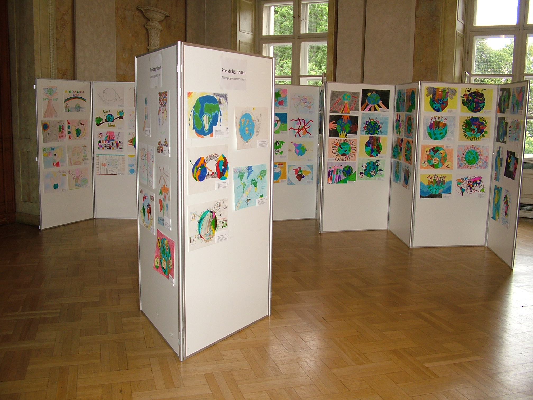
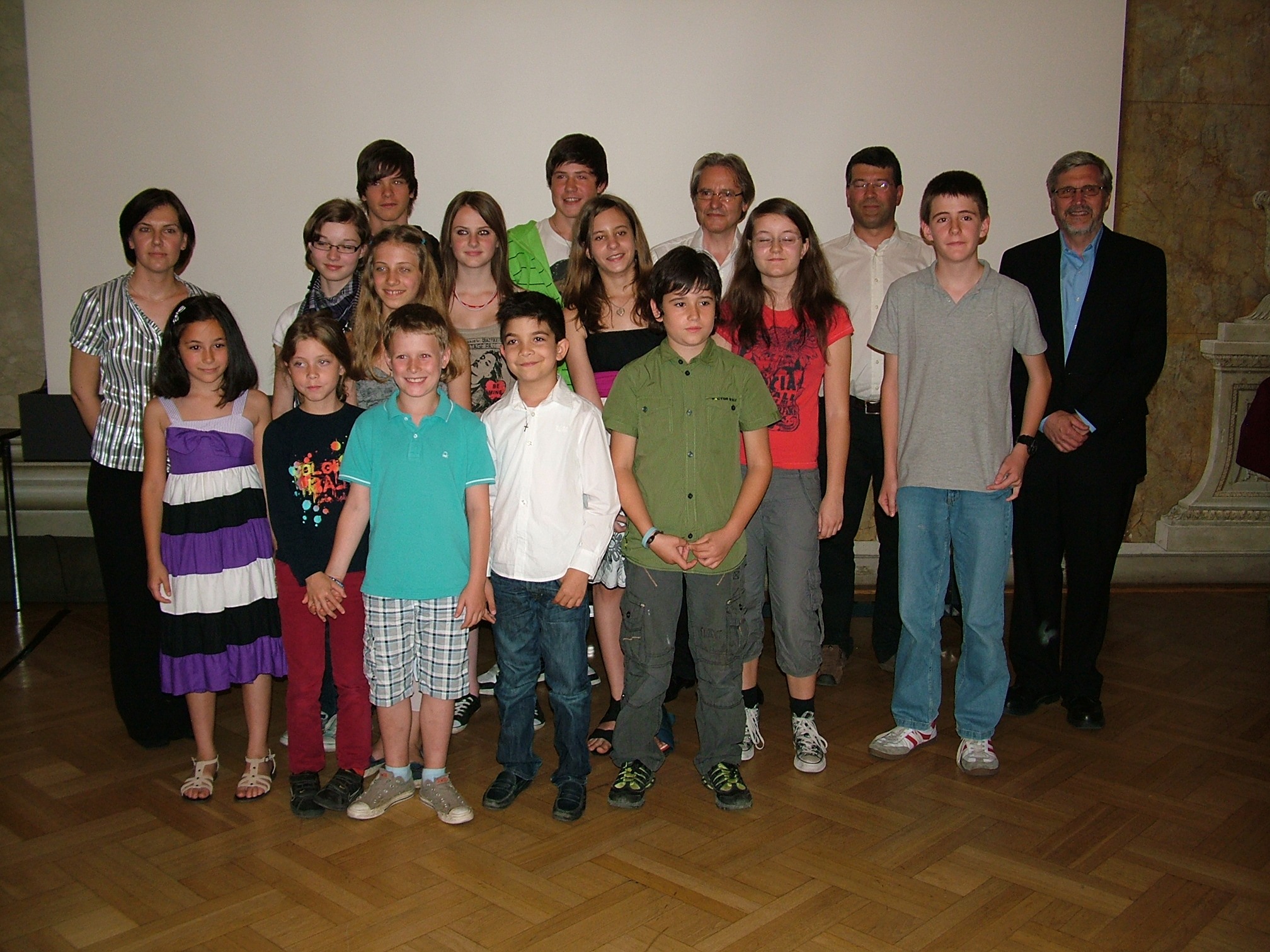
Preisverleihung des Barbara-Petchenik-Wettbewerbs in Österreich 2011
Preisverleihung des Barbara-Petchenik-Wettbewerbs in Österreich 2011 fand am,18. Juni 2011 statt – finden Sie alle Details und Fotos auf der Wettbewerbs-Seite!
CartoTalk Liu Liu
We are happy to inform that on 15 June 2011, Liu Liu from TU Delft will give a CartoTalk entitled
3D indoor “door-to-door” navigation approach to support first responders in emergency response
Please find the abstract in the invitation pdf.
This post was automatically fetched from geo.tuwien.ac.at. Please find the original here.
CartoBusinessTalk with OCAD
There will be a CartoBusinessTalk with OCAD on 10 June 2011.
CartoBusinessTalk with Tupalo
There will be a CartoBusinessTalk with Tupalo on 26 May 2011.
CartoBusinessTalk with Nokia Maps
There will be a CartoBusinessTalk with Nokia Maps on 10 May 2011.
Workshop-TeilnehmerInnen gesucht
Das Projekt EmoMap untersucht die emotionale Raumwahrnehmung von FußgängerInnen und sucht dafür noch TeilnehmerInnen für einen Fokusgruppenworkshop
am Donnerstag, dem 5. 5. 2011 von 16 bis 17:30,
im Seminarraum 126 (4, Gußhausstraße 30, 1. Stock).
Voraussetzung ist, dass die TeilnehmerInnen gelegentlich zu Fuß unterwegs sind und somit gewisse Stadtteile Wiens als FußgängerInnen kennen.
Bei Interesse und für weitere Informationen kontaktieren Sie bitte Silvia Klettner unter silvia.klettner@tuwien.ac.at oder +43-1-58801-12617.
CartoTalk Peter Mooney
We are happy to welcome Peter Mooney of the National University of Ireland, Maynooth for a CartoTalk:
Volunteered Geographic Information (VGI):
A source of spatial data for Location-based Services (LBS)?
The ubiquity of location-based services (LBS) has created an exciting and rapidly evolving confluence of: GIS, web application programming, mobile cartography and user interfaces, and computer networking. As a consequence the amount of Volunteered Geographic Information (VGI) available on the Internet today has grown enormously in the past few years. Initiatives such as Wikimapia, Google Mapmaker, OpenStreetMap (OSM), geotagging in Flickr, geolocation in Twitter, Geonames, etc have seen VGI become a “hot topic in GIS research” (Mooney et al, 2010). VGI (such as OSM) has begun to to provide interesting and feasible alternatives to traditional authoritative spatial information from National Mapping Agencies and corporations. However VGI, as a spatial form of user-generated content in Web 2.0, has raised serious concerns and reservations within the GIS, Geomatics, and Cartography communities surrounding its quality, accuracy, sustainability, and fitness for use/purpose (Mooney et al, 2010). Keßler et al (2009) Compared to other projects building on user contributed content, such as Wikipedia, VGI remains on “the GIS periphery” (Keßler et al, 2009), has been restricted to web-based mapping applications (Haklay, 2010), and not considered for involvement in “serious geomatics applications” (Over et al, 2010). This talk will investigate, using OSM as a case-study, if VGI can support the geospatial data/content requirements of todays and tomorrow’s LBS. Raper et al (2007) stress that “one key function that is rarely discussed in LBS is geospatial content management” and subsequently classify it as an urgent research need. Khurri and Luukkainen (2009) argue that spatial data vendors must, to gain competitive advantage in the marketplace, supply accurate, timely, and relevant content to consumers in dynamically changing environments. Through a statistical analysis of the history of user contributions to OSM databases this talk will highlight the advantages and disadvantages of VGI for LBS. Our conclusions indicate that VGI will need to introduce improved management of contributions and contributors to prevent its spatial data moving indefinitely between a status of good and bad quality. The presentation will close with some thoughts on the future for management of geospatial data and associated content for LBS.
Friday, 15 April 2011, 3.00 pm
Seminarraum 126
Research Group Cartography
Erzherzog-Johann-Platz 1, 1040 Vienna
Invitation as PDF
Presentation slides as PDF
This post was automatically fetched from geo.tuwien.ac.at. Please find the original here.