Ass.Prof. i.R. Dipl.-Ing. Dr.techn.
E-mail: mirjanka.lechthaler@tuwien.ac.at
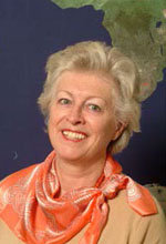
Mirjanka Lechthaler (born in Zagreb/Crotia) has been Assistant Professor at the Research Group of Cartography at the Vienna University of Technology since 1999, where she teached basic and advanced courses in analogue, digital and web cartography. She finished her graduate qualifications in Geodesy and Cartography at the University of Zagreb. She was a member of the Working Committee on Equal Opportunities. Retired in 2011.
Research interests
- topographic and thematic modelling
- interactive and multimedia cartographic information systems
- cross media publishing
- decision support system
Lebenslauf
- 1966-1972 Studium der Geodäsie an der Geodätischen Fakultät (GF) der Universität Zagreb
- 1972 Diplom-Ingenieur der Geodäsie, GF der Universität Zagreb
- 1975 Magister der Informatik, Universität Zagreb
- 1985 Doktor techn. der Geodäsie/Kartographie, Universität Zagreb
- 1972–1985 Univ. Ass.am Inst. f. Kartographie und Reproduktionstechnik der GF, Univ. Zagreb
- 1990–1999 Univ. Ass. am Inst. f. Kartographie und Geo-Medientechnik, TU Wien
- seit 1999 Ass. Prof. am Inst. f. Kartographie und Geo-Medientechnik, TU Wien
Forschung (seit 2000)
Forschungsbereiche
- Grundfragen der Kartographie (Kartosemiotik 2003, GIS Croatia 2004, KG 2004)
- Kartographische Generalisierung (KN 98, VGI 98, KN b99, CJ 99 )
- Atlas Kartographie / Thematische Kartographie – (FWF Projekt “Raum und Gesellschaft”- Atlas Kartenwerk Austria, GIS CROATIA 2000, IGW 2001; ÖROK Projekt “ÖROK Atlas Online” – IGW 2005, GIS CROATIA 2005, AGIT 2005, ICC 2009)
- Datenqualität (DKT 98, KN 98, CORP’99, KN 99, GM 00)
- Interaktivität in der Kartographie (GIS CROATIA 2000, AGIT 2001, GIS Polonia 2001, IGW 2003, MÖGG 2009, MÖGG 2010)
- Multimedia-Cartography: FTW Projekt – “UMTS Application Development – Service Presentation and Interactive Human-Interface” Kartographische Applikation für mobile handheld devices (AGIT 2001, GM 2002, GIS CROATIA 2002, IGW 2003, GL 2004)
- Bildschirmgerechte kartographische Visualisierung (AGIT 2005, CORP 2006, AGIT 2006, MKT 2006)
- Formalisierung der Signaturierung im Atlas IS (GIS Croatia 2006, AGIT 2007, ICA 2007 )
- Geschichte der Kartographie (KiG 2007, Art&Cartography 2008, ICC 2009)
- Entscheidungsunterstützende Systeme und Kartographie (AGIT 2008, CORP 2008, MÖGG 2008, ICA 2009, KiG 2009)
Vorträge/Poster
- XI. Internationale Geodätische Woche, Obergurgl, 2001
- Geodätische Fakultät Gastvortrag, Zagreb, 2001
- AGIT Salzburg, 2001
- GIS POLONIA Warszawa, 2001
- map2web I Hochschullehrgang, Wien-IKgeoM, 2001
- TELEKARTOGRAPHIE , Wien-IKgeoM, 2002
- map2web II Hochschullehrgang, Wien-IKgeoM, 2002
- GIS ODYSEEY Croatia, Split, 2002
- XII. Internationale Geodätische Woche, Obergurgl, 2003
- map2web III Hochschullehrgang, Wien-IKgeoM, 2003
- GIS ODYSEEY Croatia, Trogir, 2004
- Gastvortrag, Geodätische Fakultät, Kroatien, Zagreb, 2004
- XIII. Internationale Geodätische Woche, Obergurgl, 2005
- AGIT Salzburg, 2005
- GIS ODYSEEY Croatia, Opatija, 2005
- Gastvortrag, Geodätische Fakultät, Kroatien, Zagreb, 2005
- CORP Wien, 2006
- AGIT Salzburg, 2006
- MKT (Mitteleuropäischer Kartographentag & 54. Deutscher Kartographentag) Wien, 2006
- Gastvortrag, Geodätische Fakultät, Kroatien, Zagreb, 2006
- AGIT Salzburg, 2007
- Cartography, Geoinformation and the See, Croatia, Zadar, 2007
- Kinderuni, TU Wien, 2007
- ICC Moskau, 2007
- Art&Cartography, 2008
- FIT, TU Wien, 2008
- CORP, TU Wien, 2008
- Kinderuni, TU Wien, 2008
- AGIT, Salzburg, 2008
- FIT, TU Wien, 2009
- Gastvortrag, Universität Zagreb,Faculty of Organisation and Informatics Varazdin, Kroatien, 2009
- Kinderuni, TU Wien, 2009

