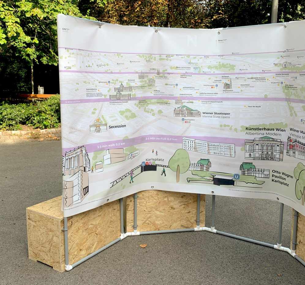
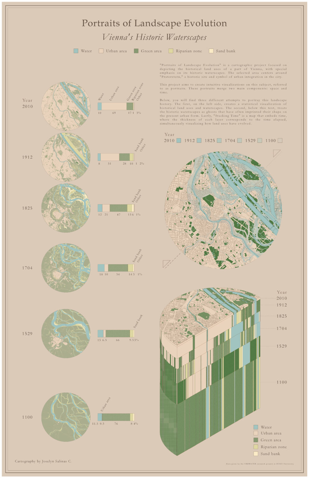
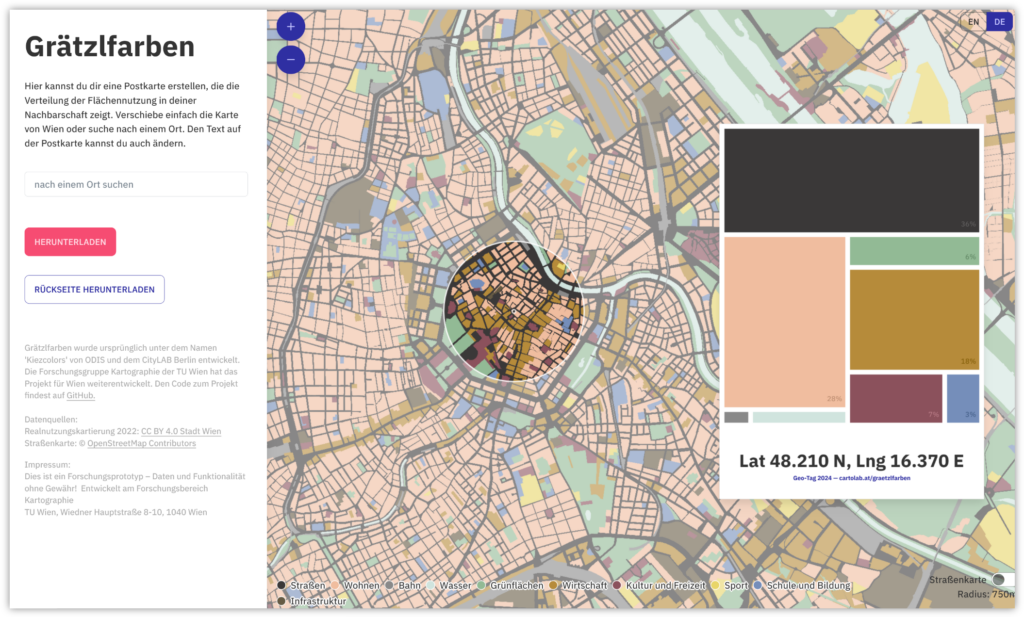
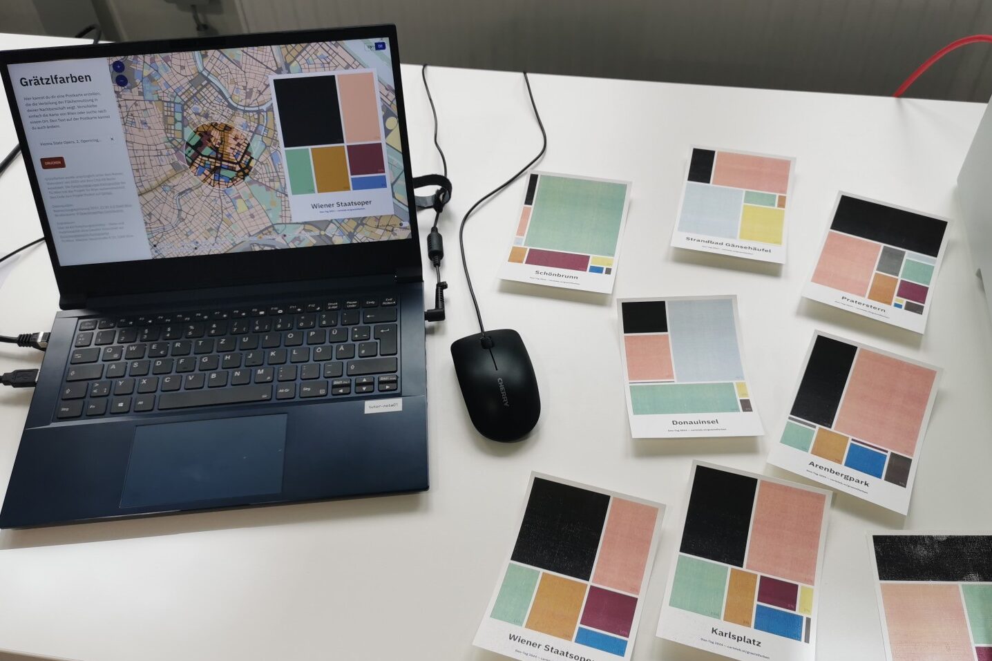
In cities like Vienna, different uses compete for land. But what uses actually take up how much space? And what is the distribution in your Viennese neighbourhood?
In our Grätzlfarben app you can explore the distribution of land use in Vienna and create and print a postcard visualizing the land use in your neighbourhood. The map is based on an open source application by the Berlin-based Open Data Informationsstelle. We have adapted it for Vienna, using open government data from the City of Vienna and giving it a new look with different colours.
We first presented this application at the GEO Day in April this year, the open day of the Department of Geodesy and Geoinformation at the TU Wien, where we talked with school kids about the variety and partiality of maps. Since then, we have continued to develop the application to make it easier to implement for other cities. Our code, like the original code, is published on GitHub and can be adapted to any other city that provides a suitable open dataset. We’re looking forward to seeing Grätzlfarben for your city!
Are you wondering what the title of the project is about? It is directly inspired by the original ‘Kiezcolors‘. Neighbourhoods or small districts in Berlin are called ‘Kiez’, while in Vienna we call them ‘Grätzl’. Since the city-specific application with the colourful postcard format brings the information to a local and large-scale level, we decided to go with this local reference.
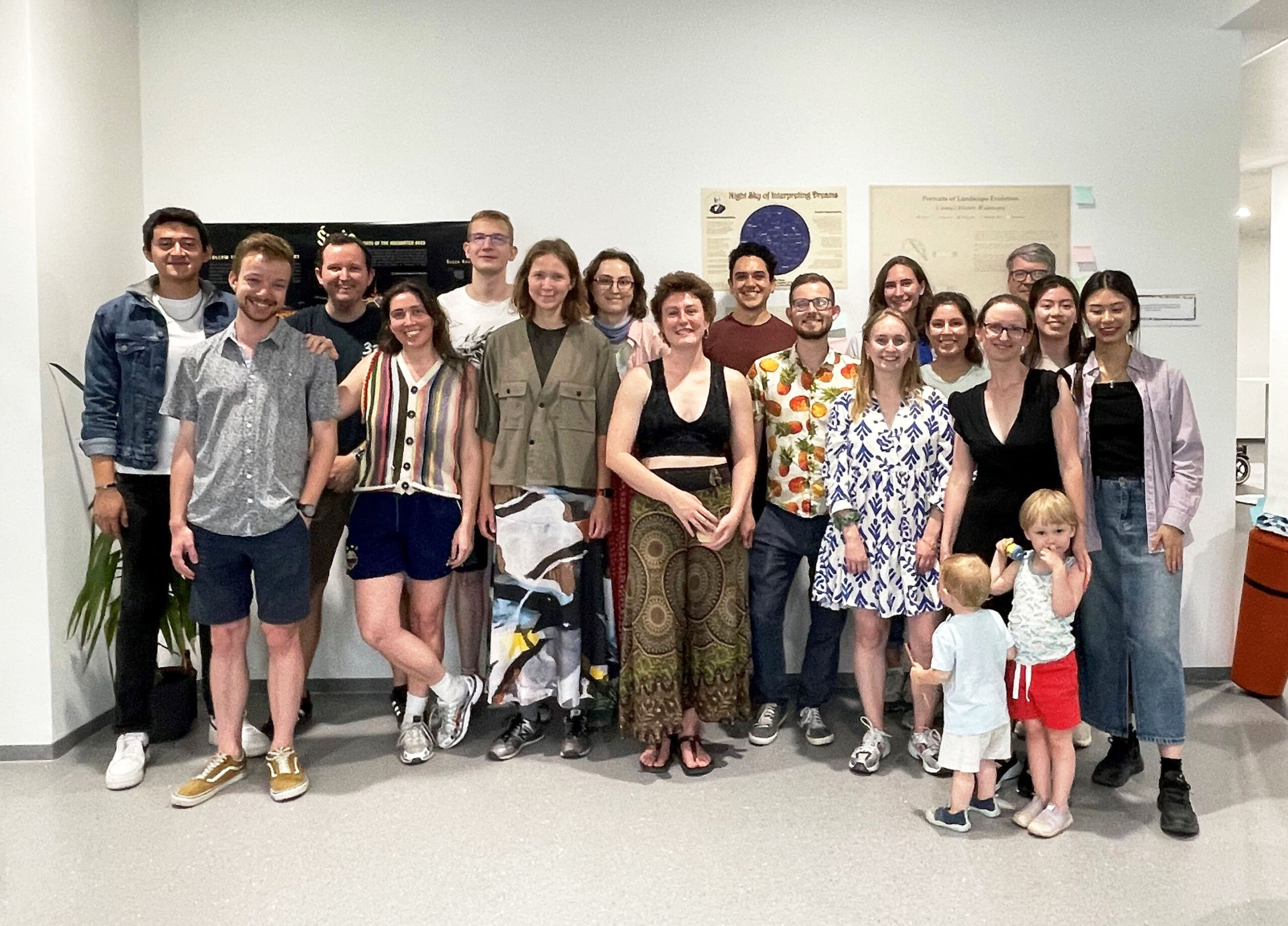
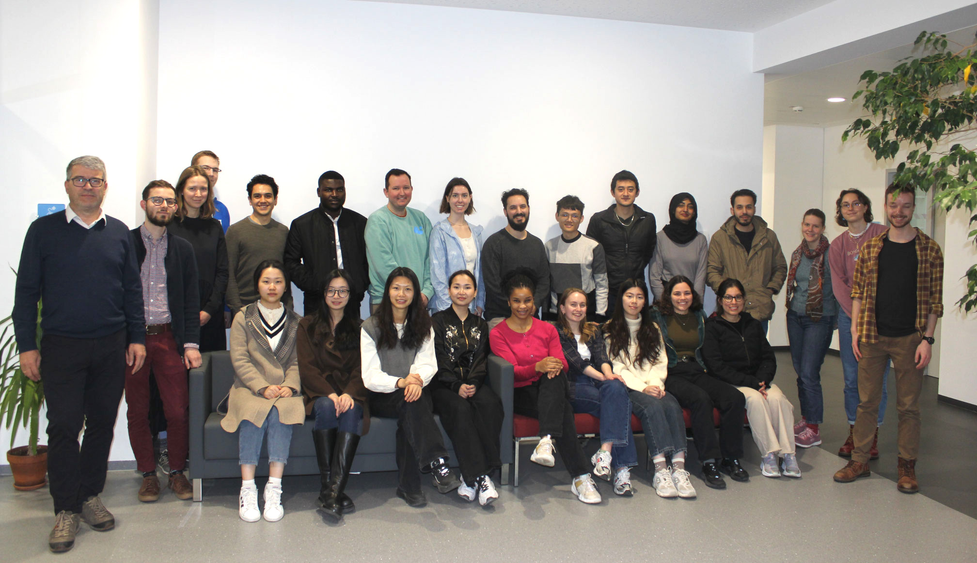
The 28 students of the 13th intake of the International Master in Cartography have finished their second semester here at TU Wien!
We want to thank them warmly for all their hard work, and especially for their boundless creativity. Over the various courses during the semester, they produced maps of a particularly professional quality.
We wish them all the best for their third semester in Dresden, Germany, and look forward to seeing them again soon!
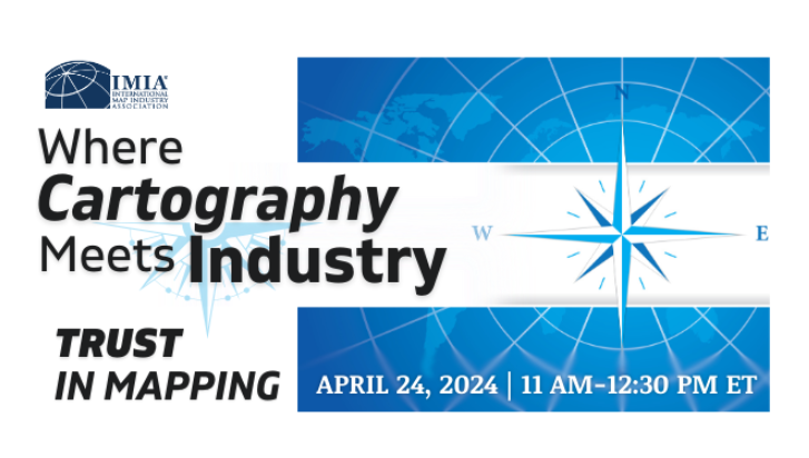
We are happy to announce the online event “Where Cartography Meets Industry – Trust in Mapping,” bringing together leading organizations, including the International Map Industry Association (IMIA), the International Cartographic Association (ICA) with Prof. Georg Gartner, the British Cartographic Society (BCS), and the Cartography and Geographic Information Society (CaGIS).
Join insightful discussions on advancing geo-ethics and exploring strategies to build trust in various aspects of cartography and mapping businesses. The online event is scheduled for April 24, 2024, from 5 to 6:30 PM (CET); admission is free of charge. For further information, visit:https://imiamaps.org/events/wcmi-2024/.
Twenty-eight students from 17 countries will study with us in Vienna for four months. We are very excited to exchange our different perspectives on cartography and to experience Vienna together!
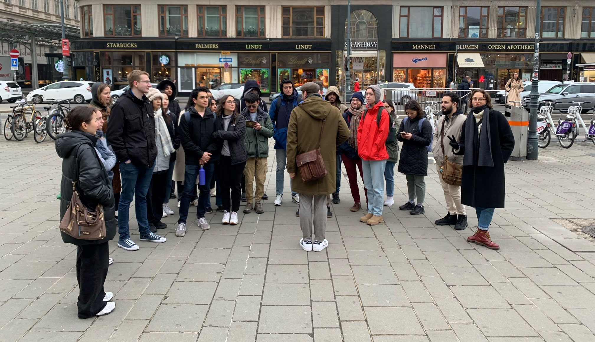
Students of the 13th intake with Prof. Dr. Gartner (left) and the local coordinator, Sacha Schlumpf, MSc (right).City tour with a professional guide, Jan Kepinski.
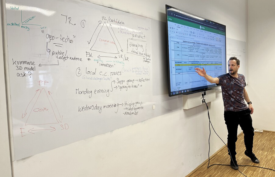
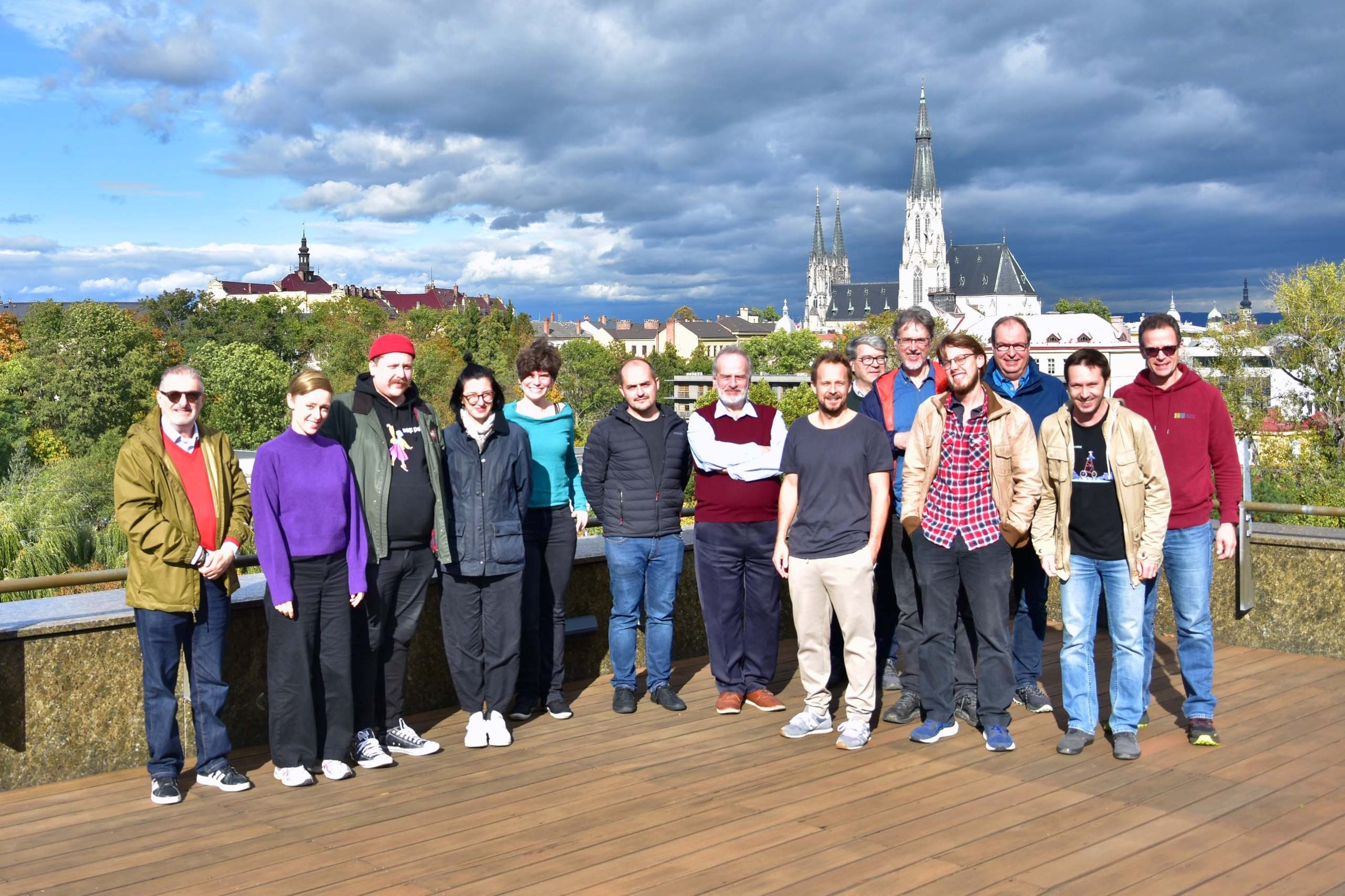
We recently concluded a workshop at TU Wien as part of the Shape2Gether project with all eight project partners. Shape2Gether aims to advance education by integrating geosciences, technology, and serious gaming to address climate change and its effects on Europe. During the workshop, we focused on laying the groundwork for three upcoming summer schools in Norway, Malta, and Germany, preparing to welcome students. Each university partner will send four students to accompany us to each summer school.
We’re looking forward to the first summer school scheduled for May 2024 in Tautra and Trondheim, Norway. The summer school will provide students with an immersive educational experience, including hands-on activities like VR, on-site exploration, and group work as an interdisciplinary, international team.
For more information and updates on the project, visit our project webpage.
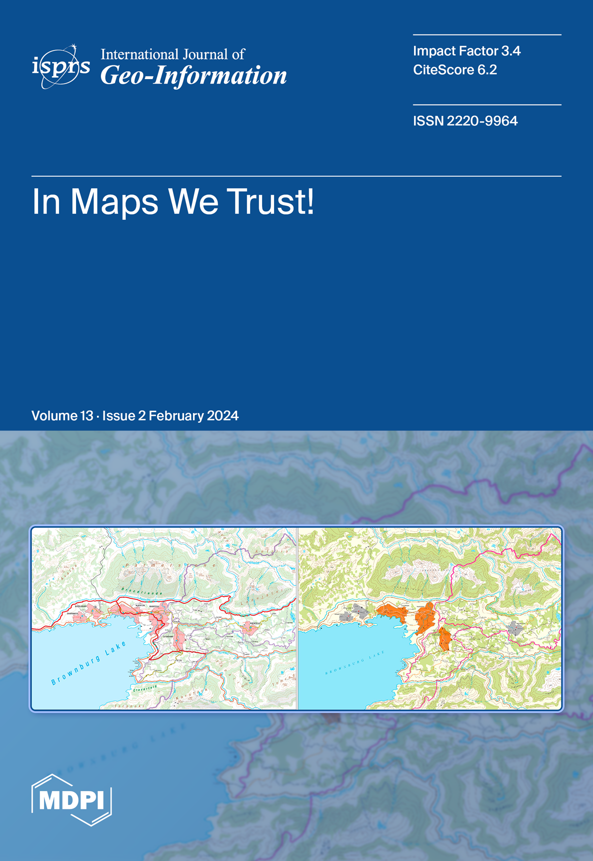
We are pleased to share that the latest issue of the ISPRS International Journal of Geo-Information features an article by Prof. Georg Gartner and his co-authors, Olesia Ignateva, Bibigul Zhunis and Johanna Pühringer, as the cover story.
“Conceptualizing and Validating the Trustworthiness of Maps through an Empirical Study on the Influence of Cultural Background on Map Design Perception” explores how cartographic modelling fundamentally shapes map comprehension and trustworthiness analysis. It also outlines key aspects of map trustworthiness and proposes an epistemological approach to research, demonstrated through an empirical study.
We are very pleased to announce that the European Cartographic Conference EuroCarto 2024, will be held from September 09-11, 2024, at TU Wien in Vienna, Austria. The conference is co-organized by us, the Research Unit Cartography at TU Wien, the International Cartographic Association (ICA) and the German (DGfK), Austrian (ÖKK), Swiss (SGK), British (BCS) and Czech (ČKS) Cartographic Societies.
We aim to bring together Cartographers and those working in related disciplines to offer a platform for discussion, exchange and stimulation of research and joined projects. If you are interested in participating or contributing to EuroCarto 2024, visit our conference website for general information.
We look forward to welcoming you to the beautiful Vienna and celebrating Cartography!
From October 25 to 27, 2023, the three-year EU-funded Erasmus+ project Shape2Gether kicked off in Olomouc, Czech Republic. Managed by Palacký University Olomouc, this project unites institutions and experts across Europe, including the Research Unit Cartography at TU Wien, Ruhr University Bochum (Germany), University of Malta (Malta), Turku University (Finland), Utrecht University (Netherlands) and Lentävä Liitutaulu OY (Seppo gamification platform) (Finland).
The core objective of this project is to explore and implement educational methods for sustainable development, with a particular focus on addressing the challenges presented by climate change and its effects on Europe. It does so by uniting three distinct areas of expertise: geosciences, new technologies, and serious game design. The ultimate aim is to establish a forward-thinking international master’s program in the following years.
We are very happy to be a part of this innovative project!
Shape2Gether project team at the kick-off meeting in Olomouc
Three students from the 11th intake of the Cartography Master’s program have recently successfully defended their master’s theses at our research unit.
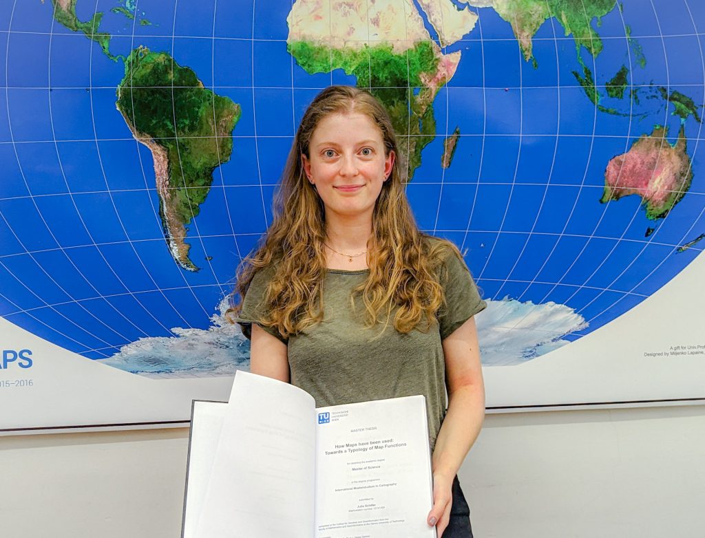
Moreover, celebrating the defence of our programme’s 200th graduate, Julia Schiller, was a special occasion. She defended the thesis on the topic “Typology of Map Functions” under the supervision of Prof. Georg Gartner.
Oskar Baumann introduced his thesis “The Nuances of Mapping Street Art – Developing a Web Map for Interactive Graffity Exploration”. His supervisors were Benjamin Wild and Prof. Norbert Pfeifer from the Research Unit Photogrammetry.
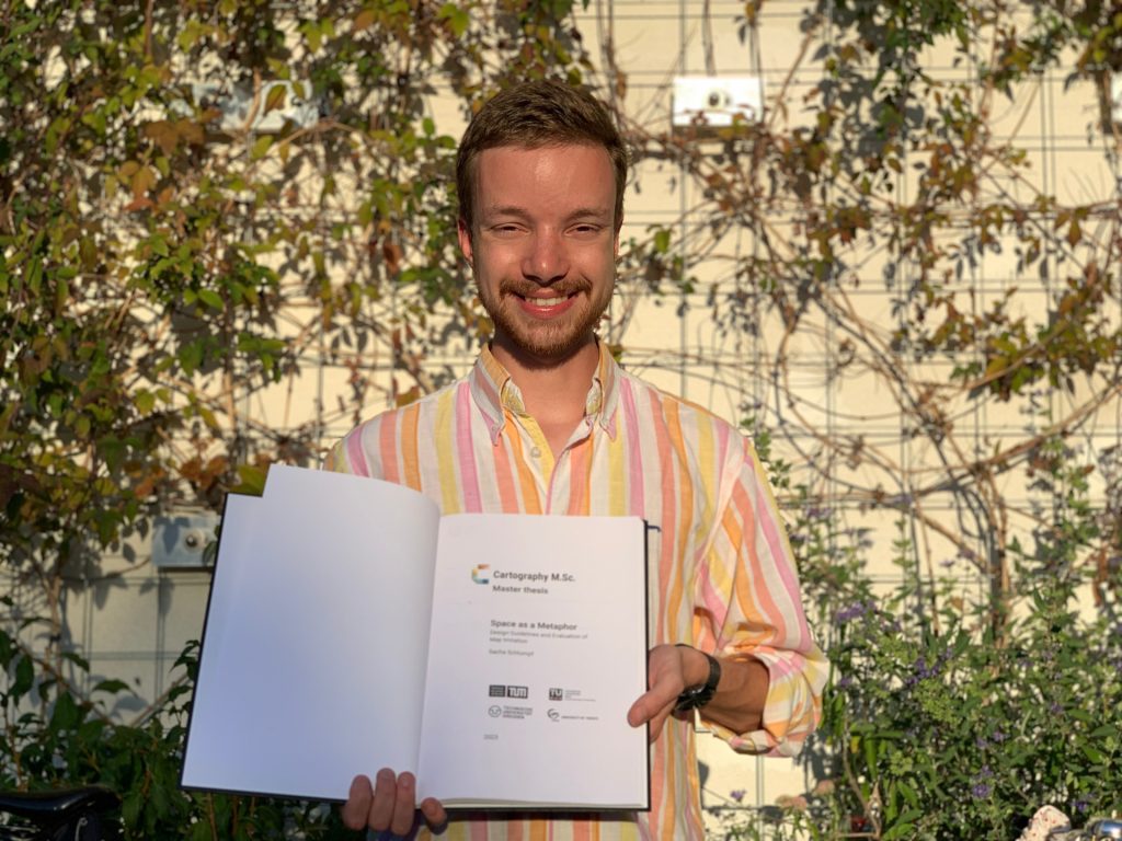
Sacha Schlumpf presented his thesis “Space as a Metaphor”, supervised jointly by Prof. Georg Gartner and Jethro Lennox from HarperCollins Publishers in the UK. Thus, he concluded successful defences of his intake at TU Wien.
Congratulations to them, and all the best in their future explorations!