Maps for the Austrian contribution to LaBiennale 2014

The Austrian contribution to this years Biennale is commissioned by Dr. Christian Kühn, professor at the Institute of Architecture and Design at TU Vienna. The subject of the exhibition is “Plenum. Places of Power” and showcases models of all parliaments of the world – in a scale of 1:500.

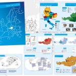
We are proud to have contributed a small aspect: Manuela created the country maps for the exhibition catalogue. The maps are equal area (Albers projections centered on each country) and are centered on the cities, where the parliaments are located.

You can skip through some catalogue pages on issuu.com:

Here are some details on how the 196 country maps were created: We used Natural Earth data (1:50m), which also include ISO country codes. These codes were used for merging the country maps with the data provided by the catalogue team. For creating the latitude/longitude lines, we used QGIS Processing and a small Python script written by Markus Mayr from the Geoinformation group. We then experimented with the Atlas feature from QGIS and Data Driven Pages from ArcMap. Both tools are extremely powerful for creating map series. While the usage of Data Driven Pages is really straight-forward, QGIS allows even more adaptation – with a slightly more complex setup. We ended up using ArcMap for the final PDF production, since QGIS doesn’t allow CMYK output yet. Of course, the PDF from QGIS could also be converted to CMYK later.

Anyways: It was a perfect task for trying out the map series functionalities of QGIS and ArcGIS. It’s good to see the growing set of features for cartography in QGIS. A big thanks to Markus Mayr and Werner Macho for their advise.

More details on the Austrian pavillon at LaBiennale 2014 can be found on labiennale.at.
The impressive visual identity of the whole project was created by buero bauer.

CartoTalk Dušan Petrovič: Cartography in Slovenia

We invite you to a CartoTalk [in English] by Dušan Petrovič of the University of Ljubljana on the topic of Cartography in Slovenia.

He will talk about the historical development of cartography on today’s Slovenian territory from 15th century, cartographic tradition in Slovenia and the establishment of cartographic systems after 1991 and their current status. He will also report on current cartographic research projects, research work and student’s products at the University of Ljubljana, Faculty of Civil and Geodetic Engineering.

Tuesday, 03 June 2014, 15:00
Forschungsgruppe Kartographie
Seminarraum 126

CartoTalk Mark Wigley

We invite you to a CartoTalk [in English] by Mark Wigley from Esri Switzerland on the topic of

Challenging Cartography in ArcGIS with the Carto-Tools from Esri Switzerland

Esri – the leading international supplier of GIS software – has often in the past been shunned by the Cartographic community as concentrating too much on GIS and too little on cartography. Since the arrival of Cartographic Representations in the software ArcMap 9.2 Esri has put considerable effort into responding to this criticism and have since come a long way. This effort has been driven by the fact that the National Mapping Agencies (swisstopo, BEV etc.) are now starting to use their GIS systems to produce the National map sheets instead of using a graphic based software solution. Esri Switzerland has taken the Cartographic possibilities offered by the base software and gone one step further. Together with swisstopo a number of Cartographic processes and tools to help automate map production have been developed. This lecture will explain these Cartographic processes and a demonstration based on Open Street Map data will be given as how they can help produce a more pleasing cartographic result and optimise a production workflow.

Tuesday, 06 May 2014, 17:15
Forschungsgruppe Kartographie
Seminarraum 126

Presentation slides

Mark Wigley studied Geographical Techniques in Luton College of Higher Education in England. After over 7 years working in the conventional cartography in both England and Switzerland he moved into desktop digital cartography at Kümmerly+Frey, the then biggest private mapping company in Switzerland. After a further 3.5 years he moved to Hallwag where he started as head of digital cartography the job of building a seamless European database using the existing paper maps. He went on, to become head of the Cartography department where he remained for over 11 years. He next moved into the software arena working 3.5 years for the Mapping Software company Morelli Informatik before finally moving to Esri Switzerland in the Autumn of 2011.

Ph.D. defense of Alexandra Millonig

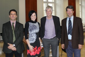
Prof. Kanonier, Dr. Millonig, Prof. Dangschat, Prof. Gartner

On 19 March 2014, our former colleague Alexandra Millonig successfully defended her PhD research on the topic of

„My Way – Towards a Typology of Pedestrian Spatio-temporal Behaviour in Shopping Environments“

Her examination committee included Prof. Georg Gartner, Prof. Jens Dangschat, and Prof. Arthur Kanonier. Prof. Kanonier chaired the examination committee.

Congratulations, Dr. Millonig!


Nice student projects

In der VU Thematische Kartographie in der Raumplanung (3. Semester) geht es um die Aufbereitung statistischer Daten und deren wirkungsvolle Umsetzung in thematischen Karten. Als Abschlussprojekt werden in Gruppenarbeiten Atlanten zu frei wählbaren Themen erstellt, wobei alle geographischen und statistischen Daten aus offenen Datenquellen (z.B. Open Government Data) stammen. Dabei entsteht jedes Jahr eine Vielzahl spannender Themenkollektionen und Visualisierungen. Einige der besonders gelungenen Arbeiten aus dem WS2013/14 möchten wir im folgenden vorstellen:

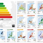
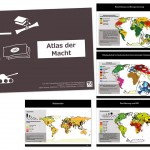
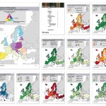
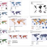
Energie-Atlas von Christina Grießler, Christoph Weber, Manuel Oberaufner, Anna Logar   Atlas der Macht von Julian Eros Behmer und Thomas Höllersberger   Bildungs-Atlas von Florian Maria Fasching, Sarah Steiner, Marvin Linke, Moritz Starzer und Veronika Schafellner
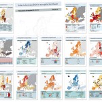
Gesundheit weltweit von Eva Mair, Isabel Zelger, Michael Gidam, Charlotte Heller und Christoph Singelmann   Meine Welt und ich – Kinderatlas von Thi Bich Ngoc Doan, Linda Liu, Balázs Cserpes, Kevin Schneider und Sonja List   Lebensqualität im europäischen Raum von Denise Goff, Maximilian Hejda, Waldemar Grunt, Solomon Gärtner von Srdjan Kuzmanovic

  • Energie-Atlas von Christina Grießler, Christoph Weber, Manuel Oberaufner und Anna Logar (1.8mb)
  • Atlas der Macht von Julian Eros Behmer und Thomas Höllersberger (13mb)
  • Bildungs-Atlas von Florian Maria Fasching, Sarah Steiner, Marvin Linke, Moritz Starzer und Veronika Schafellner (15mb)
  • Gesundheitsatlas von Eva Mair, Isabel Zelger, Michael Gidam, Charlotte Heller und Christoph Singelmann (37mb)
  • Meine Welt und ich – Kinderatlas von Thi Bich Ngoc Doan, Linda Liu, Balázs Cserpes, Kevin Schneider und Sonja List (4.3mb)
  • Lebensqualität im europäischen Raum von Denise Goff, Maximilian Hejda, Waldemar Grunt, Solomon Gärtner und Srdjan Kuzmanovic (7mb)

Auch wenn alle Arbeiten ein sehr positives Gesamtes ergeben, gibt es an der einen oder anderen Stelle natürlich auch noch Raum für Verbesserungen… Die Studierenden aus dem 3. Semester stehen dafür aber auch noch ganz am Anfang ihrer kartographischen Betätigung 🙂

Danke an die Studierenden für ihr Engagement und die Einwilligung zur Veröffentlichung!

CartoTalk OSGeo and QGIS

We were very happy to welcome Anne Ghisla, Berlin, and Andreas Neumann, Uster, to our CartoTalk series. On the occassion of the Vienna Code Sprint 2014, Anne and Andreas gave a joined presentation on

OSGeo and QGIS

[Talk 1] OSGeo and OpenSource in general – Why using it? How to contribute? by Anne Ghisla. Anne is a natural scientist who got interested in GIS and open source programming during university. She started with GRASS GIS and QGIS, first met the OSGeo community by helping on documentation. Then she started programming in 2008 thanks to Google Summer of Code, and became mentor and administrator for OSGeo in following years. She is interested in spreading the word about open source and GIS among students and researchers, and her main objective is to connect people and communities of different software projects.

[Talk 2] The QGIS project – current and future developments with an emphasis on the cartographic possibilities of QGIS by Andreas Neumann. Andreas is a GIS coordinator at the City of Uster, Zurich, Switzerland. The city administration, like many other governmental agencies in Switzerland, is increasingly using OpenSource GIS projects (like QGIS, Postgis, GRASS, GDAL/OGR) to realize the geodata infrastructure, analysis and GIS application modules. Andreas is the current president of the Swiss QGIS user group. He studied Geography, with an emphasis on Cartography and GIS at the Universities of Vienna, Zurich, ETH Zurich and Santa Barbara/California. In 2010 Andreas finished his PhD at ETH Zurich. Between 2004 and 2007 he was also a member of the W3C SVG working group and an organizer of a web graphic conference series called SVG Open (now: Graphical Web conference).

Learning QGIS 2.0Also on board was Anita Graser – a local QGIS activist working at the Austrian Institute of Technology, Vienna. Please check out her blog. We also recommend her book “Learning QGIS 2.0”.


CartoTalk details:
Monday, 24 March 2014, 15:00
EI5 Hochenegg HS, Gußhausstr. 25-29 (Altes EI), 2. Stock


This post was fetched from geo.tuwien.ac.at. Please find the original here.
CartoTalk Jan D. Bláha

We invite you to a CartoTalk [in German] by Jan Daniel Bláha
from J. E. Purkyne University in Ústí nad Labem on the topic of

Der Kartograph und seine Kooperation mit geisteswissenschaftsorientierten Experten

Viele Kartographen finden während ihrer Praxis schnell heraus, dass kartographische Theorie und Praxis zu verbinden, oft nicht einfach ist. Kartographische Praxis nämlich liefert, was an der Universität schwierig zu lehren ist, also die individuellen Anforderungen von Kunden und Verlagen und die individuellen Bedürfnisse des Benutzers. Diese Anforderungen und Bedürfnisse finden sich oft in Kontradiktion sowohl in der Theorie selbst als auch in gegenseitigem Widerspruch.Zusätzlich kann der Kartograph oft nicht ausreichende Kenntnisse in den verschiedensten Bereichen haben, um eine Karte vorzubereiten. Dies wird v. a. deutlich in den Geisteswissenschaften wie Geschichte, Soziologie, Anthropologie u. ä. Solch kartographische Produktion ist mit zahlreichen Konsultationen bei den Autoren und einer Reihe von Änderungen und Korrekturen der Karten verbunden. Der Kartograph ist somit gezwungen, geduldig zu sein. Es ist leider auch nicht leicht, dem Autor des Buches zu erklären, dass seine Ideen auf der Karte nicht viel Sinn machen. In diesem Fall muss der Kartograph eine ausreichende Anzahl vorbereiteter Argumente haben, warum es nicht geht, warum es nicht funktioniert usw.Ein weiteres Problem sind die gelieferte Kartengrundlage und Daten. Sie sind manchmal in gegenseitigem Widerspruch, veraltet, nicht zeitgemäß (sehr wichtig in Geschichtsbüchern) usw. Der Kartograph ist also manchmal gezwungen, sich weniger auf Genauigkeit als auf Anschaulichkeit und Logik zu verlassen. Manchmal ist der Karteninhalt nicht im Voraus bekannt, manchmal geht es um zeitlich veränderliche Phänomene, manchmal muss der Kartograph mit dem Autor Informationen über die Lage der Objekte usw. suchen.Die Aufgabe der Kartenherstellung bildet ein eigenes Kapitel. Wenn der Autor einen thematischen Inhalt in die vorher vorbereitete Kartengrundlage einfügt, ist die Situation noch relativ gut. Schlechter ist die Situation, wenn die Autoren eigene Karten vorbereiten. Das schwierigste ist, wenn der Kartograph einen originellen Kartenstil finden soll. In solchen Fällen sollte der Kartograph auch Graphiker sein.Die Kooperation mit den geisteswissenschaftsorientierten Experten stellt ganz ungewöhnliche Anforderungen an die Karte. Der Kartograph muss jedoch diese Realität als Aufforderung sehen, sonst wird er nur ein Operator von GIS.

Wednesday, 29 January 2014, 11:00
Forschungsgruppe Kartographie
Seminarraum 126

Jan Daniel Bláha ist Assistenzprofessor am Institut für Geographie der naturwissenschaftlichen Fakultät UJEP. Er absolvierte einerseits Geographie und Kartographie mit Schwerpunkt Kartographie und Geoinformatik, andererseits Kulturtheorie und Theorie der Kunst, beides an der Karlsuniversität in Prag. Er ist Mitglied der Tschechischen Gesellschaft für Geographie und vertritt Tschechien in der Kommission „Art and Cartography“ im Rahmen der ICA. In der Forschung konzentriert er sich auf die ästhetischen und kulturanthropologischen Aspekte der kartographischen Produktion und Auswertung von kartographischen Werken aus der Sicht der Nutzer. Insbesondere geht es um Beziehungen von Utility-Funktionen der Karte mit ästhetischen Funktionen und das Studium ihrer gegenseitigen Beeinflussung. Generell versucht er die Humandimension der naturwissenschaftlich-technischen Disziplin, genannt Kartographie, zu zeigen. Er arbeitete mehrere Jahre für den Verlag Kartografie Praha und erstellt jetzt Karten für die Bücher des Universitätsfachverlags Karolinum und andere Verlage, sowie Karten für den tschechischen Geographischen Schulwettbewerb. Er hat auch zahlreiche wissenschaftliche Publikationen und mehrere Kapitel in internationalen Büchern von Springer veröffentlicht.

presentation slides 4 MB, map example

This post was fetched from geo.tuwien.ac.at. Please find the original here.