
Link to article: Überall, wo ich jemals war.
This post was automatically fetched from geo.tuwien.ac.at. Please find the original here.
This post was automatically fetched from geo.tuwien.ac.at. Please find the original here.
Die Internationale Kartographische Vereinigung freut sich, auch dieses Jahr wieder Kinder und Jugendliche zum Zeichnen von Karten im Rahmen des Barbara Petchenik-Wettbewerbes aufzurufen. Motto des Wettbewerbs 2013 und 2015 ist »My place in today’s world«. Finden Sie hier alle Details zu den Teilnahmemöglichkeiten und -fristen der österreichischen Ausschreibung.
This post was automatically fetched from geo.tuwien.ac.at. Please find the original here.
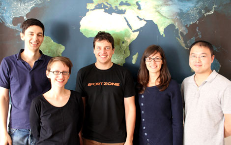
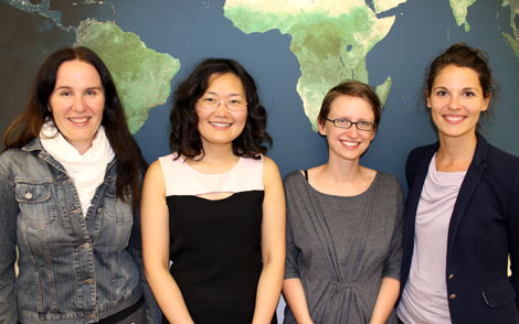
![]() Our new department is organized in seven research groups:
Our new department is organized in seven research groups:
The Research Group Cartography was an institute of its own from 1971 until 2003 (E126). Until 2012 it was part of the Institute of Geodesy and Geoinformation (E127-2).
Last week the Geoserver / OpenLayers Code Sprint Vienna took place at the Research Group Cartography.
This post was automatically fetched from geo.tuwien.ac.at. Please find the original here.
Courses for WS 2012/2013 are online in our teaching section.
Zdeněk Stachoň of the research team of the Laboratory on Geoinformatics and Cartography (LGC) at Masaryk University in Brno visited our institute for a research exchange. We are happy for the insight into his work and are looking forward to a cooperation of our groups. In return to this visit, our colleague Huang Haosheng will visit Masaryk University soon!
Please find details about Zdeněk’s work in the post about his CartoTalk.
Zdeněk Stachoň, PhD is a member of research team of Laboratory on Geoinformatics and Cartography (LGC). Since 2009 works as Assistant professor on Institute of Geography, Masaryk University. He focuses mainly on GIS technologies, map usability testing, semiotics, toponomastic and historical cartography.
We are happy to welcome Zdeněk for a CartoTalk:
Selected issues of cartographic visualization testing
Maps as spatial representations are used by different users in various situations. There are a number of approaches and methods of cartographic visualization, that has been developed based for example on Bertin’s theory of graphic variables and combining both static and dynamic elements of visualization. Development of information technologies allowed cartographers to produce more personalized maps.
The issue of spatial data visualization is studied for a long period. Challenge is generated by need of evaluation of designed visualization. Despite partial achievements and existing conceptual approaches to visualisation evaluation, relatively little is known about specific influence of certain visualization on end users, especially on their ability to use the given visualization in an effective and unambiguous way.
The ongoing research on mentioned topic will be presented and the process of test development for selected methods of cartographic visualization will be described. The web-based testing application Mutep was used enabling parallel testing of heterogeneous user groups, automatic recording of test results, and semiautomatic processing for final evaluation.
Wednesday, 19 September 2012, 11 am
Research Group Cartography
Erzherzog-Johann-Platz 1, 1040 Wien
Download the PDF of the presentation slides [4 MB]
This post was automatically fetched from geo.tuwien.ac.at. Please find the original here.
We are happy to welcome Yuwei Lin of the University of Salford, UK, to our colloquium CartoTalks.
Demystifying the relationships between women and maps
Too often, articles with headlines such as “Why women cannot read maps and men lose their keys” appear in the news. Pseudoscience or not, these instances suggest that maps are definitely socio-technical artefacts, shaped by (and also shaping) creators and consumers’ behaviours and (inter)actions, embodying certain ideologies and identities and ideologies.
In this talk, Dr Lin will draw on feminist theorising and Science and Technology Studies (STS) to exemplify how gender is explicitly or implicitly embedded in innovation and design of a technical service or a product, and to highlight the importance of improving our understandings of specific, culturally, politically, socially and materially embodied identities, epistemologies, and practices that make up technical systems.
She will also share her ongoing research on gender and free/libre open source software (FLOSS) to respond the growing interest in open source technologies and crowd sourced data in cartography. Her participatory observation and interventions at some events and online groups will demonstrate how women actively engage with free/libre open source software and how different dimensions of engagement and assemblages of social and material practices shape innovation or uses of technologies. Methodologies and social research methods will also be discussed in this part.
Overall, this talk should shed light on socio-technical dynamics and influences of crowd sourcing in an open innovation system.
Wednesday, September 12 2012, 3 pm
Seminar room 126
Research Group Cartography
Erzherzog-Johann-Platz 1, 1040 Wien
For registration and questions, please contact Silvia Klettner.
For childcare, please contact us before September 7.
Be welcome!
This talk is organized in cooperation with Salzburg Research as part of the fem2map project. fem2map is funded by the Austrian Ministry for Transport, Innovation and Technology (BMVIT) within the structural research programme FEMtech-fFORTE.
This post was automatically fetched from geo.tuwien.ac.at. Please find the original here.
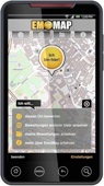 EmoApp (Beta) for Android smartphones and tablet PCs is a on-site tool for reporting your subjective evaluation of the environment. It is part of the BMVIT funded research project EmoMap, which aims at collecting “subjective/emotional” ratings towards the environment. More information about the project can be found at openemotionmap.org.You can download the EmoApp at openemotionmap.org.
If you have any questions or problems, please contact us at info@openemotionmap.org.
Thank you for your participation.
This post was automatically fetched from geo.tuwien.ac.at. Please find the original here.
Watch the photos of our lectures here!
This post was automatically fetched from geo.tuwien.ac.at. Please find the original here.