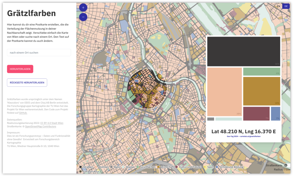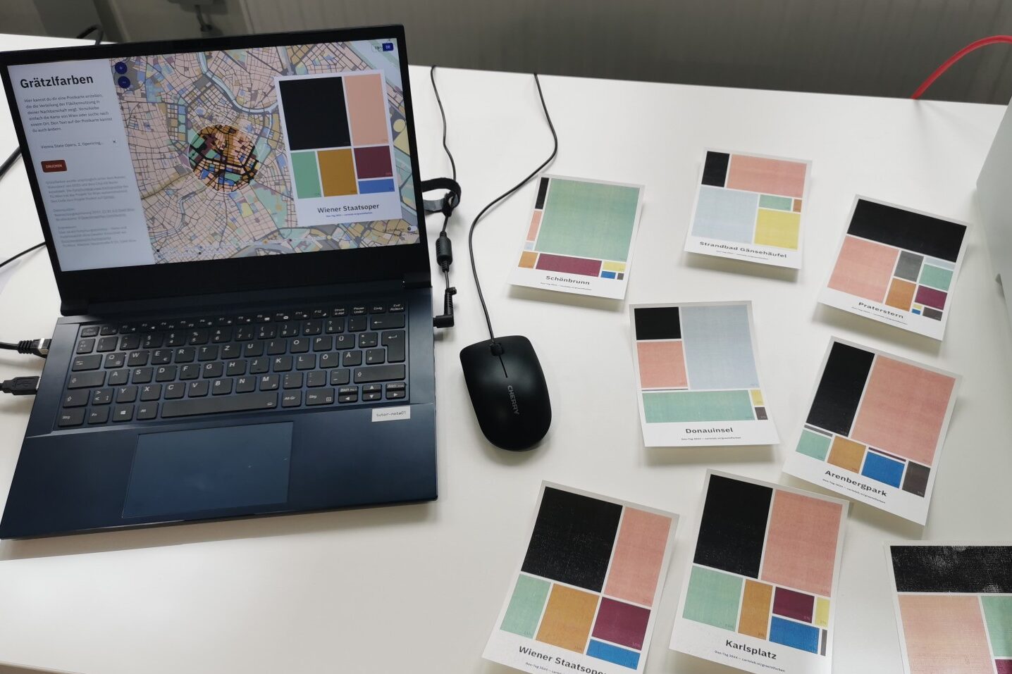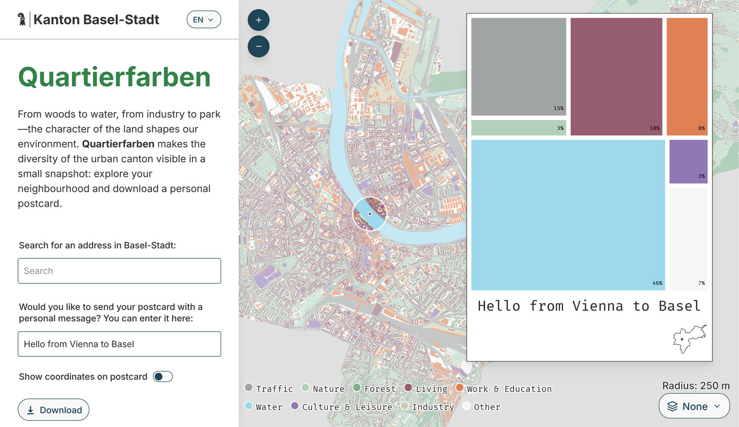
Our open-source web map, Grätzlfarben, which visualizes land use in Vienna and is based on the Berlin project, Kiezcolors, has now also been implemented and adapted for the city of Basel: Quartierfarben!
With its own color scheme, corporate design, and new features like an inset map on the postcard, automatic neighborhood-based labeling, and multiple basemaps to choose from, it shows how open-source collaboration can benefit everyone. The Statistisches Amt Basel-Stadt has also published the visualization in their statistical dossier (April 2026) and as posters around the city, offering a postcard printing option at events. It’s wonderful to see this project spread and evolve.
If you want to build such a web app for your own city, make sure to check out our GitHub repository and reach out if we can support you.