Education Award: Jansa, Ortag, Schmidt ausgezeichnet

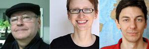
Jansa, Schmidt, Ortag
Urkunden
Urkunden

Am Department für Geodäsie und Geoinformation wird jährlich ein Preis für besondere Leistungen in der Lehre vergeben. Die Auswahl erfolgt durch die Studienkommission, die Fachschaft und den Studiendekan und berücksichtigt die Lehrveranstaltungsbewertungen durch die Studierenden an der TU Wien.

Für das Studienjahr 2012/2013 wurden am 26. November 2013 ausgezeichnet:

ao. Univ.-Prof. Dr. Josef Jansa
für wiederholt hervorragend beurteilte Lehrveranstaltungen in Bachelor und Master:
VO Digitale Bildverarbeitung in Vermessung und Geoinformation
UE Digitale Bildverarbeitung in Vermessung und Geoinformation
VU Angewandte Fernerkundung

Dipl.-Ing. (FH) Manuela Schmidt

für innovative E-Learning-Methoden auch im Bereich der Raumplanungs-Studien:
VU Thematische Kartographie in der Raumplanung
VU Internet-Kartographie
VU Multimedia-Kartographie und Geokommunikation

Dipl.-Ing. Felix Ortag

für innovative E-Learning-Methoden:
UE Grundzüge der Kartographie
VU Angewandte Kartographie
VU Geo-Medientechnik
PR Projekt Kartenerstellung

This post was automatically fetched from geo.tuwien.ac.at. Please find the original here.

CartoTalk Christoph Kinkeldey

We invite you to a CartoTalk [in German!] by Christoph Kinkeldey from HafenCity University Hamburg on the topic of

Evaluation von Visualisierungsmethoden für Unsicherheiten in Geodaten: Status Quo und zukünftige Herausforderungen

Unsicherheiten sind allgegenwärtig beim Umgang mit Geodaten, sei es bei der Vermessung eines Grundstücks, bei der Klassifizierung eines Satellitenbilds oder bei der Erstellung einer Karte. Dass die Information über Unsicherheiten in vielen Fällen wertvoll sein kann und nicht mehr ignoriert werden sollte, ist inzwischen unbestritten. Doch obwohl die visuelle Kommunikation von Unsicherheiten bereits seit Jahrzehnten Gegenstand der Forschung ist, bleibt der Einsatz in der Praxis die Ausnahme.

Ein Grund dafür ist das Fehlen von Leitlinien für den Einsatz solcher Methoden in der Praxis, zum Beispiel für die Entwicklung geeigneter grafischer Werkzeuge. Diese existieren kaum, obwohl seit den neunziger Jahren einige Studien durchgeführt wurden, um Methoden zur  Unsicherheitsvisualisierung zu evaluieren. Zum einen wurde die reine Lesbarkeit verschiedener Darstellungsmethoden getestet, zum anderen, wie einfache Entscheidungen auf Grundlage von visuell kommunizierter, unsicherer Information getroffen werden. Dennoch konnten daraus kaum verlässliche Aussagen für die Verwendung entwickelt werden, da viele Ergebnisse schwer vergleichbar sind und es häufig widersprüchliche Aussagen gibt.

Ziel dieses Vortrags ist es, einen Überblick auf existierende Nutzerstudien zu geben und die Gründe für die beschriebene Situation abzuleiten. Erste Empfehlungen für die Weiterentwicklung solcher Studien werden gegeben, um dem Ziel von Leitlinien für die Unsicherheitsvisualisierung näher zu kommen. 

Wednesday, 4 December 2013, 11:00
Seminar Room 121, click here for map
Gußhausstraße 27–29, 3rd floor, Engineering Geodesy

Dipl.-Ing. Christoph Kinkeldey ist wissenschaftlicher Mitarbeiter und Doktorand bei Prof. Dr. Jochen Schiewe am Labor für Geoinformatik und Geovisualisierung (g2lab) an der HafenCity Universität Hamburg. In seinem Dissertationsprojekt beschäftigt er sich mit der Nutzung von Unsicherheitsinformation bei explorativen Analysen von Veränderungen aus Fernerkundungsdaten.

This post was automatically fetched from geo.tuwien.ac.at. Please find the original here.
CartoTalk Otakar Čerba

We invite you to a CartoTalk by Otakar Čerba from the University of West Bohemia on the topic of

XSLT Map Programming

Cartographers work with many various technologies and software enabling a development of web cartographic products. Majority of these applications have two typical characteristic features – they are quite simple to use and process spatial data, but they are very poor with the respect to cartography. They have a limit number of cartographic techniques available. Therefore they are not able to exploit and cover richness of cartography.

It is one of the reason why we use XSLT (Extensible Stylesheet Language – Transformation) styles in the development process of web thematic maps in the University of West Bohemia in Plzen (Czech Republic). This contribution introduces another benefits of XSLT implementation, including spatial data exploitation, processing and visualization. There are also a lot of examples of maps which have been created by the XSLT styles. The approach based on XSLT styles does not represent only a programmers’ task but also the research connected to particular questions of data harmonization or correct implementation of cartographic techniques. Moreover the XSLT styles and transformations (as well as all structures based on XML) interconnect web cartography with many activities of contemporary geomatics and geoinformatics (including Spatial Data Infrastructures, INSPIRE directive, semantic data or Open Linked Data).

Friday, 15 November 2013, 11:00
Research Group Cartography
Erzherzog-Johann-Platz 1, 1040 Wien

Otakar Čerba is researcher of New Technologies for the Information Society – European Centre of Excellence at the Faculty of Applied Sciences, University of West Bohemia in Pilsen. Otakar studied Geomatics in the Faculty of Applied Sciences in the University of Bohemia in Plzen (Master degree), Teaching of geography and information technologies in the Faculty of Education in the University of Bohemia in Plzen (Master degree) and Cartography, geoinformatics and remote sensing in the Charles University in Prague, Faculty of Science (Ph.D. degree). He is the member of the Commission of Maps and the Internet of International Cartographic Association, member of board of Czech Association for Geoinformation and vice-chair of Czech Center for Science and Society. He cooperated and is cooperating in many national and international projects such as Plan4all, plan4business, Humboldt, Habitats, VisualHealth or development of INSPIRE data specification Natural Risk Zones. Otakar’s research interests lie in the areas of thematic cartography, web cartography, mark-up languages, semantics and ontologies. His teaching includes courses on thematic cartography, computer cartography, history of maps and mappings and social geography for geomatics.

Update 21 November 2013: the presentation slides [PDF, 3 MB] are now online.

This post was automatically fetched from geo.tuwien.ac.at. Please find the original here.

Austrian Map wins in the International Children’s Map Competition

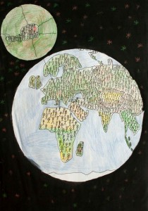
“One Among Many” by  Florian Gruber & Lukas Schostal
“One Among Many” by Florian Gruber & Lukas Schostal

We are happy to inform, that of the five children maps that won in the Austrian round of the Barbara Petchenik Children’s Map Competition and were forwarded to the international round, one was awarded an international prize at the International Cartographic Conference 2013 in Dresden, Germany.

The drawing titled “One Among Many” by Florian Gruber & Lukas Schostal won the 3rd place in the age range 9–12 years. Find all details at the Austrian Petchenik Competition website [in German].

The Austrian round of the Petchenik Competition is organized by Eszter Simonné-Dombóvári and the Research Group Cartography in cooperation with the Austrian Cartographic Commission.

This post was automatically fetched from geo.tuwien.ac.at. Please find the original here.
Ph.D. defense of Haosheng Huang

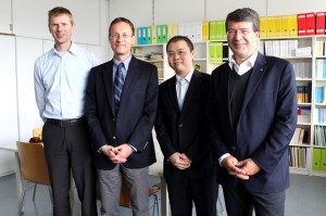
Prof. Pfeifer, Prof. Raubal, Dr. Huang, Prof. Gartner


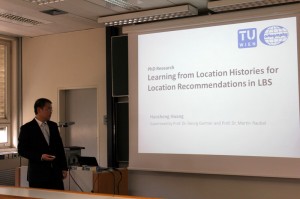
Today, our colleague Haosheng Huang successfully defended his PhD research on the topic of

Learning from Location Histories for Location Recommendations in LBS.

His supervisors were Prof. Martin Raubal from ETH Zurich and Prof. Gartner from our Research Group Cartography. Prof. Pfeifer chaired the examination committee.

Congratulations, Dr. Huang!

This post was automatically fetched from geo.tuwien.ac.at. Please find the original here.

CartoTalk Martin Raubal

We invite you to a CartoTalk by Martin Raubal from the Swiss Federal Institute of Technology on the topic of

Mobile eye tracking for spatial research

Eye tracking has been employed to study people’s visual attention in areas such as psychology or marketing. Interest in eye-tracking technology is also growing in GIScience, for example, when investigating users’ interaction with maps and GIS. In this talk I will introduce the new technology of mobile eye tracking, which allows for a more flexible deployment, such as in outdoor environments. We have used mobile eye tracking both for the combined tracking of an individual’s gaze and position in a spatial reference system to investigate people’s wayfinding behavior, as well as for recognizing their activities on cartographic maps. Our studies demonstrate how such approach can help to tackle research questions on spatial problem solving in novel ways.

Friday, 20 September 2013, 14:00
Research Group Cartography
Erzherzog-Johann-Platz 1, 1040 Wien

Martin Raubal is Professor of Geoinformation-Engineering at the Swiss Federal Institute of Technology Zurich. He was previously Associate Professor and Vice-Chair at the Department of Geography, University of California, Santa Barbara, and Junior Professor at the University of Münster. Martin received his Ph.D. in Geoinformation from Vienna University of Technology in 2001 with honors. He holds a M.S. in Spatial Information Science and Engineering from the University of Maine and a Dipl.-Ing. in Surveying Engineering from Vienna University of Technology. Martin’s research interests lie in the areas of mobile GIS & LBS, spatial cognitive engineering, mobile eye-tracking, and GIS for renewable energy analysis. His teaching includes courses on GIS, cartography, geovisualization, location-based services, temporal aspects of GIS, spatial cognition and wayfinding, and research methods. Martin is currently a council member of AGILE (Association of Geographic Information Laboratories in Europe) and was a board member of UCGIS (University Consortium for Geographic Information Science) from 2008-11. He serves on the editorial boards of Transactions in GIS, Journal of Location Based Services, Journal of Spatial Information Science, and Geography Compass. He has authored and co-authored more than 90 books and research papers published in refereed journals and conference proceedings.

This post was automatically fetched from geo.tuwien.ac.at. Please find the original here.
Participate in a survey with the chance to win!

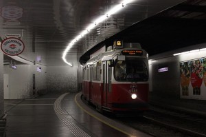
Photo by darkweasel94 at Wikimedia Commons.One of our master students is working on his thesis about public transportation in Vienna. He has set up an online survey that will take no longer than 10 minutes and is available in both German and English. Participants have the chance to win one of five Amazon vouchers valid for 20 Euros each.

Interested? Please participate at https://cartography.tuwien.ac.at/limesurvey/index.php/123134/lang-de. Thank you!

This post was automatically fetched from geo.tuwien.ac.at. Please find the original here.