Update: The CartoTalk will take place at EI 11 Geodäten-Hörsaal!
We invite you for a CartoTalk by Mark Wigley from the Esri Switzerland on the topic of
The New Swiss National Map Series
The Swiss National Mapping Agency (swisstopo) started production of the new 1:25’000 national map series with ArcGIS on the 1st of March this year. A short presentation will describe the history of this project and of its connection with the Topographic Landscape Model. The presentation will go on to show some of the tools developed for this project as well as the new technology being used to produce print ready PDF files. Finally a live demonstration with OSM data will show some of the tools and processes in action.
Mark Wigley studied Geographical Techniques in Luton College of Higher Education in England. After over 7 years working in the conventional cartography in both England and Switzerland he moved into desktop digital cartography at Kümmerly+Frey, the then biggest private mapping company in Switzerland. After a further 3.5 years he moved to Hallwag where he started as head of digital cartography the job of building a seamless European database using the existing paper maps. He went on, to become head of the Cartography department where he remained for over 11 years. He next moved into the software arena working 3.5 years for the Mapping Software company Morelli Informatik before finally moving to Esri Switzerland in the Autumn of 2011.
Tuesday, 4 June 2013, 17:15 17:30
Research Group Cartography, Erzherzog-Johann-Platz 1, 1040 Wien
EI 11 Geodäsie HS (Geodäten-Hörsaal)
Gußhausstr. 25-29, Stiege 1, 3. Stock
1040 Wien
We are looking forward to your visit!
Update 7 June 2013: the presentation slides [PDF, 4 MB] are now available.
This post was automatically fetched from geo.tuwien.ac.at. Please find the original here.

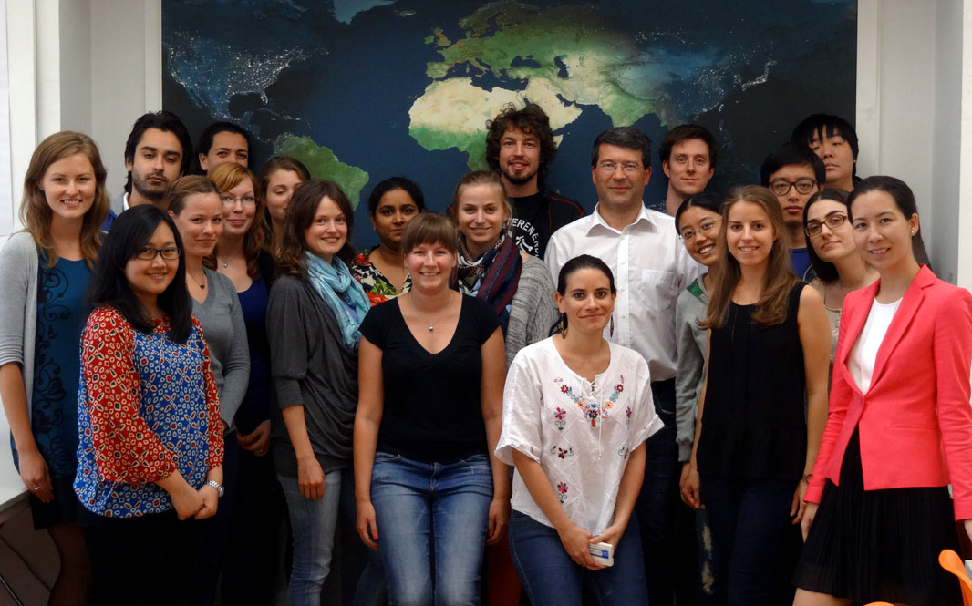 The second intake of the International Master Programme on Cartography has finished the “Vienna Semester” and is heading to TU Dresden for the third semester. We wish them all the best!
 Thank you
 The
The