Ph.D. defense of Haosheng Huang

Prof. Pfeifer, Prof. Raubal, Dr. Huang, Prof. Gartner


Today, our colleague Haosheng Huang successfully defended his PhD research on the topic of

Learning from Location Histories for Location Recommendations in LBS.

His supervisors were Prof. Martin Raubal from ETH Zurich and Prof. Gartner from our Research Group Cartography. Prof. Pfeifer chaired the examination committee.

Congratulations, Dr. Huang!

This post was automatically fetched from geo.tuwien.ac.at. Please find the original here.

CartoTalk Martin Raubal

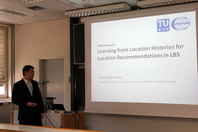
We invite you to a CartoTalk by Martin Raubal from the Swiss Federal Institute of Technology on the topic of

Mobile eye tracking for spatial research

Eye tracking has been employed to study people’s visual attention in areas such as psychology or marketing. Interest in eye-tracking technology is also growing in GIScience, for example, when investigating users’ interaction with maps and GIS. In this talk I will introduce the new technology of mobile eye tracking, which allows for a more flexible deployment, such as in outdoor environments. We have used mobile eye tracking both for the combined tracking of an individual’s gaze and position in a spatial reference system to investigate people’s wayfinding behavior, as well as for recognizing their activities on cartographic maps. Our studies demonstrate how such approach can help to tackle research questions on spatial problem solving in novel ways.

Friday, 20 September 2013, 14:00
Research Group Cartography
Erzherzog-Johann-Platz 1, 1040 Wien

Martin Raubal is Professor of Geoinformation-Engineering at the Swiss Federal Institute of Technology Zurich. He was previously Associate Professor and Vice-Chair at the Department of Geography, University of California, Santa Barbara, and Junior Professor at the University of Münster. Martin received his Ph.D. in Geoinformation from Vienna University of Technology in 2001 with honors. He holds a M.S. in Spatial Information Science and Engineering from the University of Maine and a Dipl.-Ing. in Surveying Engineering from Vienna University of Technology. Martin’s research interests lie in the areas of mobile GIS & LBS, spatial cognitive engineering, mobile eye-tracking, and GIS for renewable energy analysis. His teaching includes courses on GIS, cartography, geovisualization, location-based services, temporal aspects of GIS, spatial cognition and wayfinding, and research methods. Martin is currently a council member of AGILE (Association of Geographic Information Laboratories in Europe) and was a board member of UCGIS (University Consortium for Geographic Information Science) from 2008-11. He serves on the editorial boards of Transactions in GIS, Journal of Location Based Services, Journal of Spatial Information Science, and Geography Compass. He has authored and co-authored more than 90 books and research papers published in refereed journals and conference proceedings.

This post was automatically fetched from geo.tuwien.ac.at. Please find the original here.

Participate in a survey with the chance to win!

Photo by darkweasel94 at Wikimedia Commons.One of our master students is working on his thesis about public transportation in Vienna. He has set up an online survey that will take no longer than 10 minutes and is available in both German and English. Participants have the chance to win one of five Amazon vouchers valid for 20 Euros each.

Interested? Please participate at https://cartography.tuwien.ac.at/limesurvey/index.php/123134/lang-de. Thank you!

This post was automatically fetched from geo.tuwien.ac.at. Please find the original here.

CartoTalk Mark Wigley

Update: The CartoTalk will take place at EI 11 Geodäten-Hörsaal!

We invite you for a CartoTalk by Mark Wigley from the Esri Switzerland on the topic of

The New Swiss National Map Series

The Swiss National Mapping Agency (swisstopo) started production of the new 1:25’000 national map series with ArcGIS on the 1st of March this year. A short presentation will describe the history of this project and of its connection with the Topographic Landscape Model. The presentation will go on to show some of the tools developed for this project as well as the new technology being used to produce print ready PDF files. Finally a live demonstration with OSM data will show some of the tools and processes in action.

Mark Wigley studied Geographical Techniques in Luton College of Higher Education in England. After over 7 years working in the conventional cartography in both England and Switzerland he moved into desktop digital cartography at Kümmerly+Frey, the then biggest private mapping company in Switzerland. After a further 3.5 years he moved to Hallwag where he started as head of digital cartography the job of building a seamless European database using the existing paper maps. He went on, to become head of the Cartography department where he remained for over 11 years. He next moved into the software arena working 3.5 years for the Mapping Software company Morelli Informatik before finally moving to Esri Switzerland in the Autumn of 2011.

Tuesday, 4 June 2013, 17:15 17:30
Research Group Cartography, Erzherzog-Johann-Platz 1, 1040 Wien
EI 11 Geodäsie HS (Geodäten-Hörsaal)
Gußhausstr. 25-29, Stiege 1, 3. Stock
1040 Wien

We are looking forward to your visit!

Update 7 June 2013: the presentation slides [PDF, 4 MB] are now available.

This post was automatically fetched from geo.tuwien.ac.at. Please find the original here.

CartoTalk Andreas Pammer

We invite you for a CartoTalk by Andreas Pammer from the Austrian BEV on the topic of

Modern Cartography at BEV

BEV – Bundesamt für Eich- und Vermessungswesen is the national mapping and cadastral agency of Austria and has a long tradition in producing maps. Nevertheless, new technologies and new user requirements lead to modern products and map production processes. The presentation will discuss the current cartographic models and map series of BEV and introduce the newest product AMap mobile. A further topic will cover the data provision for European reference datasets.Furthermore, we will have a look on present developments regarding the production processes as well as on possible products in future.

Monday, 27 May 2013, 10:00 am
Research Group Cartography
Erzherzog-Johann-Platz 1, 1040 Wien

Update 3 June 2013: the presentation slides [PDF, 6.5 MB] are now available.

This post was automatically fetched from geo.tuwien.ac.at. Please find the original here.

CartoTalk Giedrė Beconytė

We invite you for a CartoTalk by Giedrė Beconytė from Vilnius University on the topic of

Geoportal.lt and New Cartography

Geographic information portals where datasets, services and applications can be shared and used for development of new datasets, services and applications, open new fields of activity for cartographers. We will discuss some issues of Web maps design, a method that allows to develop semantically correct representations and some cartographic examples inspired by the geoportal – collaboration and crowdsourcing  in Lithuania: analytical maps, mapping alternative tourism sites,  mapping literature and maps for fun.

Giedrė BECONYTĖ received her PhD in Geography and MSc in System Engineering (Informatics) from the University of Vilnius. She is currently employed as Professor at the Centre for Cartography, Vilnius University and is a head of Spatial Information Infrastructure department at the State Enterprise “GIS-Centras”. She has published three textbooks on spatial project management  and DBMS. Her current research interests include innovations in thematic mapping, geographic information system design and project management.

Wednesday, 8 May 2013, 10:30 am
Research Group Cartography
Erzherzog-Johann-Platz 1, 1040 Wien

This post was automatically fetched from geo.tuwien.ac.at. Please find the original here.

Austrian Winners of the Petchenik Children’s Map Drawing Competition

A jury selected the best entries from all the maps sent to us in the national Austrian round of the Barbara Petchenik Children’s Map Drawing Competition. Check them out here [German website]!

A selection of the winning maps will be forwarded to the international round organized by the International Cartographic Association.

This post was automatically fetched from geo.tuwien.ac.at. Please find the original here.

Take our survey and get the chance to win Amazon vouchers

Dear visitors and colleagues,

Research Group Cartography is currently conducting a study on experiences and attitudes towards route choices in urban environments: http://bit.ly/13FX4fH. Completing the whole survey will take you about 10 to 12 minutes only.

All participants have the chance to win one of five 20 € Amazon or Thalia vouchers. Of course we will handle your personal data confidentially, and will not pass them to any third party.

Please feel free to forward the questionnaire to friends and colleagues.

Thank you for participating, we appreciate your help!
Silvia Klettner & Haosheng Huang

Update, March 26: Our survey is closed now. The five winners have been contacted. Thank you very much for your participation!

This post was automatically fetched from geo.tuwien.ac.at. Please find the original here.