
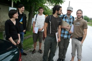
 Check out the photo gallery to see our students in the fields.
Hilfreiche Tipps zum Studieren im Ausland
Wir möchten auf hilfreiche Tipps des Außeninstituts zum Studium im Ausland hinweisen.
Kurierbericht über unser Studium
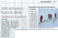 Die österreichische Tageszeitung Kurier hat sich für ihre Sonderausgabe “Universität März 2011” auf die Suche nach Studienrichtungen abseits der Massenfächer gemacht. Gefunden wurden drei Fächer, die sowohl ein gutes Betreuungsverhältnis als auch positive Jobaussichten bieten: Veterinärmedizin an der VetMed, Kulturtechnik und Wasserwirtschaft an der Boku sowie Vermessung und Geoinformation an der TU Wien.
Volltext als PDF (0,5 MB) (Quelle: Kurier)
P.S.: Im Artikel ist ein offensichtlicher Fehler versteckt – für Geodäten wahrscheinlich einfach zu finden!
This post was automatically fetched from geo.tuwien.ac.at. Please find the original here.
Visiting professor Michael Peterson
We are happy to announce that Prof. Michael Peterson from the University of Nebraska at Omaha, USA, will be with us in the summer term 2011. Dear students, please take the chance to be in one or more of the following courses that will be held partly or fully by our guest professor:
Angewandte Kartographie, VO(2) 126.079
Kartographische Informationssysteme, VU(2) 126.102
Seminar für Geoinformation und Kartographie, SE(2) 126.105
This post was automatically fetched from geo.tuwien.ac.at. Please find the original here.
Courses of SS 2011 are online
Courses of SS 2011 are online in the teaching section.
Bachelorarbeitsthemen 2011
Die folgenden PDF-Dokumente enthalten allgemeine Informationen sowie Bachelorarbeitsthemenvorschläge für Studierende des Bachelorstudiums Geodäsie und Geoinformatik.
Themen Geoinformation
Themen Geophysik
Themen Höhere Geodäsie
Themen Ingenieurgeodäsie
Themen Kartographie
Themen Photogrammetrie und Fernerkundung
This post was automatically fetched from geo.tuwien.ac.at. Please find the original here.
OVG-Jahresabschluss 2010
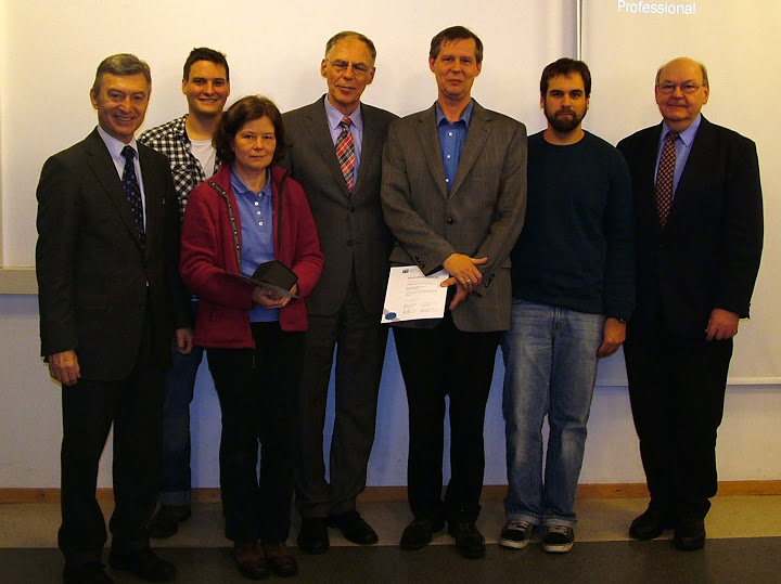 Im Rahmen des diesjährigen OVG-Jahresabschlusses wurde ein “Geodäsie und Geoinformations-Tag” mit der Fachschaft für Vermessung und Geoinformation der TU Wien sowie dem Studiendekan für Vermessung und Geoinformationan der TU Wien am Mittwoch dem 1. Dezember als zentrale Veranstaltung für unsere StudentInnen und MitarbeiterInnen organisiert.
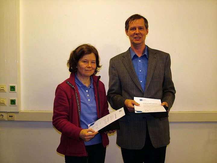
Im ersten Teil fand eine Informationsveranstaltung mit studienrelevanten Informationen statt, in der auch die Auszeichnung für die beste Lehrveranstaltung des Studienjahres 2009/2010 vergeben wurde. Die Geo Education Awards wurden für besondere Leistungen in Lehre und Ausbildung im Bereich der Studien für Vermessung und Geoinformation an der TU Wien auf Grund von Lehrverantaltungsbewertungen letztes Jahr gegründet. In einer zweiten Runde wurden die endgültigen Preisträger aus den nominierten Lehrveranstaltungsleitern schließlich durch eine Jury, bestehend aus dem Studiendekan, dem Vorsitzenden der Studienkommission und zwei Fachschaftsvertretern festgelegt. Dabei wurden auch die langjährigen Ergebnisse aller Lehrveranstaltungsbewertungen für diesen Lehrenden berücksichtigt.
In Beisein von Vize-Rektor Prof. Prechtl und Dekan Prof. Dorninger wurden den Preisträgern für das Studienjahr 2009/2010, Herrn Prof. Weber und Frau Prof. Schranz-Kirlinger, im Rahmen einer kleinen Feier die Auszeichnungen überreicht.
Anschließend wurde der OVG-Jahresabschluss mit Kurzvorträgen begangen:
Stadtvermessung Wien (MA 41)
Hauer & Stix ZT GmbH
Korschineck & Partner Vermessung ZT GmbH
SynerGIS Informationssysteme GmbH
rmDATA GmbH und
GEODATA Ziviltechnikergesellschaft mbH
Jede Firma hatte ca. 10–15 Minuten Zeit sich und Ihre Anforderungen als Arbeitgeber für die StudentInnen vorzustellen (was künftige Mitarbeiter können sollten und erwarten können).
Als Ausklang der Veranstaltung wurde bei einem gemütlichen Beisammensein mit Buffet und Getränken Gelegenheit zum weiteren gegenseitigen Kennenlernen gegeben.
This post was automatically fetched from geo.tuwien.ac.at. Please find the original here.
All thesis topic proposals now in TISS
All our proposals for topics for thesis (bachelor, master) are no longer available on our site but via TISS. For the link and some more details, visit our teaching page.
LVA-Verschiebungen im Studienjahr 2011/2012
Die Forschungsgruppe Kartographie plant, ab dem Studienjahr 2011/2012 an einem internationalen Masterstudiengang in Kartographie teilzunehmen. Dadurch wird es notwendig werden, einige Lehrveranstaltungen vom Wintersemester in das Sommersemester zu verschieben. Da dies für einige Studierende bereits in der Studienplanung für das Studienjahr 2010/2011 relevant sein könnte, sind die geplanten Änderungen hier angeführt.
Die folgenden Lehrveranstaltungen werden ab dem Studienjahr 2011/2012 nicht mehr im Winter- sondern im Sommersemester angeboten:
- VO Theoretische Kartographie
- VU Geomedientechnik
- VU Kartenredaktion und kartographisches Projektmanagement
- PR Projekt Kartenerstellung
Änderungen vorbehalten!
Courses of WS 2010/2011 are online
Courses of WS 2010/2011 are online in the teaching section.