Unsere Straßennamenkarte im Wien Museum

Plakat_Wien_von_oben

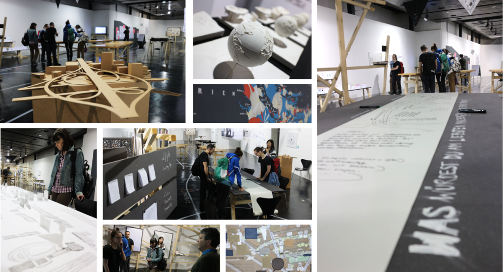
Wir freuen uns, dass unsere Karte Straßennamen in Wien in der aktuellen Ausstellung Wien von oben. Die Stadt auf einen Blick im Wien Museum zu sehen ist.

Die Ausstellung ist bis 17. September 2017 geöffnet. Empfehlung!

Wie können wir Wien als Ganzes fassen? Der Versuch, der immer größer werdenden Stadt visuell beizukommen, fasziniert seit Jahrhunderten – ob in Form von klassischen Panoramen, Vogelschauen oder Plänen. Doch diese befinden sich stets im Spannungsfeld zwischen Vollständigkeitsanspruch und Fragmentierung, zwischen Sichtbarmachung und Verdecken, zwischen Orientierung und Kontrolle. Sie bilden nie das „reale“ Territorium zur Gänze ab, sondern sind auch Modell, Bild oder Vision der Stadt.

In der Ausstellung werden nicht nur einige der ältesten, größten oder berühmtesten Pläne, Panoramen und Modelle Wiens gezeigt, sondern ebenso seltene thematische Karten oder künstlerische Zugänge und Designprodukte bis hin zu gegenwärtigen partizipativen Bestrebungen, „Mapping the City“ auf die Bedürfnisse minderprivilegierter Gruppen anzuwenden. Außerdem werden traditionsreiche, aber auch neue Aussichts­punkte der Stadt exemplarisch beleuchtet – von Stephansturm und Kahlenberg bis hin zum heutigen Hochhaus. Die Ausstellung soll BesucherInnen ermun­tern, die Stadt mit anderen Augen zu sehen und sich auch aktiv in deren Darstellung einzubringen.

Wien Museum

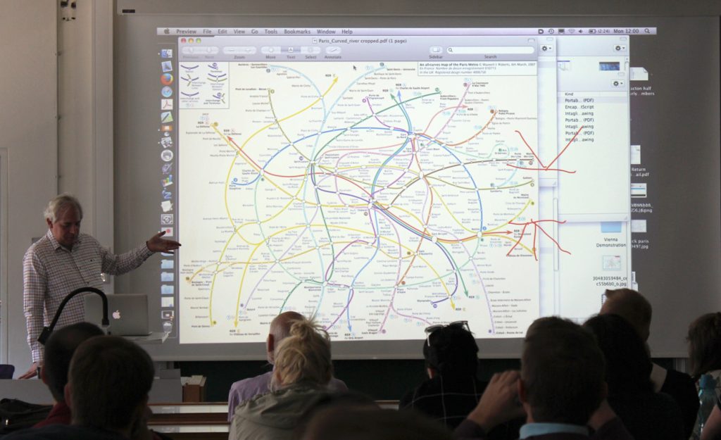
CartoTalk Maxwell Roberts: Step by Step in London and Berlin: Understanding transit maps by systematically exploring design rules

We are happy to announce a CartoTalk by Maxwell Roberts from University of Essex, UK, on Monday 10 April 2017.

In this presentation, Maxwell Roberts will discuss the criteria necessary for effective visual information design, and suggest that the optimum rules for a schematic map depend on the structure of the network, and that octolinearity may sometimes be inapproCartoTalk_MaxwellRoberts2priate. To
illustrate this, he will describe usability studies in which people’s planning performance is measured objectively using different map versions. Maxwell Roberts will also show how an exploration of design, in which rules are manipulated systematically, can highlight issues when applied to the London and Berlin networks.

For more information about his research, projects, and public lectures, visit http://www.tubemapcentral.com/

Maxwell Roberts completed a BSc and PhD in psychology at the University of Nottingham, UK, and has lectured at the University of Essex since 1993. His research interests have included reasoning and intelligence, but now focus on schematic maps. He creates challenging designs and tests their usability and aesthetics. He has authored two books on maps, and his work has been exhibited in Germany, the USA, and the UK, and is currently on display in Vienna.

Monday, 10 April 2017, 11:00
Geodäsie HS (EI 11)
Gußhausstraße 27-29, 3rd floor


Call for papers for the 14th International Conference on Location-Based Services

We are pleased to announce the 14th International Conference on Location-Based Services (LBS 2018), taking place in Zurich from 15-17 January 2018.lbs2018

Built on the success of previous conferences in this series, LBS 2018 will offer a common ground to colleagues from various disciplines and practice where they can meet, interact and exchange knowledge, experience, plans and ideas on how LBS can and could be improved and on how it will influence both science and society.

The Call for Papers is currently open:
12 Jul 2017 Submission of full & work-in-progress papers
29 Sep 2017 Notification of acceptance for full & work-in-progress papers
13 Oct 2017 Camera-ready full & work-in-progress papers
15 Nov 2017 Submission for showcases
22 Nov 2017 Notification of acceptance for showcases

The best accepted full and work-in-progress papers will be invited to submit an extended version to the Journal of Location Based Services.

More information can be found at lbsconference.org

CartoTalk Pepijn Viaene: Landmark-based path-finding indoors

We are happy to announce a CartoTalk by Pepijn Viaene from Ghent University, on Thursday 16 March 2017.

In recent years, there has been a growing interest in indoor navigation tools and applications. As such, various approaches to indoor navigation have been developed by research institutions (e.g. SoleWay, Nadine-navigation) and commercial companies (e.g. Eyedog, Insoft, IndoorAtlas, SPREO Indoor Navigation, Meridian). Although, these approaches often highlight the importance of landmarks, they rarely incorporate landmark-based path-finding algorithms. A major difficulty remains the identification of landmarks in indoor environments. Moreover, commonly used spatial models are not fully capable of handling basic characteristics of landmark-based wayfinding. During this talk, a theoretical approach to identify landmarks through eye tracking measures and a way to implement these landmarks in a path-finding algorithm are presented.

CartoTalk_Pepijn Viaene
Since 2013, Pepijn Viaene is a researcher at the Department of Geography, Ghent University. His PhD research is entitled “Indoor landmarks: the study and implementation of navigational aids” and deals with wayfinding and navigation in buildings. This research specifically focuses on the identification of landmarks and the use of landmarks in path algorithms and smartphone applications. Before starting his PhD, he studied Geomatics and Land Surveying.

Thursday, 16 March 2017, 11:00
Research Group Cartography
Seminar room 126
Welcome to the 6th intake of the International Master in Cartography

We are happy to welcome 20 students of the International Master in Cartography at TU Vienna for the summer semester 2017. Students come from all over the world, including Albania, Austria, Canada, China, Colombia, Croatia, Denmark, Ethiopia, Georgia, Germany, India, Indonesia, Ireland, Romania, Russia, and the USA.

IMC2017_1_1

After finishing their first semester at TU München, the students are now with us for their second semester, before they move to TU Dresden. We wish them a fun and successful semester!

To find out more about the International Master in Cartography, please visit cartographymaster.eu.

Neu: genderATlas für die Schule

Im Auftrag des Bundesministeriums für Bildung (BMB) wurde 2016 eine Didaktisierung des genderATlas vorgenommen. Der daraus entstandene genderATlas für die Schule wurde letzte Woche per Bekanntgabeerlass an alle relevanten Schulen ausgesandt.

Screenshot aus dem neu entwickelten Beitrag VolksschullehrerIn – ein Frauenberuf?
Screenshot aus dem neu entwickelten Beitrag “VolksschullehrerIn – ein Frauenberuf?”. Der Beitrag enthält neben Kartendarstellungen auch ein Diagramm der historischen Entwicklung.

Ziel des genderATlas für die Schule ist es, Schüler/innen und Studierenden (Sek. I und v.a. Sek. II und PH) aktuelles und sehr anschauliches Informationsmaterial für eigenes forschendes Lernen zur Verfügung zu stellen. Der ATlas bietet insbesondere auch im Zusammenhang mit zu verfassenden wissenschaftlichen Arbeiten (z.B. der VWA in der AHS) ein sehr konkretes Instrument, da er vielfältige Rechercheimpulse, sowie Forschungsmethoden und -fragen bereit hält.

Den genauen Wortlaut des Bekanntgabeerlasses finden Sie hier.

Call for Maps: Einladung zur Einreichung von Beiträgen zur International Cartographic Exhibition

call-for-maps2017

Vom 2.–7. Juli 2017 findet in Washington, D.C., die 28. International Cartographic Conference (ICC) statt. In diesem Rahmen wird auch wieder die International Cartographic Exhibition organisiert – eine Ausstellung für digitale und analoge Karten aus aller Welt. Bis 19. Februar haben Sie die Möglichkeit, österreichische Beiträge für die Ausstellung zu nominieren!

Warum teilnehmen?

  • Sichtbarkeit Ihres Produkts bei über 1.500 Kartographie- und GIS-ExpertInnen aus aller Welt bei der International Cartographic Conference (ICC 2017)
  • Listung im online verfügbaren Ausstellungskatalog
  • Chance, einen ICA Map Award zu gewinnen. ICA Map Awards eignen sich hervorragend als Marketinginstrument. Die ausgezeichneten Beiträge werden im Anschluss außerdem als Map of the Month auf der ICA-Website gefeatured und erreichen auf diese Weise eine hohe Sichtbarkeit.

Alle Infos zur Nominierung finden Sie unter sites.google.com/view/callformaps-2017.

Ansprechpartnerin für die österreichischen Beiträge bei der ICC-Kartenausstellung ist dieses Jahr Manuela Schmidt.