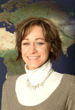
Wir gratulieren ganz herzlich!
- Details zur Auszeichnung und ein Personenportrait von Alexandra auf der FEMtech-Website
- Nachricht auf dieStandard.at
This post was automatically fetched from geo.tuwien.ac.at. Please find the original here.
Wir gratulieren ganz herzlich!
This post was automatically fetched from geo.tuwien.ac.at. Please find the original here.
Editierbare Jagdrevierkarte
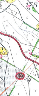
Für ein Jagdrevier im südöstlichen Niederösterreich soll eine Jagdrevierkarte für Print-Zecke erstellt werden. Es sind dabei unterschiedlichste, teils analoge Quelldaten zusammenzuführen (analoge handgezeichnete Karte, Bundesforstkarte, Urmappe, eventuell Geländemodell). Die erstellte Karte muss vektorbasiert sein und soll ein einfaches Editieren im Fall von Aktualisierungen erlauben.
Die Arbeit ensteht in enger Zusammenarbeit mit DI Stix vom Vermessungsbüro Stix.
Für interessierte Studierende ist dieses Thema auch für die Lehrveranstaltung Projekt Kartenerstellung verwendbar (dann ohne schriftliche Arbeit, Beginn jederzeit möglich, nicht ans Semester gebunden).
Edit 12. 12. 2012: Dieses Thema wurde bereits von einer Studierenden erfolgreich abgeschlossen.
Das Bundesministerium für Verkehr, Innovation und Technologie (BMVIT) vergab am 10. Mai 2010 erstmals den Gender Award an Projekte aus den Förderungsprogrammen “Intelligente Verkehrssysteme und Services plus” (IV2Splus) und TAKE OFF mit dem Ziel, die teilweise noch geringe Beteiligung von Wissenschafterinnen in den Forschungs- und Technologieprogrammen kontinuierlich zu steigern. Durch die Vorbildwirkung der prämierten Projekte soll die Bedeutung von Chancengleichheit und Gender-Aspekten in Forschung und Entwicklung (F&E) unterstrichen werden.
Wir freuen uns, dass zu den PreisträgerInnen des Gender Awards auch das Konsortium von ways2navigate gehört.
This post was automatically fetched from geo.tuwien.ac.at. Please find the original here.
We are happy to announce, that we are partners in the new research project ways2navigate. Find out more about it!
This post was automatically fetched from geo.tuwien.ac.at. Please find the original here.
Im Rahmen des von uns veranstalteten 5th International Workshop on Digital Approaches in Cartographic Heritage fand unter anderem eine Exkursion ins Bundesamt für Eich- und Vermessungswesen (BEV) statt. Auf der BEV-Website gibt es nun dazu einen kurzen Bericht.
Courses for SS 2010 are online in the teaching section.
The 5th International Workshop on Digital Approaches in Cartographic Heritage was organized by Research Group Cartography and took place at TU Vienna from 22 to 23 February 2010.
Check out the photos at https://cartography.tuwien.ac.at/cartoheritage.
This post was automatically fetched from geo.tuwien.ac.at. Please find the original here.
Congratulations!
This post was automatically fetched from geo.tuwien.ac.at. Please find the original here.
Alexandra Millonig leaves our group and we wish her all the best for her future undertakings!
On December 11, 2009 the Geo Education Awards for excellent achievements in teaching in the field of geodesy at TU Vienna were awarded for the first time.
The selection process for the award is two-stage: the selection of nominees is based on the results of the student’s online teaching evaluation. The prize winners are choosen by the dean for academic affairs, the chairman of the committee for studies and two student representatives. The prize can be given to senior as well as junior teachers.
For the first Geo Education Awards ceremony the speakers were the dean for mathematics and geoinformation Prof. Dietmar Dorninger and the vice rector for academic affairs Prof. Adalbert Prechtl. In the first ceremony the awards were given for the previous two academic years.
We congratulate the winners and thank for their commitment!
This post was automatically fetched from geo.tuwien.ac.at. Please find the original here.