This post was automatically fetched from geo.tuwien.ac.at. Please find the original here.
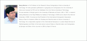
Inaugural Prof. Gartner
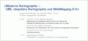
»Moderne Kartographie – LBS, ubiquitäre Kartographie und WebMapping 2.0«
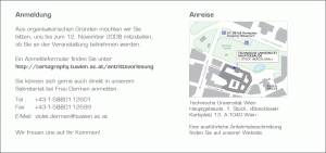
Die Antrittsvorlesung von Prof. Gartner fand am 18. November 2008 statt.
Fotos von der akademischen Feier finden Sie hier!
This post was automatically fetched from geo.tuwien.ac.at. Please find the original here.
CartoTalk Yan Li
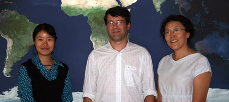
Prof. Yan Li (right) and Dr. Yang Cao (left) from South China Normal University visited our research group.
Prof. Yan Li overviewed one of her research topics. The title of her CartoTalk was An Extension of Spatial Functionality for SVG Specification.
Professor Yan LI is vice Director of School of Computer, and Director of Spatial Information Research Center, South China Normal University in Guangzhou, China. She focuses on the theories and methods of spatial information and also on Remote Sensing and GIS applications. Some related projects are: “Spatial Information Integration and applications in Guangdong”, “a prototype of hyper-spectral image processing System development”, “Environment monitoring with hyper-spectra data”, “A XML based spatial information service system” etc.
Find all CartoTalks here.
This post was automatically fetched from geo.tuwien.ac.at. Please find the original here.
Website for CEE2009 online
 Research Group Cartography is organizing the First ICA Symposium on Cartography in Central and Eastern Europe. The symposium website including the call for papers is now online at https://cartography.tuwien.ac.at/cee2009.
This post was automatically fetched from geo.tuwien.ac.at. Please find the original here.
Standardartikel zu Kartographie von Mobilnetzdaten
This post was automatically fetched from geo.tuwien.ac.at. Please find the original here.
CartoTalk by Ioannis Delikostidis
Ioannis Delikostidis from ITC Enschede gave a CartoTalk on 17 July 2008 on the topic of
Geo-identification and pedestrian navigation with geo-mobile applications: how do users proceed?
Please find out more in his presentation slides.
This post was automatically fetched from geo.tuwien.ac.at. Please find the original here.
KinderUni 2008

This year Research Group Cartography is involved in KinderUni Technik (University for Children) with 3 lectures:
- Mika: Weißt du, wo du bist? Wie die Erdoberfläche zu einer Karte wird.
- Eszter: Kennst du die Geographie von Österreich? Interaktive Kartenlernspiele im Internet.
- Antje and Felix: Die Vermessung der Welt. Wie kommt die Welt in die Karte und wie die Karte in die Welt?
This post was automatically fetched from geo.tuwien.ac.at. Please find the original here.
AGILE 2008 Best Paper Award
 Our Ph.D. student and colleague Markus Jobst won the Best Paper Award at AGILE 2008, together with Haik Lorenz, Matthias Trapp, and Jürgen Döllner for their paper Interactive Multi-Perspective Views of Virtual 3D Landscape and City Models.
Research Group Cartography congratulates!
This post was automatically fetched from geo.tuwien.ac.at. Please find the original here.
CartoTalk by Rein Ahas
Rein Ahas from the University of Tartu, Estonia gave a CartoTalk on 9 May 2008 on the topic of Using mobile positioning data for mapping space-time behavior and developing LBS: Experiences from Estonia.
Please find the abstract in the invitation pdf or check out the slides.
This post was automatically fetched from geo.tuwien.ac.at. Please find the original here.
Guest professor Rein Ahas
Rein Ahas, professor at the University of Tartu, Estonia, will be with us as a guest professor at Research Group Cartography for a month.
More info about him: http://www.geo.ut.ee/ahas/ahaseng.html
This post was automatically fetched from geo.tuwien.ac.at. Please find the original here.
