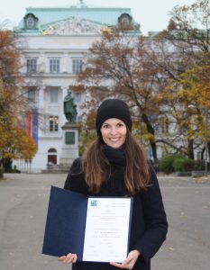
PhD defense of Florian Ledermann

We are pleased to invite you to the public PhD defense of our staff member Florian Ledermann on the “Empirical assessment of minimum dimensions for cartographic symbology on smartphone displays”

The defense will take place on the 7th of December 2022, 11 am at the Seminarraum DA02C  (TU Wien “Freihaus”, green area, 2nd floor), Wiedner Hauptstraße 8, 1040 Wien and via Zoom

For more information on his doctoral research, find the abstract here

Doctoral defense of Silvia Klettner

Silvia Klettner has successfully defended her dissertation titled “The Polysemy of Map Signs: An Exploration of the Connotative Meanings of Cartographic Point Symbols”.

Her supervisor was Prof. Gartner from our Research Unit Cartography; reviewers were Prof. Michael P. Peterson from the University of Nebraska Omaha, USA and Dr. Amy Griffin from the RMIT University in Australia.

Congratulations, Dr. Klettner, and all the best for your future!

Dr. Silvia Klettner, Prof. Georg Gartner

Read more about Dr. Klettner`s research here.

Best Paper Award goes to Silvia Klettner

We are proud to announce that Silvia Klettner’s research on cartographic semiotics received TU Wien’s Best Paper Award 2019 from the Faculty of Mathematics and Geoinformation:

Klettner, S. (2019). Why Shape Matters — On the Inherent Qualities of Geometric Shapes for Cartographic Representations. ISPRS International Journal of Geo-Information, 8(5), 217.

Continue reading “Best Paper Award goes to Silvia Klettner”

The EURECA project closing event in Brussels

On last Thursday 12th the closing event of the EURECA/UGESCO projects was held at Cinematek, the Royal Belgian Film Archive in Brussels. EURECA is an international cooperation of the TU Wien, the Ghent University and several Belgian and Austrian archives focused on revealing inter-regional traces in Europe.

Results were presented by Steven Verstockt, Nico Van de Weghe, Kenzo Milleville, Dilawar Ali, Georg Gartner and Francisco Porras Bernárdez. We will extend further our excellent cooperation with our colleagues.

(Images from ÖKF Brüssel)

More information about EURECA can be found here.

The research group’s contributions at ICC2019

This year’s 29th International Cartographic Conference (ICC) took place in Tokyo, Japan, with over 950 participants. The members of the Research Division Cartography and its affiliates also contributed their latest works by Scientific Presentations, Scientific Posters, Maps, and Atlases. With a Position Paper, the research group also participated in the pre-conference workshop in Beijing, China on “User Experience Design for Mobile Cartography: Setting the Agenda”. Read more to access all contributions.

Continue reading “The research group’s contributions at ICC2019”

Eyetracking Studie – TeilnehmerInnen gesucht

Was? Die Eyetracking Studie findet am Hauptbahnhof Wien statt.  Für Ihre Teilnahme erhalten Sie 50 Euro Aufwandsentschädigung.

Wann? Die Studie findet im Oktober 2018 statt. Termine werden individuell mit Ihnen vereinbart.

Wer kann teilnehmen? Voraussetzung ist normale oder über Kontaktlinsen korrigierte Sicht. Die Durchführung des Eyetrackings mit Brille ist leider nicht möglich.

Anmeldung, Fragen und Details bei Tabea Fian: tabea.fian@tuwien.ac.at oder Martin Söllner: martin.soellner@univie.ac.at

Florian Ledermann wins best paper award at GI_Forum 2018

We are proud to announce that PhD candidate and lecturer Florian Ledermann has won the award for “Best Student Paper” at this year’s GI_Forum conference in Salzburg, Austria. The jury unanimously voted for his paper “Analysing Digital Maps Online: A Reverse Engineering Approach” and praised the author’s accomplishment of making the complex workings of online maps transparent to a wide audience. A preprint of the paper, which will appear in print later this year in the GI_Forum journal, is available here.

Congratulations!

Florian Ledermann with Adrijana Car (Editor of GI_Forum Journal). (Photo by Julia Stepan)

genderATlas won a 1st prize at the International Cartographic Exhibition in Washington, D.C.

At the 28th International Cartographic Conference in Washington, D.C., USA, our atlas project genderATlas für die Schule won the first jury prize in the category educational cartographic products. The jury stated:

“A very well thought through mini-atlas that explores gender issues for women and men. This version specifically aimed at school children to promote understanding of equality and support research initiatives.”

We are extremely happy about this award! The atlas, which is a sub-project of the regular genderATlas was funded by the Bundesministeriums für Bildung (BMB) in 2016 and developed by a team around Elisabeth Aufhauser and Christiane Hintermann from Universität Wien. The technical implementation was done by Manuela Schmidt based on the prototype by Florian Ledermann. A huge thank you to everyone involved!

More about genderATlas für die Schule can be found here (German).