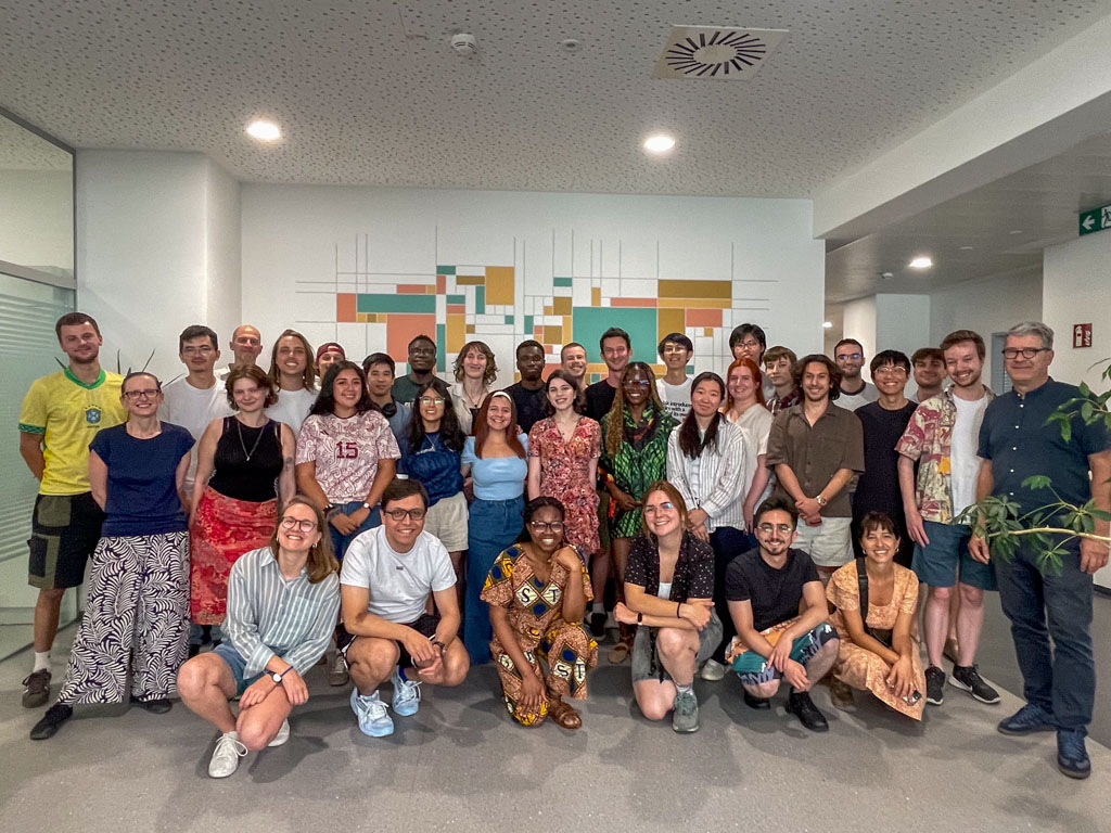
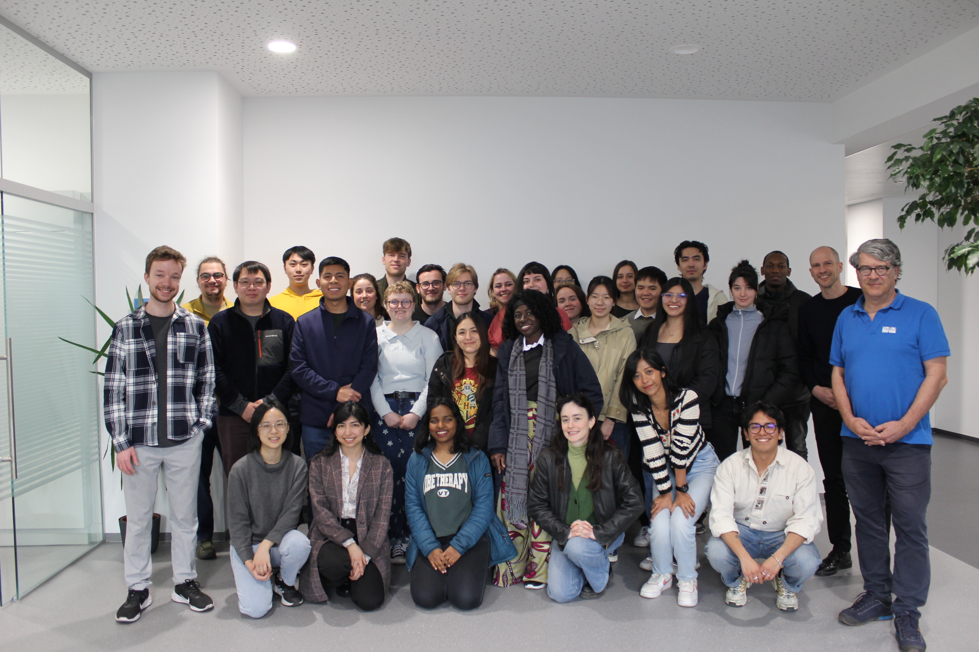
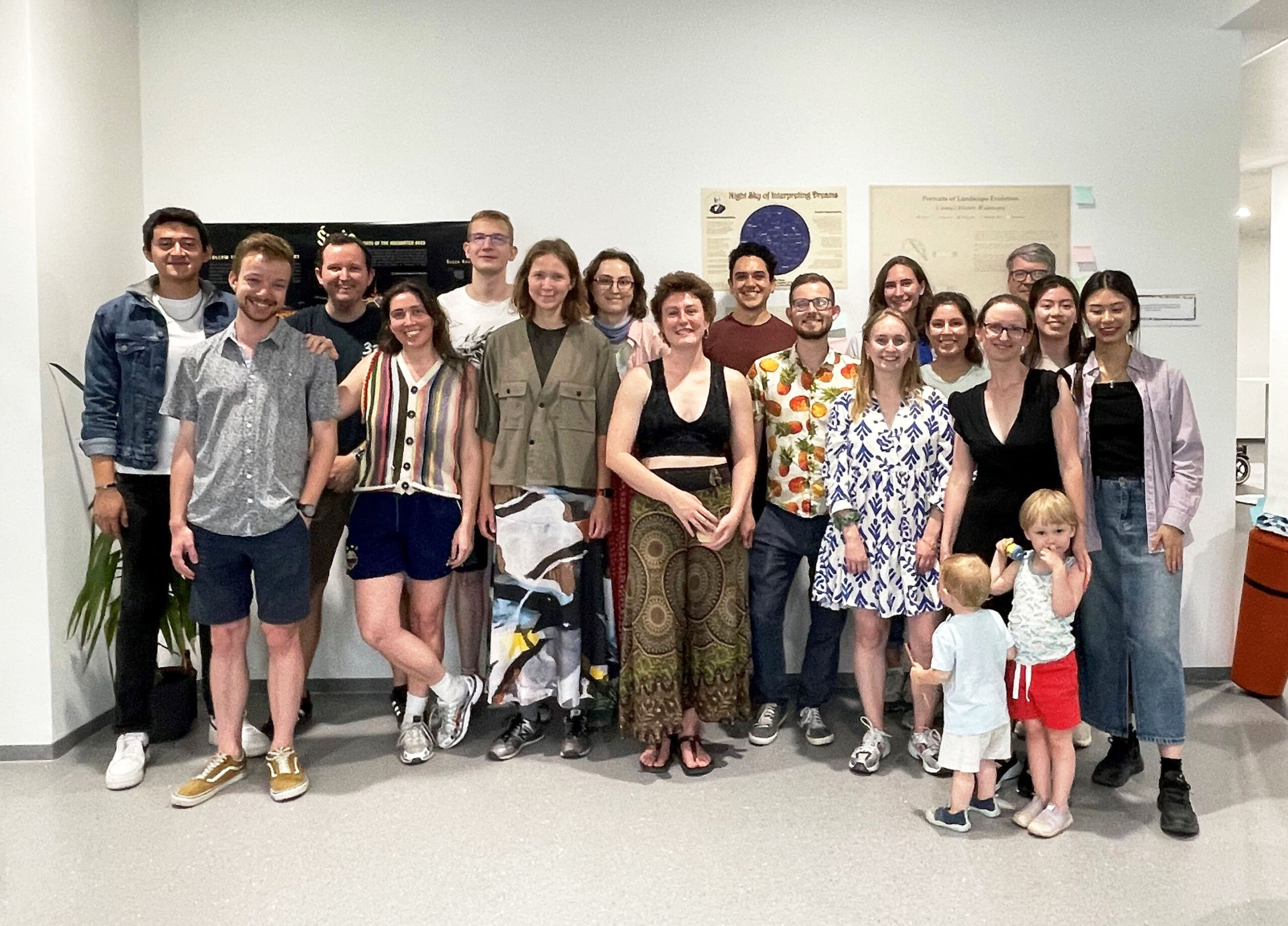
The 15th intake of cartography students finished their semester! During the past 4 months, they have practiced many cartographic skills: web mapping, location-based services, theoretical cartography, graphic design, and many others. And they learned by doing, as this semester is almost fully assignment-based.
In the Project Map Creation course (supervised by Manuela Schmidt and Camila Narbaitz Sarsur), they had the chance to apply all the techniques they want to realize one big project, which they exhibited at the occasion of our yearly Map Exhibition on June 25th!
We celebrated the end of their semester, and their beautiful maps. It was a great moment — although we are of course always sad to say bye.
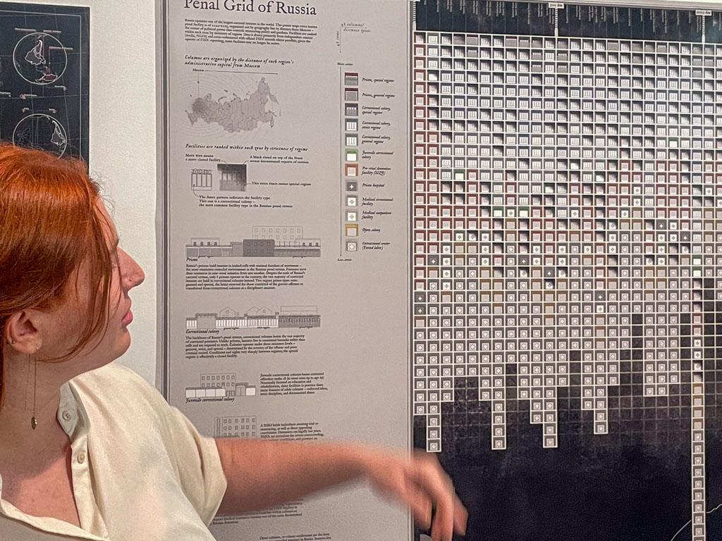
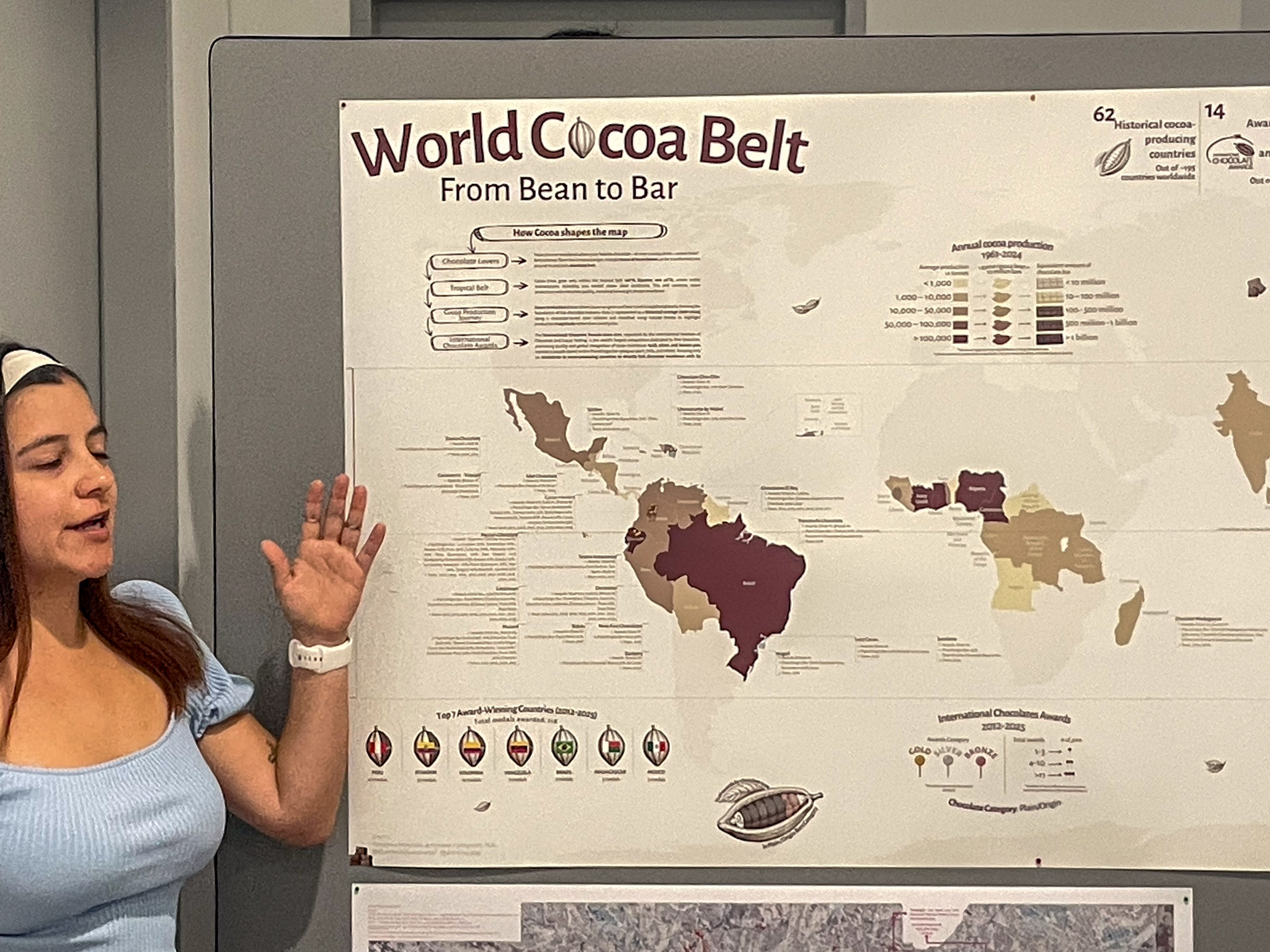
The students and some of the staff!Alena Avdeeva and her map “Penal Grid of Russia”Domenica Fernandez de Cordova and her map “World Cocoa Belt”
Their next stop, after a well-deserved summer break, is the Technical University of Dresden! We wish them a great semester and hope to see them soon.
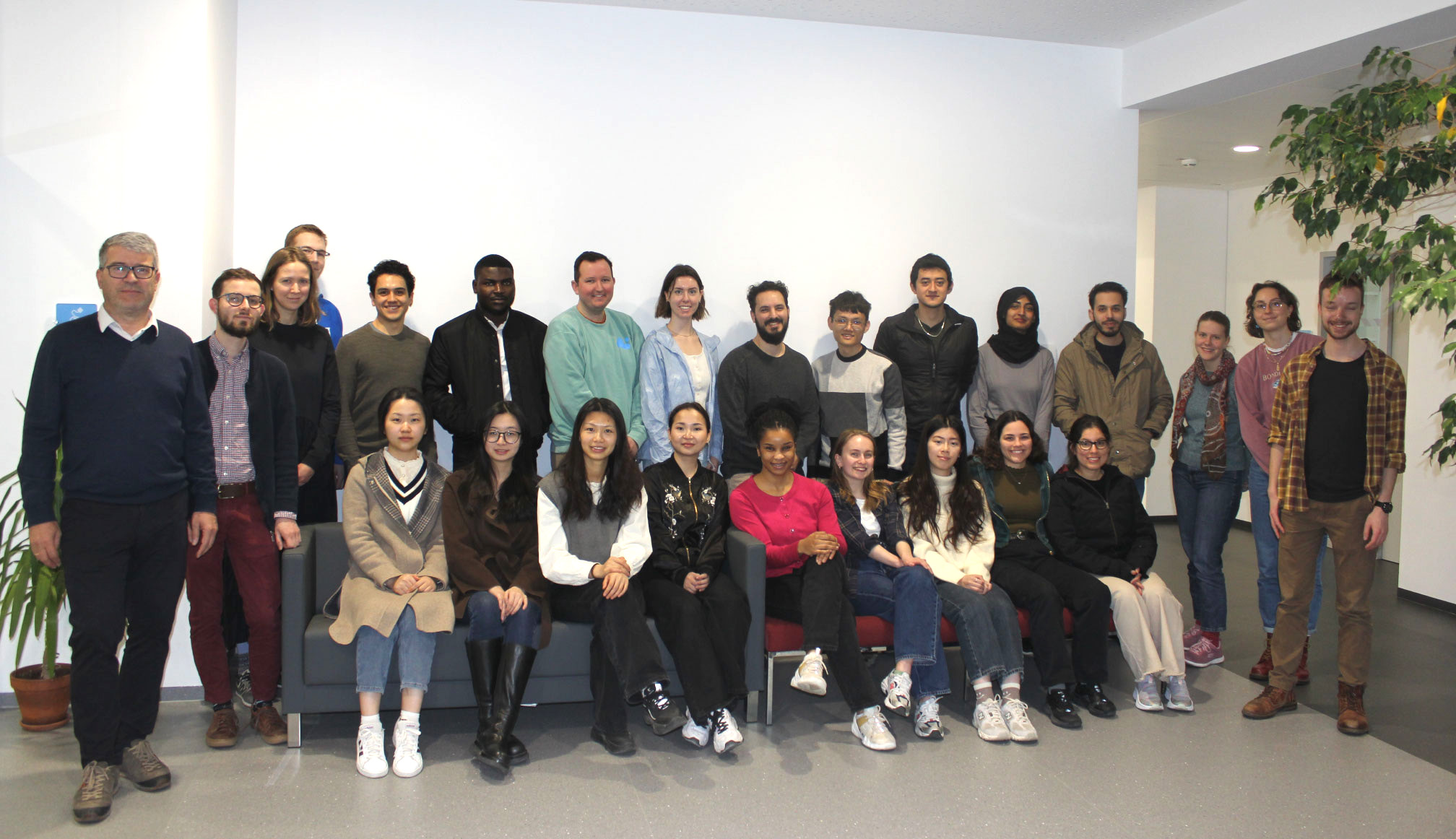
Already the 15th one! We wish a very warm welcome to Vienna to the new intake. On Thursday 5th of March, the new students of the International Master’s in Cartography program started their second semester with us, after their first semester in Munich.
The 29 students, from 20 different countries, will study with us in Vienna for four months. Through the 10 courses we offer, they will learn a broad range of theoretical and practical skills, all very useful for their cartographic career. We wish them a great time in their new city, and are looking forward to exchanging diverse perspectives on cartography!
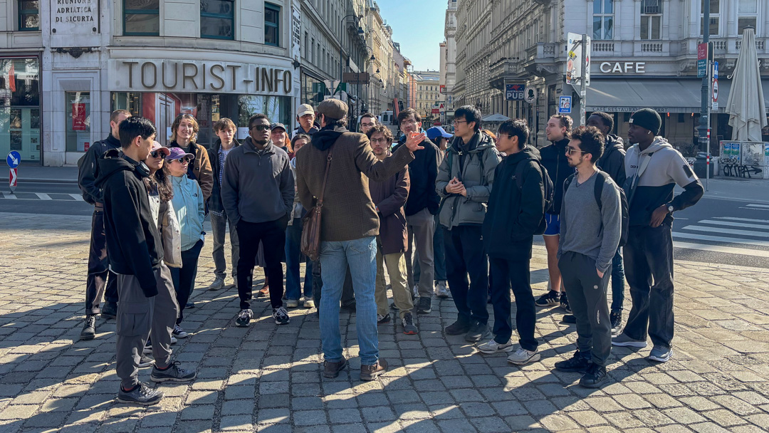
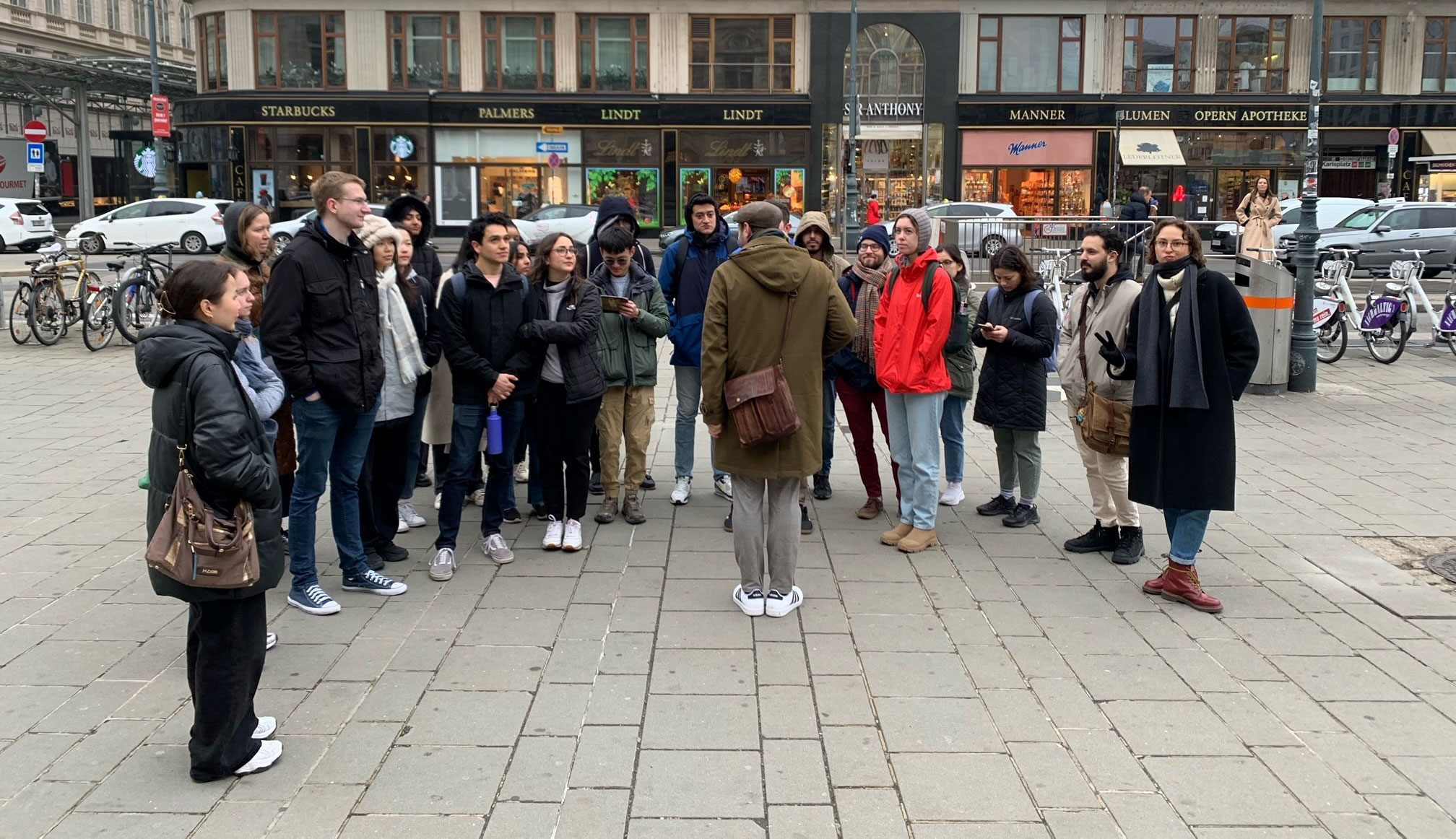
Students of the 15th intake, with our team.On Friday, they attended a city tour offered by a professional guide, Jan Kepinski
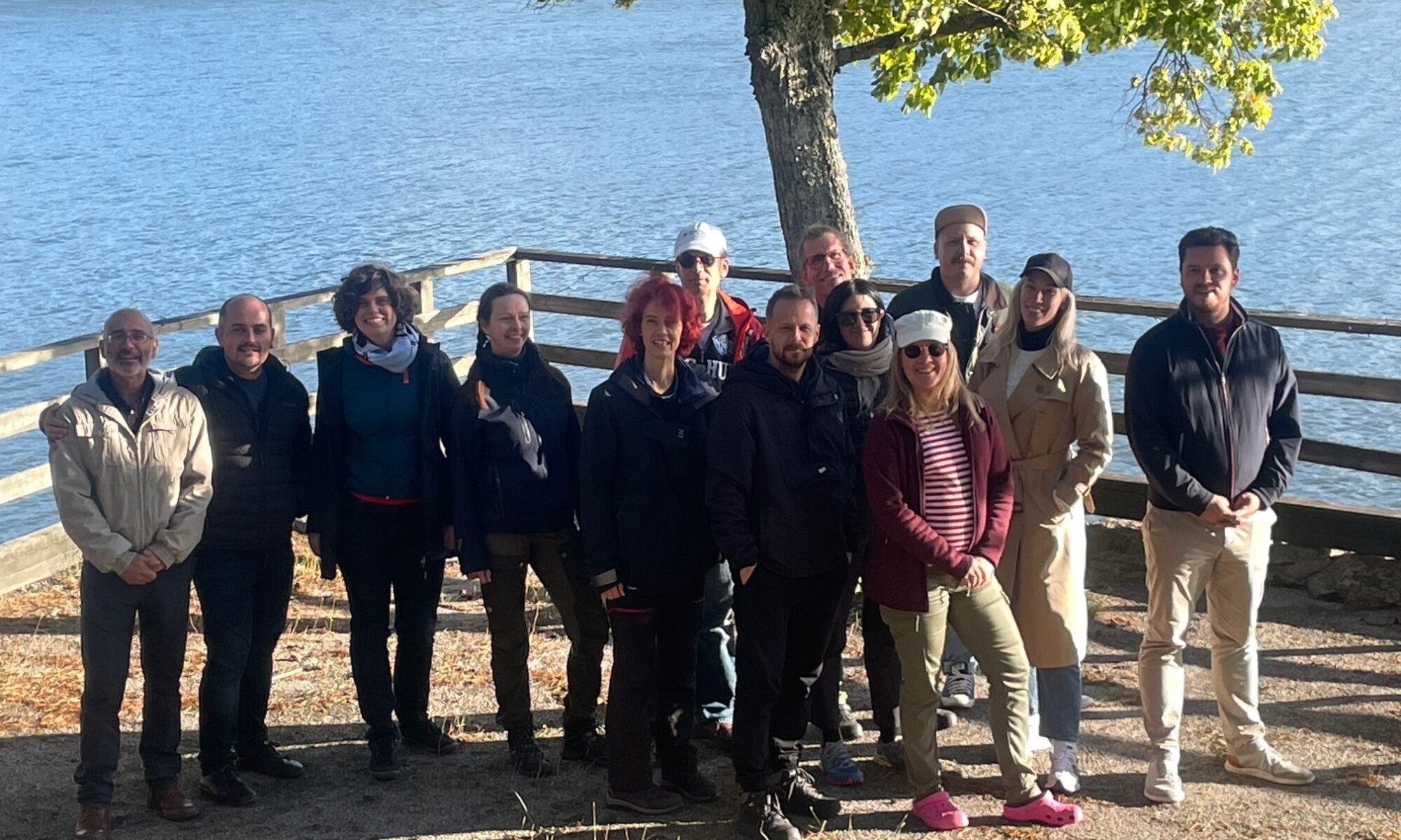
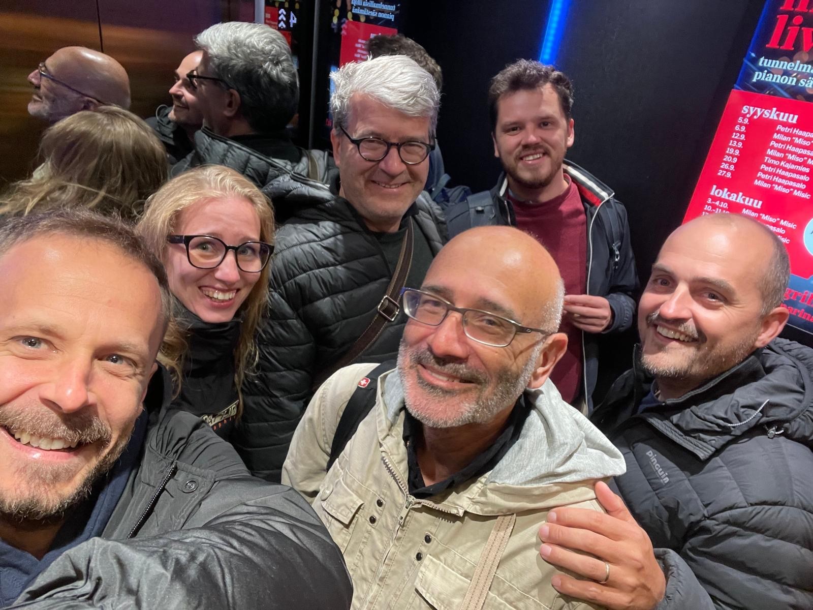
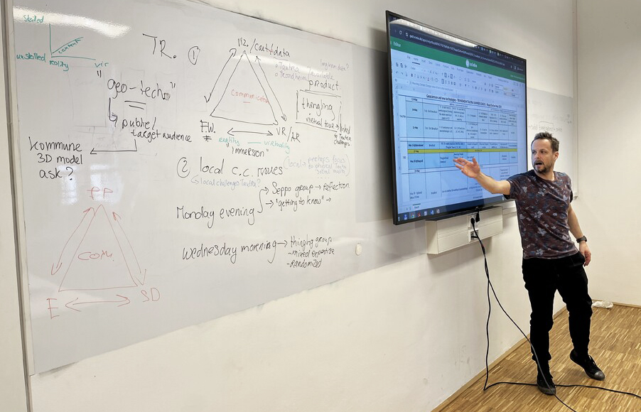
In late September, the international Shape2Gether project team gathered in Turku, Finland, for a productive workshop hosted by the University of Turku. The Research Unit Cartography of TU Wien was represented by Georg Gartner, joining colleagues from seven European universities and the Finnish educational company Seppo to review recent progress, reflect on the outcomes of this summer’s activities, and plan the next stages of the project.
The Shape2Gether project aims to implement innovative approaches in education for sustainable development within the context of climate change and its impacts on Europe. It brings together three key areas of expertise — geosciences, new technologies, and serious game design — to explore how these disciplines can enhance learning and engagement in sustainability-related topics. The long-term vision is to shape a new pan-European curriculum that integrates these elements and to apply for funding to establish an Erasmus Mundus Joint Master’s programme.
Building on three earlier Erasmus+ initiatives — Spationomy 2.0, EduChange 2.0, and DigiGeo — the project seeks to:
contextualise geosciences, technology, and serious games with real-world climate change challenges;
innovate in education for sustainable development (ESD) by addressing local environmental issues;
equip students and educators with competencies to become agents of change;
promote active citizenship and local-level climate action across Europe;
and ultimately develop a new, joint curriculum encapsulating these goals under the Erasmus Mundus Joint Masters scheme.
Over its three-year timeline, Shape2Gether combines short-term staff mobilities and blended student mobilities, centring on summer schools as immersive, five-day learning events. These schools unite students and educators to explore sustainability challenges through geospatial technologies, game-based learning, and collaborative fieldwork. Students learn to apply modern mapping tools, critical thinking, and creative design to address real-world sustainability issues—becoming true “actors of change.”
The recent Turku meeting (22–24 September 2025) provided a valuable opportunity for consortium partners to evaluate feedback from past summer schools in Norway, Malta, and Germany. Participants reflected on the learning outcomes and began drafting the structure of the forthcoming joint curriculum that uniquely combines ESD, new technologies, and gamification.
For TU Wien, the Turku meeting highlighted once again the power of interdisciplinary collaboration and digital innovation in shaping sustainable education. The ongoing cooperation across Europe — uniting geoscientists, educators, and technologists — continues to strengthen our shared commitment to fostering awareness, creativity, and resilience in the face of global climate challenges.
Stay tuned for updates as the consortium continues to design the Shape2Gether curriculum and follow the project on Instagram (@shape2gether) for the latest news from the team!
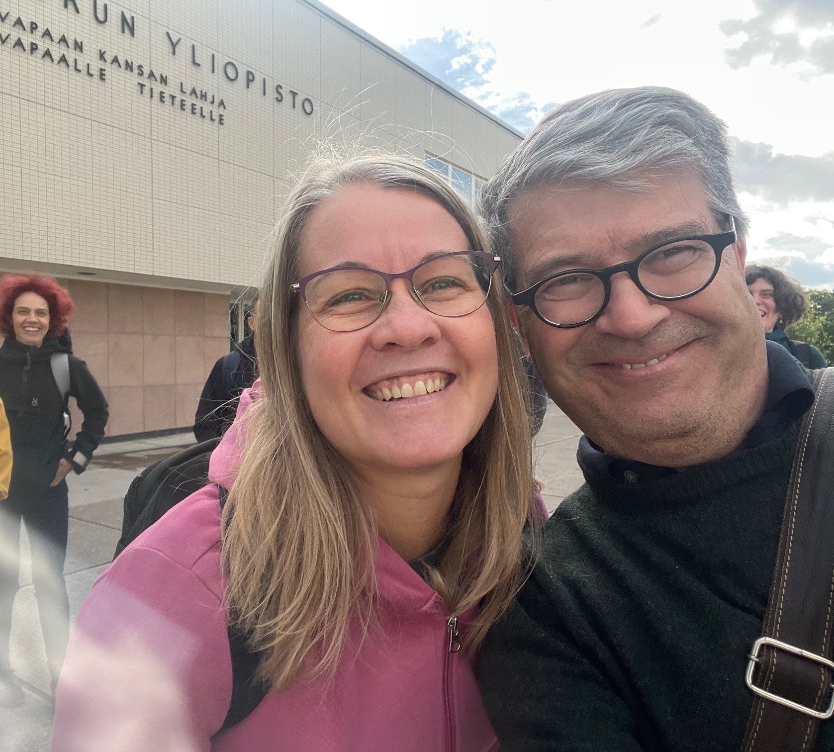
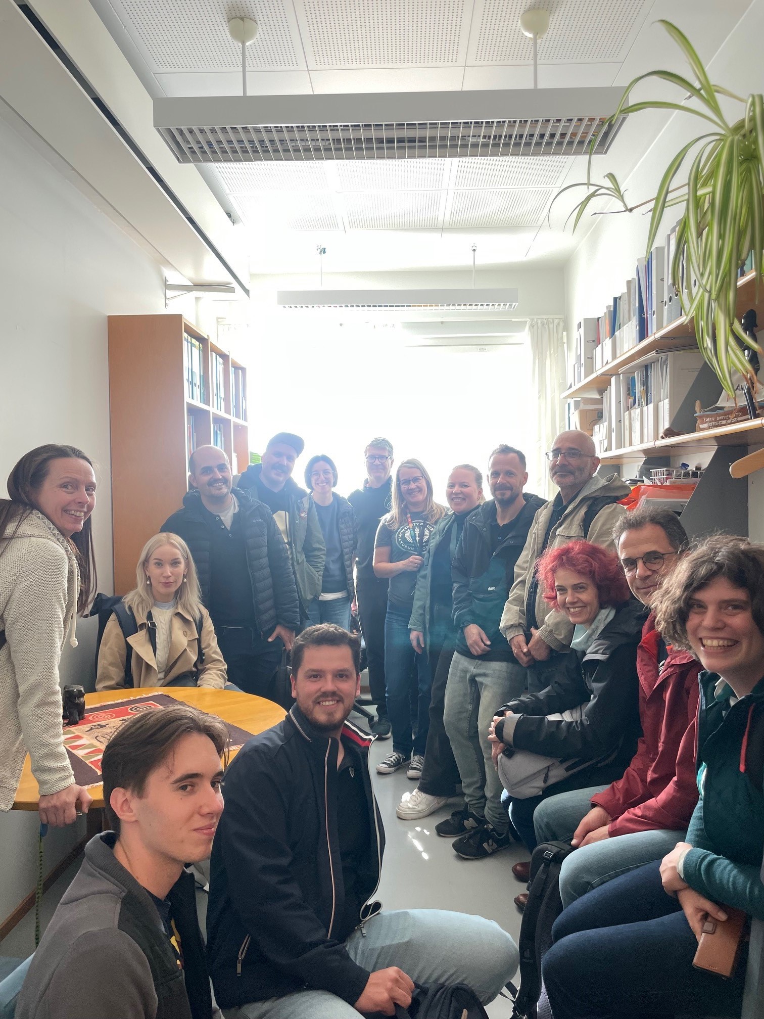
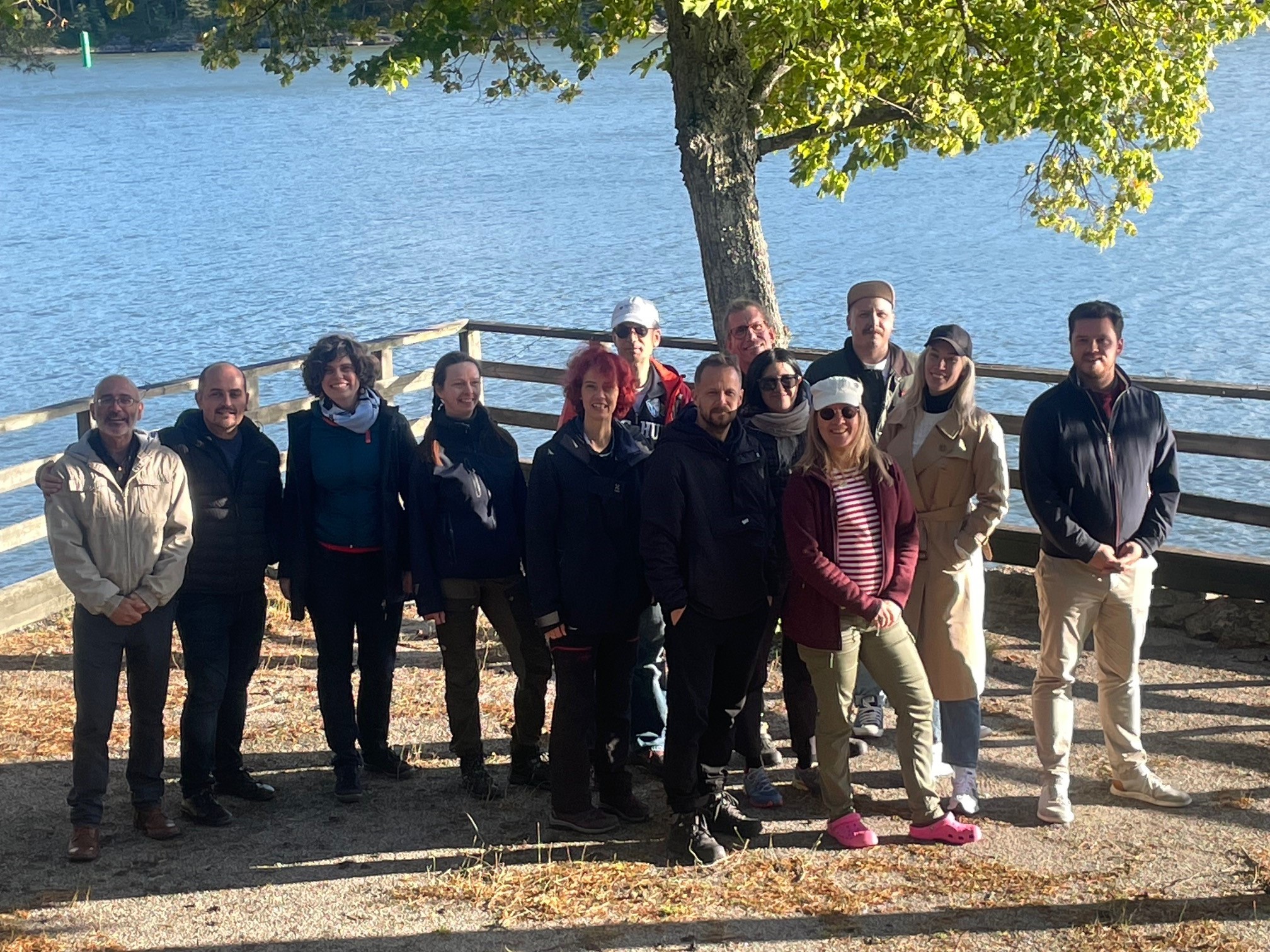
Prof Nina Käyhkö welcoming the TU Wien representativeThe consortium visit at Prof Käykho’s OfficeParticipants of the Shape2Gether project team on their way to workThe project consortium during the field work at the island of Ruissalo
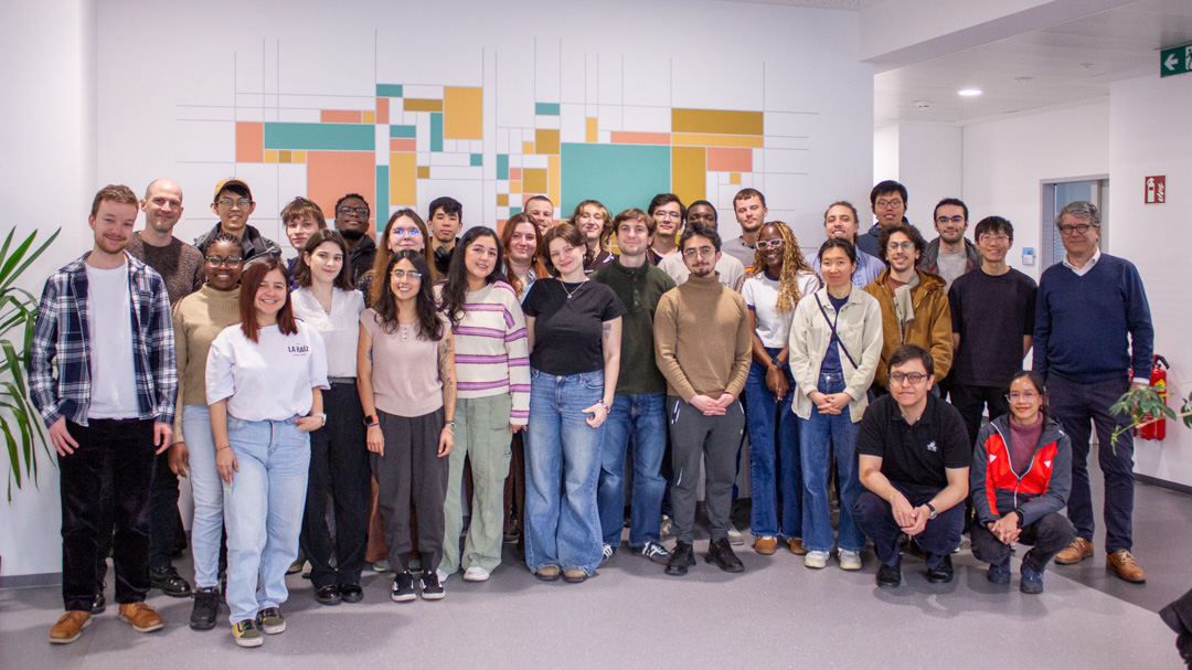
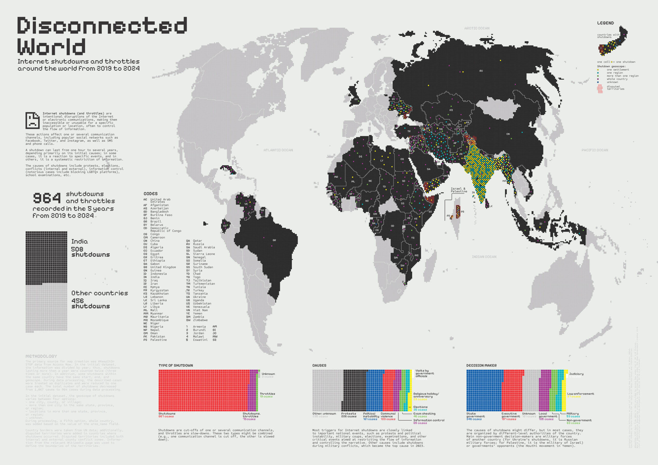
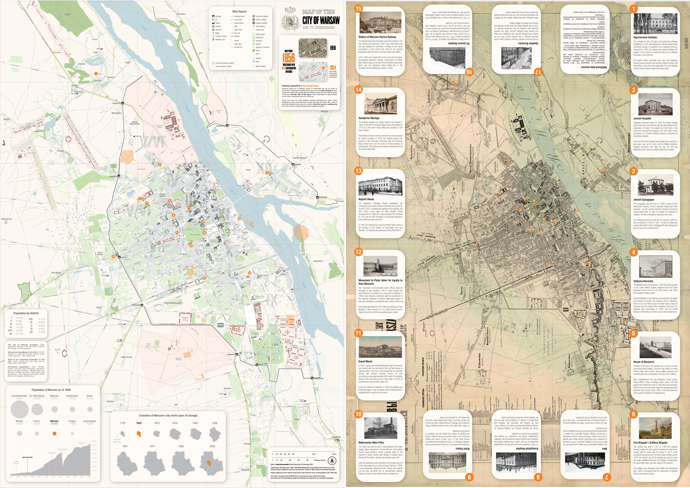
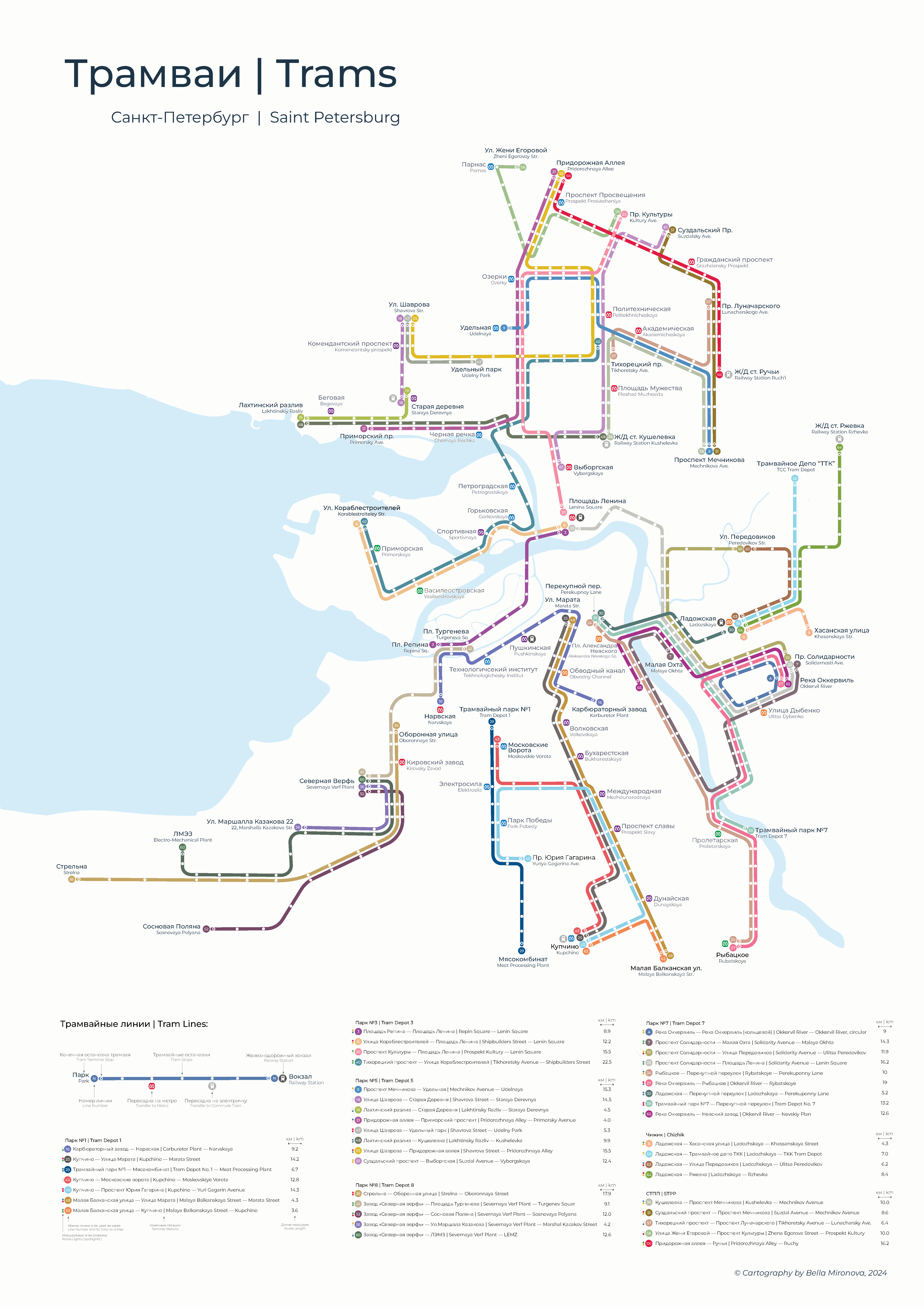
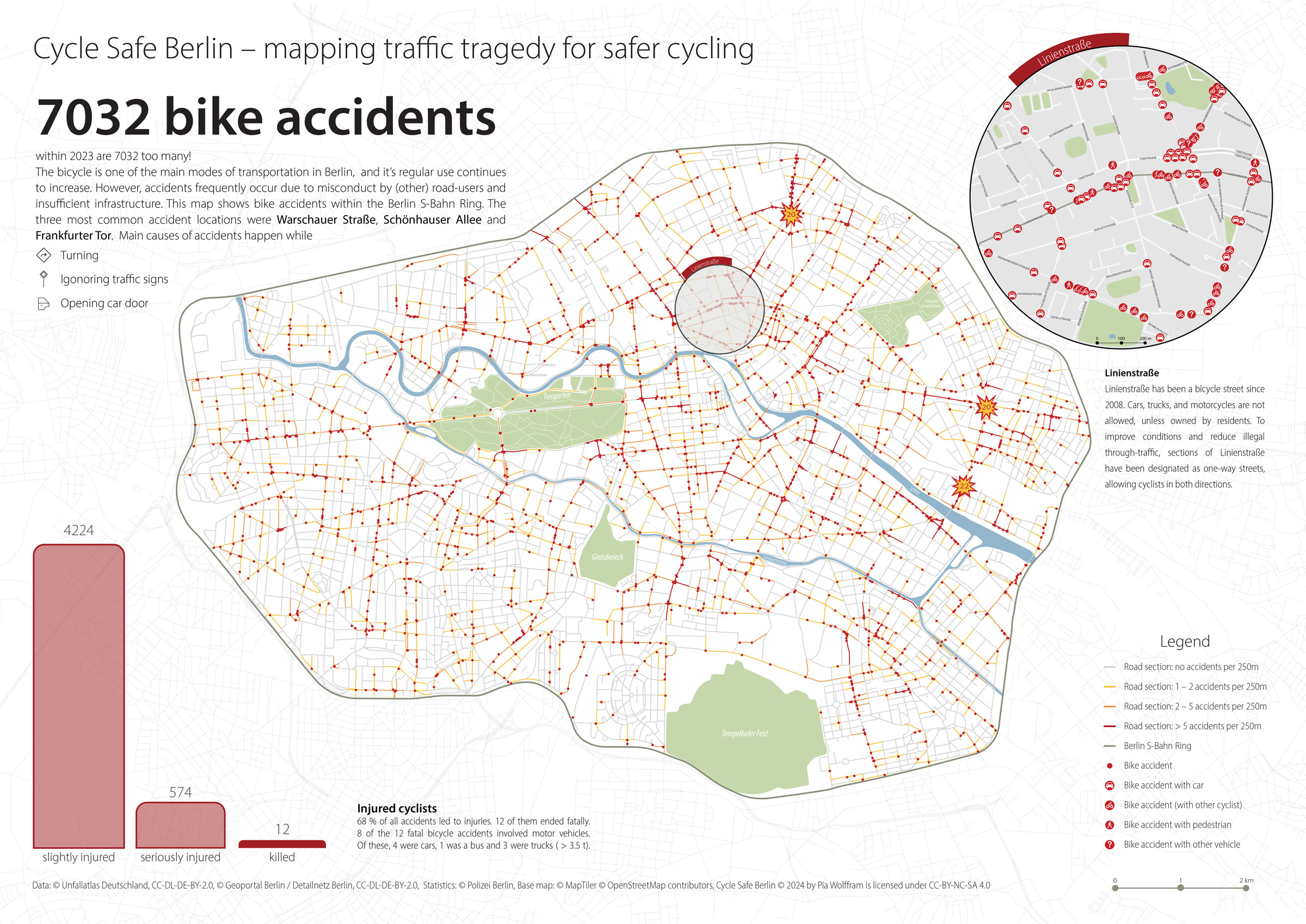
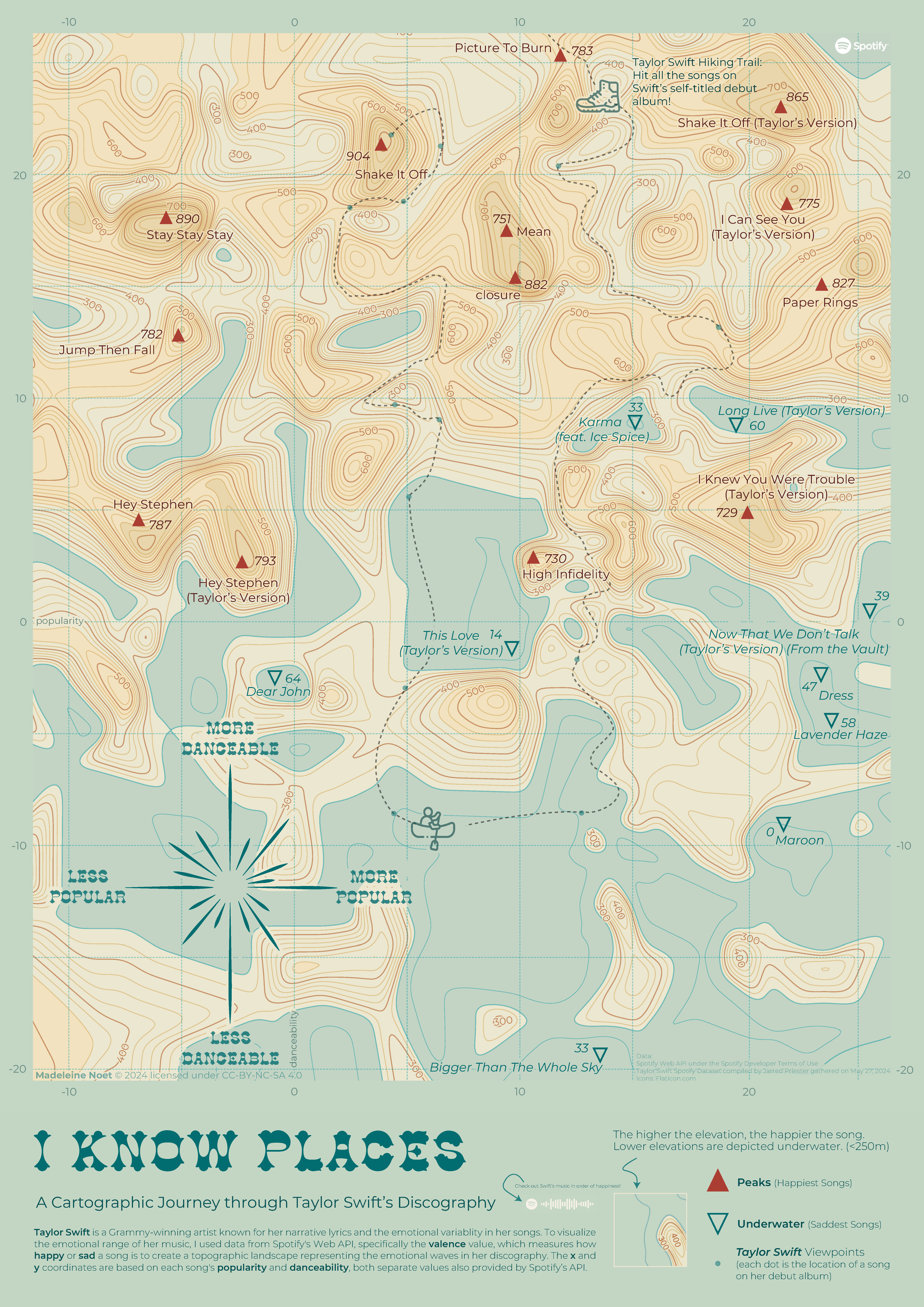
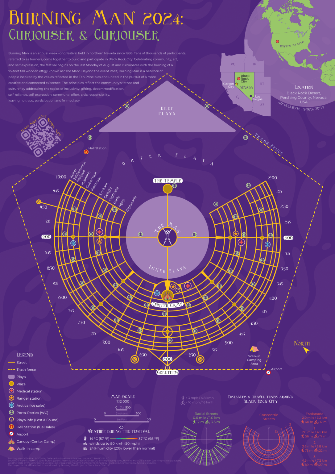
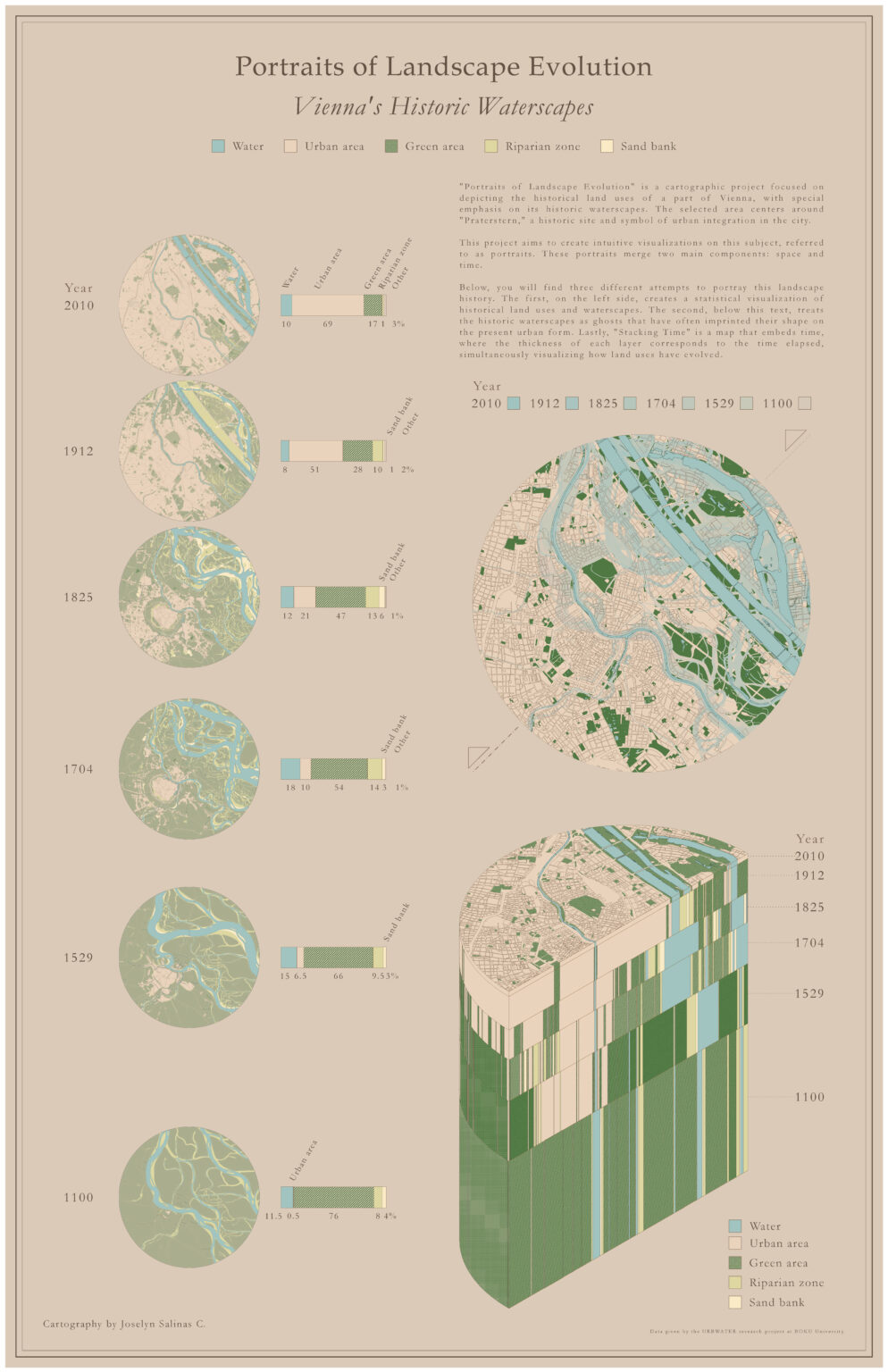
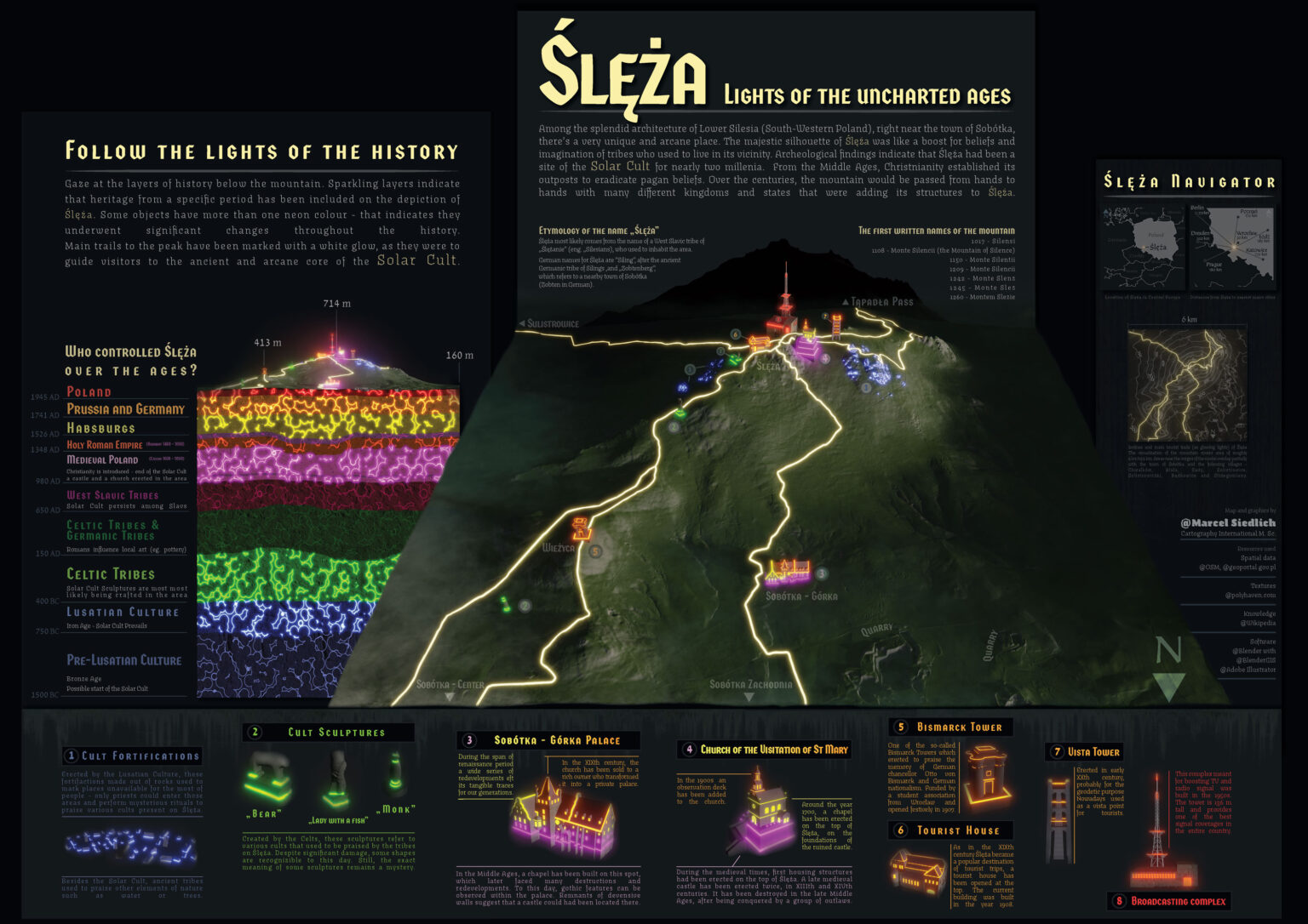
Would you like to see the maps that our students have created? Here, you can view in detail the maps they created for the Project Map Creation course this year, which was supervised by Manuela Schmidt and Camila Narbaitz Sarsur. Enjoy your visit!
Welcome to Vienna! On the 6th of March, the new intake of the International Master in Cartography program started their second semester at the Research Unit Cartography of the TU Wien.
The 31 students, from 24 different countries, will study with us in Vienna for four months. We are very glad to welcome them here and to exchange perspectives and knowledge on cartography!
Students of the 14th intake with Prof. Gartner (right) and the local coordinator, Sacha Schlumpf, MSc (left).City tour with a professional guide, Jan Kepinski.
The 28 students of the 13th intake of the International Master in Cartography have finished their second semester here at TU Wien!
We want to thank them warmly for all their hard work, and especially for their boundless creativity. Over the various courses during the semester, they produced maps of a particularly professional quality.
We wish them all the best for their third semester in Dresden, Germany, and look forward to seeing them again soon!
Twenty-eight students from 17 countries will study with us in Vienna for four months. We are very excited to exchange our different perspectives on cartography and to experience Vienna together!
Students of the 13th intake with Prof. Dr. Gartner (left) and the local coordinator, Sacha Schlumpf, MSc (right).City tour with a professional guide, Jan Kepinski.
We recently concluded a workshop at TU Wien as part of the Shape2Gether project with all eight project partners. Shape2Gether aims to advance education by integrating geosciences, technology, and serious gaming to address climate change and its effects on Europe. During the workshop, we focused on laying the groundwork for three upcoming summer schools in Norway, Malta, and Germany, preparing to welcome students. Each university partner will send four students to accompany us to each summer school.
We’re looking forward to the first summer school scheduled for May 2024 in Tautra and Trondheim, Norway. The summer school will provide students with an immersive educational experience, including hands-on activities like VR, on-site exploration, and group work as an interdisciplinary, international team.
For more information and updates on the project, visit our project webpage.
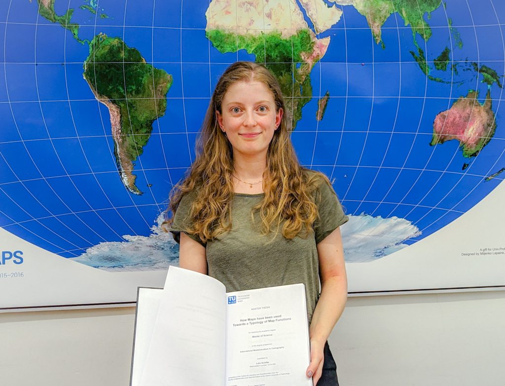
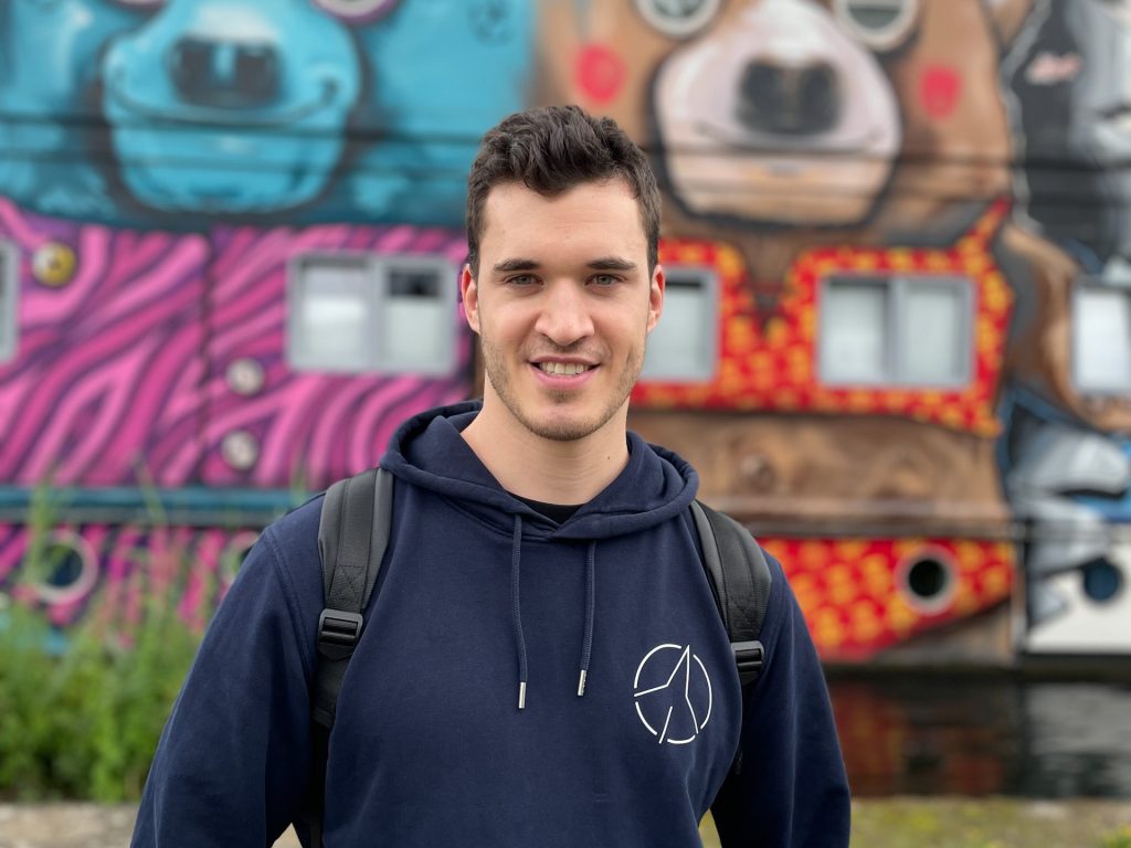
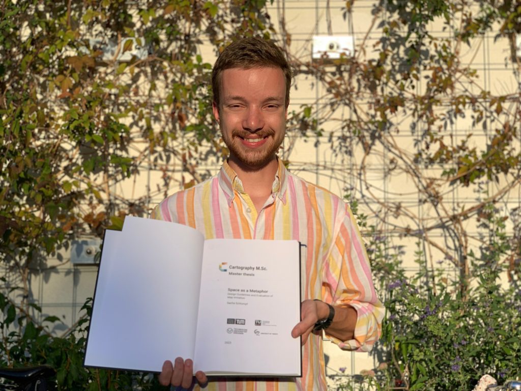
Three students from the 11th intake of the Cartography Master’s program have recently successfully defended their master’s theses at our research unit.
Moreover, celebrating the defence of our programme’s 200th graduate, Julia Schiller, was a special occasion. She defended the thesis on the topic “Typology of Map Functions” under the supervision of Prof. Georg Gartner.
Oskar Baumann introduced his thesis “The Nuances of Mapping Street Art – Developing a Web Map for Interactive Graffity Exploration”. His supervisors were Benjamin Wild and Prof. Norbert Pfeifer from the Research Unit Photogrammetry.
Sacha Schlumpf presented his thesis “Space as a Metaphor”, supervised jointly by Prof. Georg Gartner and Jethro Lennox from HarperCollins Publishers in the UK. Thus, he concluded successful defences of his intake at TU Wien.
Congratulations to them, and all the best in their future explorations!