
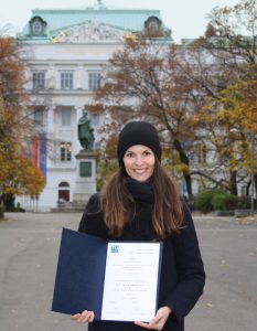
We are proud to announce that Silvia Klettner’s research on cartographic semiotics received TU Wien’s Best Paper Award 2019 from the Faculty of Mathematics and Geoinformation:
Continue reading “Best Paper Award goes to Silvia Klettner”We are proud to announce that Silvia Klettner’s research on cartographic semiotics received TU Wien’s Best Paper Award 2019 from the Faculty of Mathematics and Geoinformation:
Continue reading “Best Paper Award goes to Silvia Klettner”The Research Division Cartography is proud to be participating in this year’s EuroCarto 2020, which is hosted as a virtual event:
All contributions can be found in the detailed conference program.
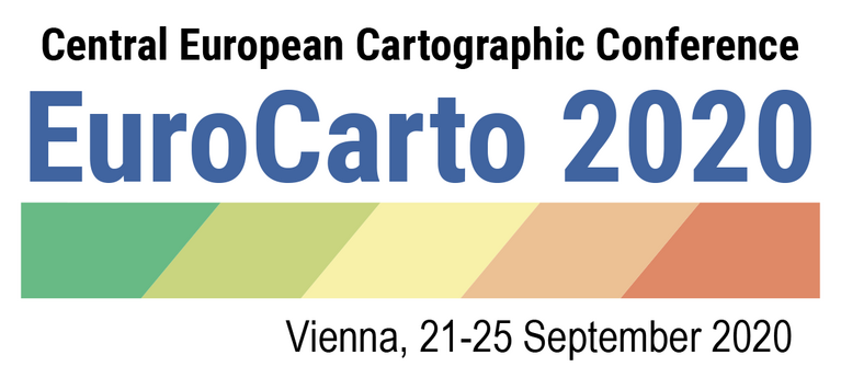
The conference is jointly carried out by the German Society of Cartography (DGfK), the Austrian Cartographic Commission in the Austrian Geographic Society (ÖKK), the Swiss Society of Cartography (SGK), the University of Vienna, and endorsed by the International Cartographic Association. The conference is also recognized as an ICA Regional Cartographic Conference. For all conference details, visit the EuroCarto2020 website at eurocarto2020.org.
As in former semesters, we would like to showcase a selection of extraordinary student projects from this summer semester.
The following maps are results from the class Project Map Creation:

Zion National Park by Anouska Jaspersen (jpg, 5.1mb)

An Urbanist’s Guide to Copenhagen (folder) by Ceren Dolma (animated gif, 2.7mb)

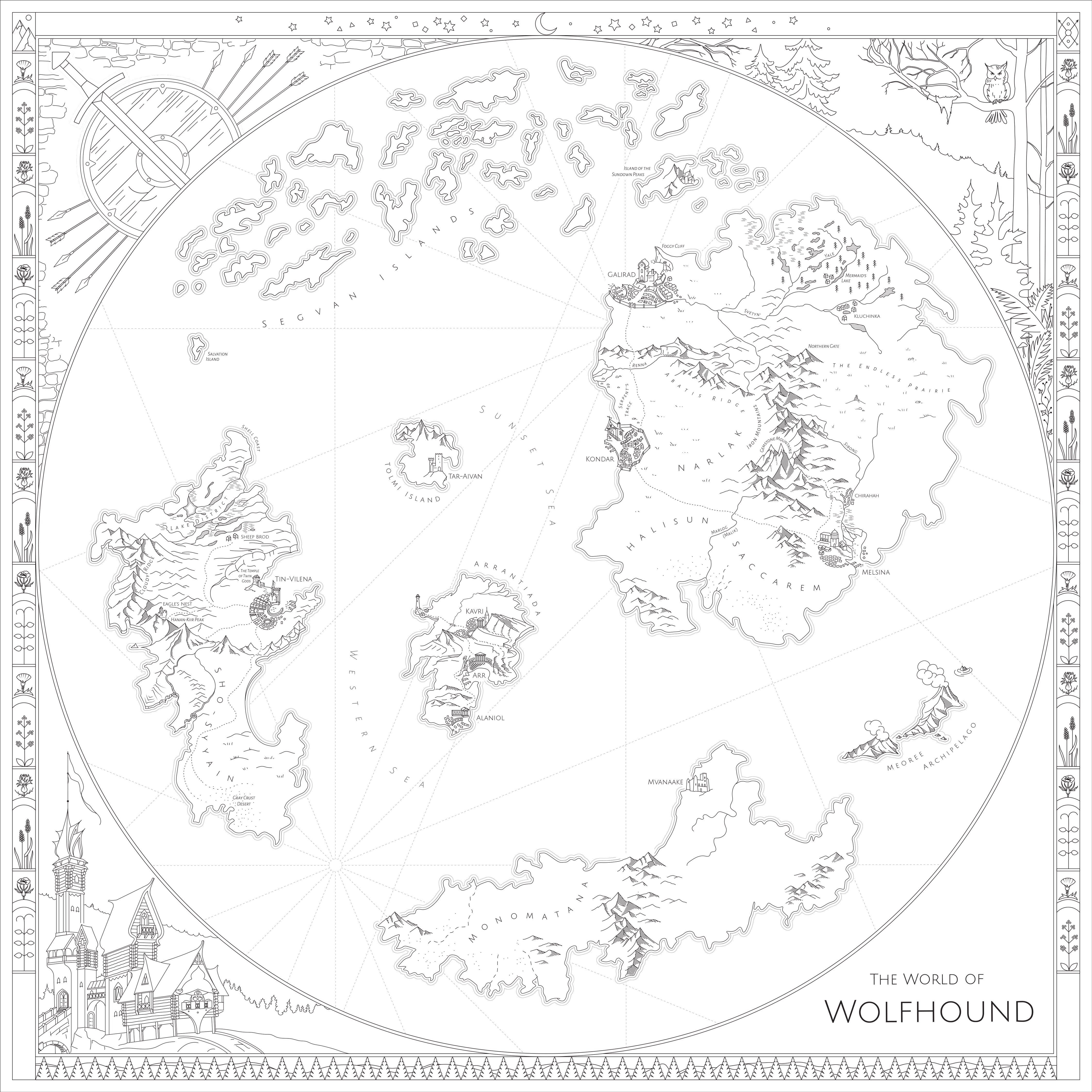
The World of Wolfhound by Milana Glebova (jpg, 2.5mb)

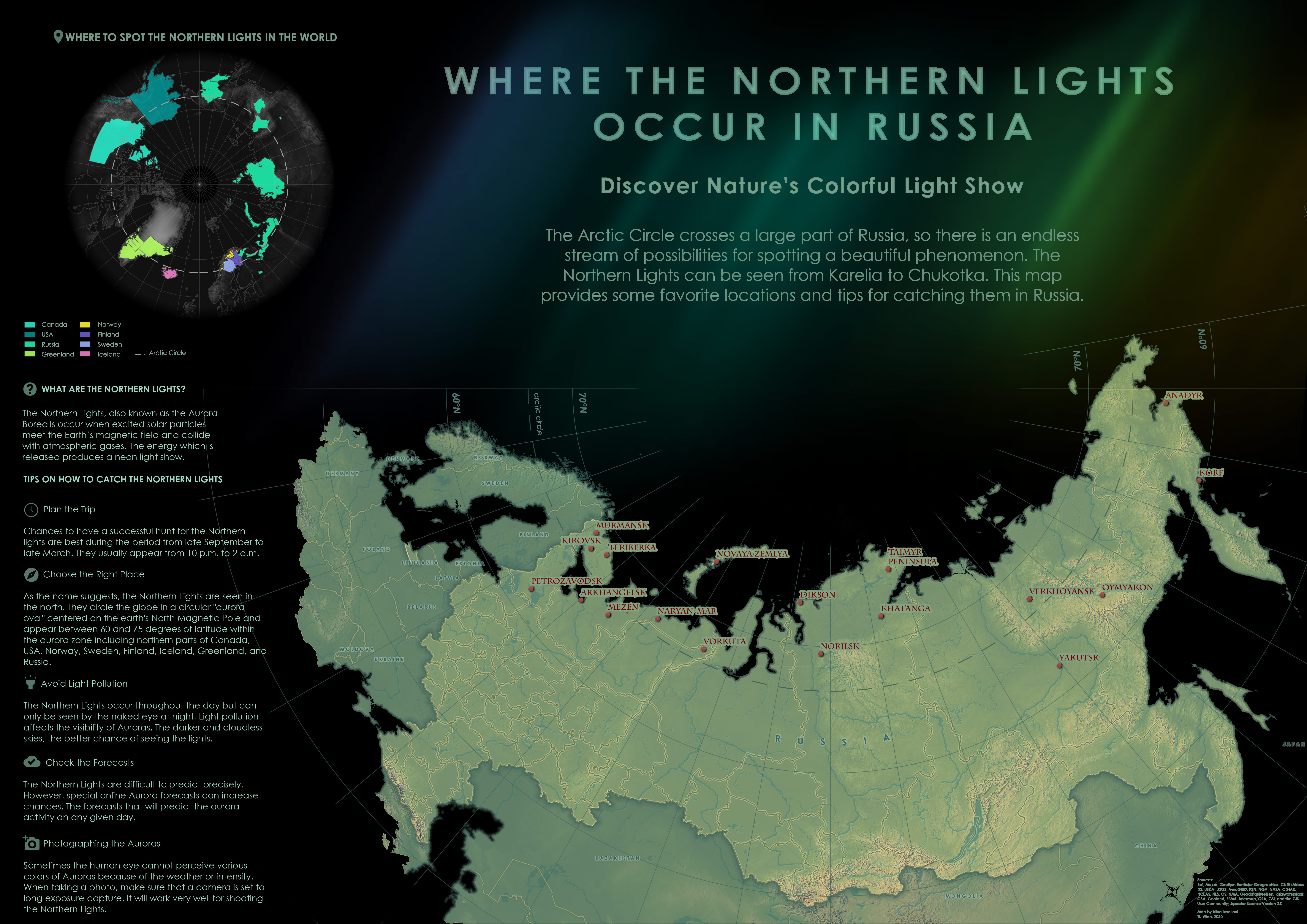
Where the Northern Lights Occur in Russia by Nina Ioseliani (jpg, 3.9mb)

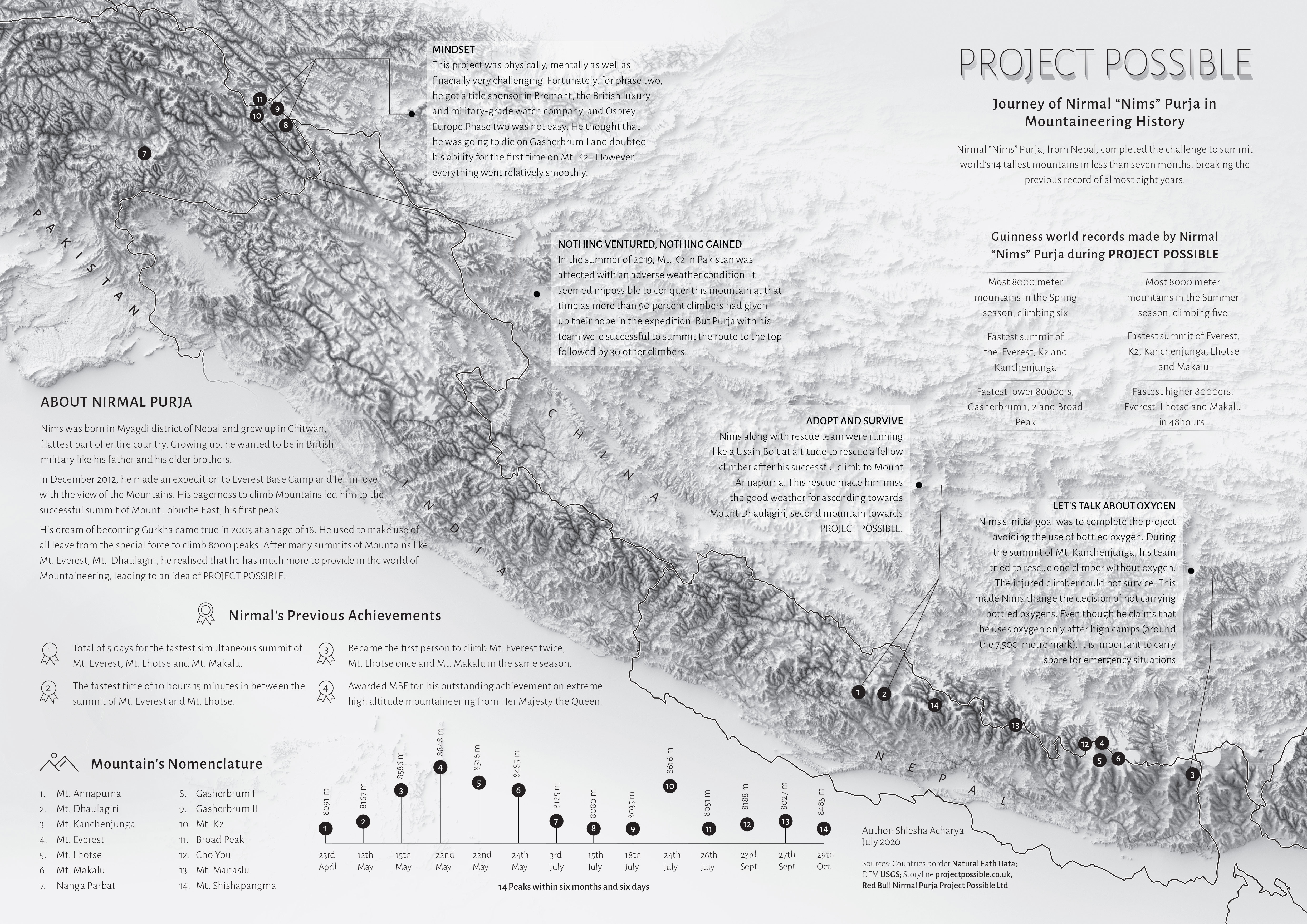
Project Possible – Journey of Nirmal “Nims” Purja in Mountaineering History by Shlesha Acharya (jpg, 3.4mb)

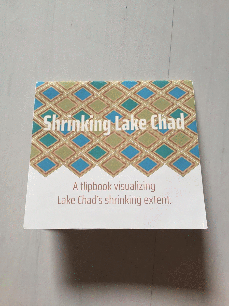
Shrinking Lake Chad (flipbook) by Stephanie Fovenyessy (animated gif, 4.5mb)
The following projects were created within the class Multimedia-Cartography and Geocommunication:
Novaya Zemlya. A carto-cast about Willem Barentsz – a navigator, cartographer and Arctic explorer by Jaspersen Anouska, Kurumbayeva Nargiz, Acharya Shlesha, and Fovenyessy Stephanie: https://storymaps.arcgis.com

100 questions about cartography. A platform aiming at helping to develop an answer to the question “What is cartography?” by Ceren Dolma, Jesse Friend, Mariam Gambashidze, and Jakob Listabarth: https://whatiscartography.netlify.app/

What is cartography? People’s perspectives in a word. A video by Estefania Ruiz Martinez, Sadhman Sadik, Md Imtiaz Uddin, and Julius Nyonyo: www.youtube.com/watch?v=ckMQlxmwoMM

What is Cartography? An interactive animation. An interactive video by Festina Sadiku, Junru Lin, and Mengyao Gao: www.bilibili.com/video/BV1bt4y1Q7A1/

A huge thank you to all students for their hard work in this busy summer semester. Enjoy the summer!
Results from earlier semesters can be found here:
2019 | 2018 | 2017 | 2016 | 2015 | summer 2014 | winter 2014 | 2013 | 2012
The ninth intake of the International Master Programme in Cartography has finished the “Vienna Semester” and is now heading to TU Dresden for their third semester. In a farewell session, we reviewed the summer term and showcased the results of their hard work.
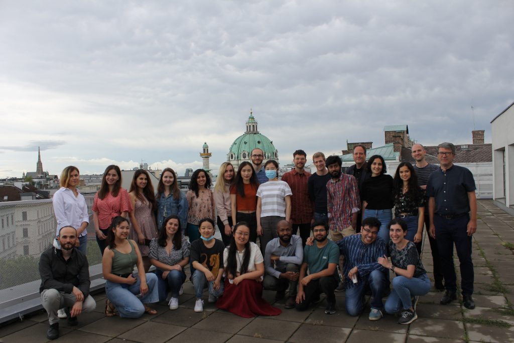
This summer term we had the pleasure to e-host six international guest lecturers who shared their research with our students from the International Master in Cartography:
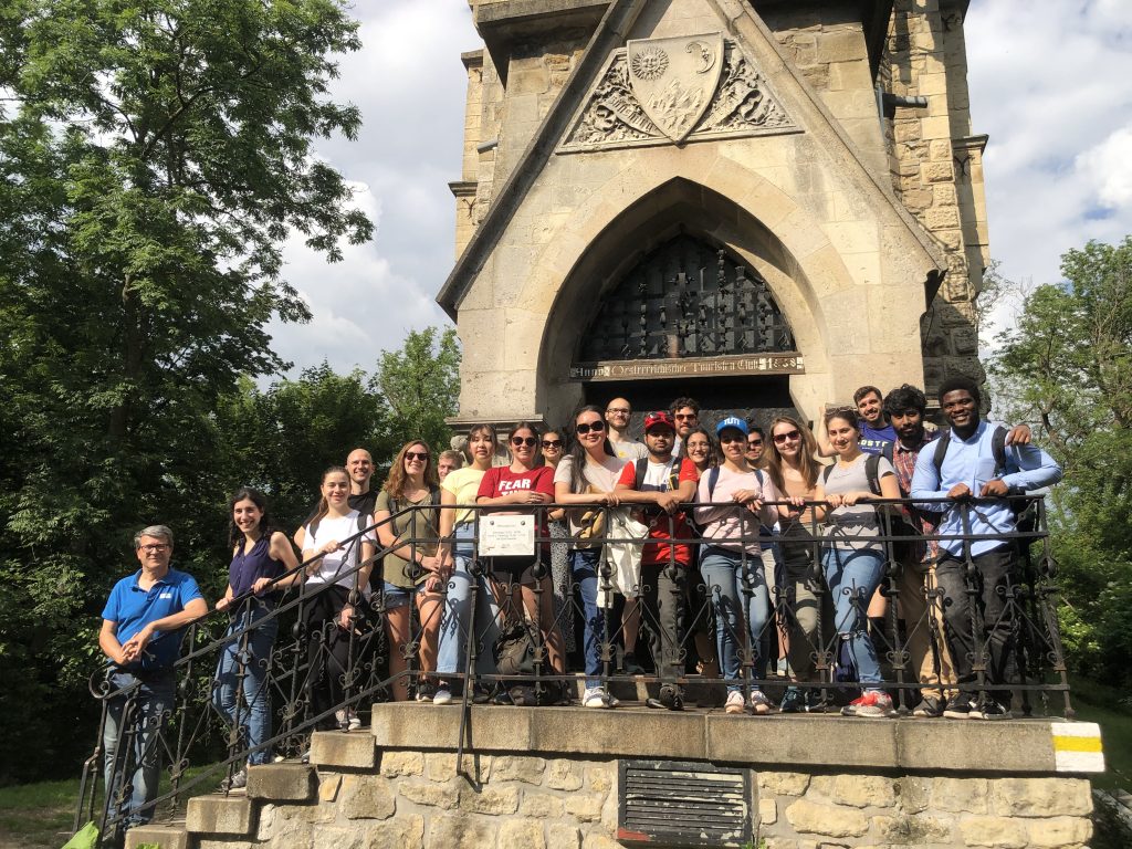
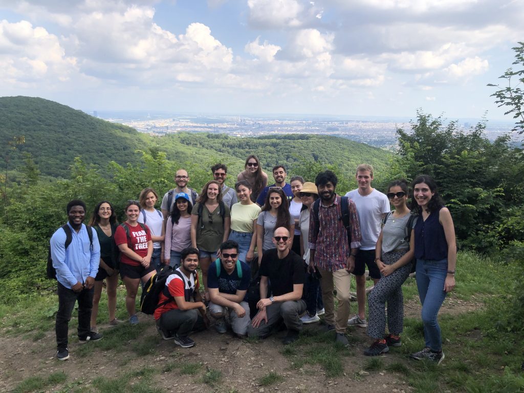
Together with our students of the International Master of Cartography, we went on a hike to Hermannskogel last week. In perfect weather conditions, we reached the highest natural point of Vienna – at 542 metres above sea level. Atop the Hermannskogel, we visited the Habsburgwarte, which marked the kilometre zero in cartographic measurements in Austria-Hungary until 1918.

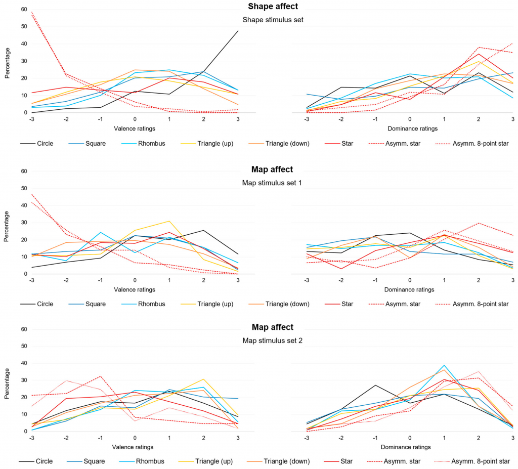
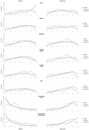
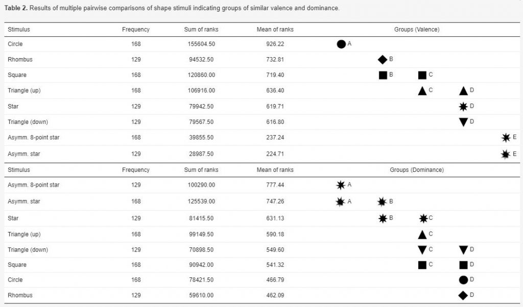
Silvia Klettner’s work on the subtle communication effects of map symbols was recently published in the ISPRS International Journal of Geo-Information in the Special Issue on Geovisualization and Map Design: Klettner, S. (2020). Affective Communication of Map Symbols: A Semantic Differential Analysis. ISPRS International Journal of Geo-Information, 9(5), 289.
Maps enable us to relate to spatial phenomena and events from viewpoints far beyond direct experience. By employing signs and symbols, maps communicate about near as well as distant geospatial phenomena, events, objects, or ideas. Besides acting as identifiers, map signs and symbols may, however, not only denote but also connote. While most cartographic research has focused on the denoting character of visual variables, research from related disciplines stresses the importance of connotative qualities on affect, cognition, and behavior. Hence, this research focused on the connotative character of map symbols by empirically assessing the affective qualities of shape stimuli.
Preview results:

We congratulate Georg Molzer for finishing his Master’s studies with his thesis on “Interactive Web-based 3D Solar Shadow Map“.
Nowadays, the majority of people live in cities, consisting of ever taller building structures, occluding more and more sunlight. Thus, humans are getting increasingly restricted from direct access to the Sun. This thesis claims that a tool, enabling humans to gain a better understanding of solar shadows in cities and around the world, would be beneficial. […] Such a tool should be able to consider relevant three-dimensional occluding structures such as buildings, terrain, and vegetation, as well as the actual Sun position, and visualize respective shadows for arbitrary points in time, providing predictability of solar shadows. […] Therefore, a methodology towards a capable prototype implementation is framed […].
For more details visit the project website shadowmap.org.
Well done and best wishes for your future career!
Dear students,
due to the recommendations of our government, we would like to inform you that:
Please, take care and keep yourselves updated about latest developments at:
Congratulations to our former staff member and PhD Student Haosheng Huang to be appointed as Professor for GIS and Cartography at University Ghent!