
This summer term we had the pleasure to e-host six international guest lecturers who shared their research with our students from the International Master in Cartography:
- Prof. Dariusz Gotlib (TU Warszawa): Selected qualities of mobile maps on the indoor navigation examples
- Prof. Michael Peterson (University of Nebraska Omaha): Paradigms guiding Cartographic Research since the 1950s
- Dr. Amy Griffin (RMIT Melbourne): The User is the Centre of the Universe: Designing Interactive Maps for End Users
- Prof. Philippe de Maeyer (Ghent University): Semiology and Syntaxis in Cartography
- Prof. Philippe de Maeyer (Ghent University): A Brief History of Cartography
- Prof. Menno-Jan Kraak (University of Twente): Maps and Time
- Prof. Rob Roth (University of Wisconsin-Madison): Cartographic Design and Visual Storytelling


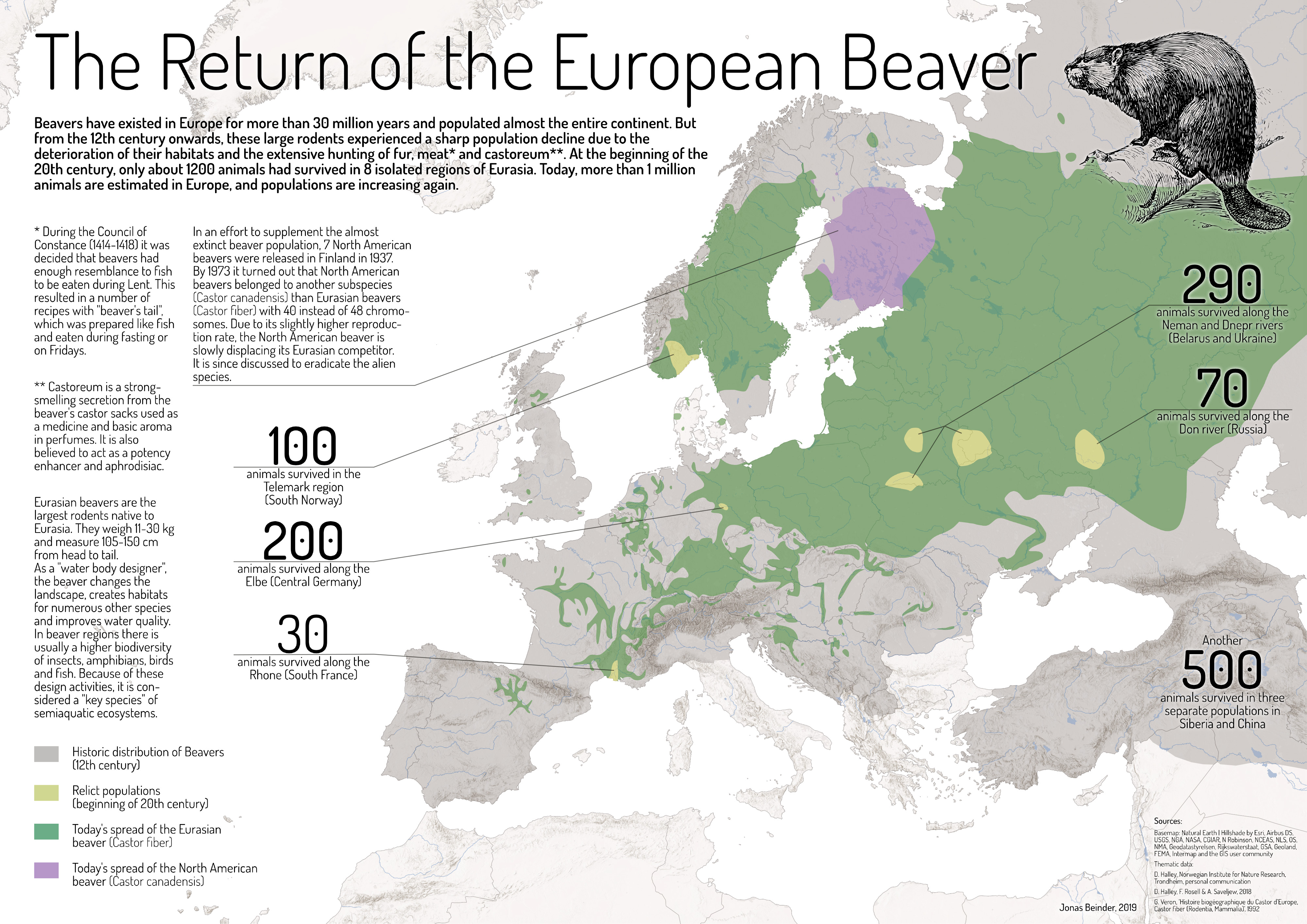
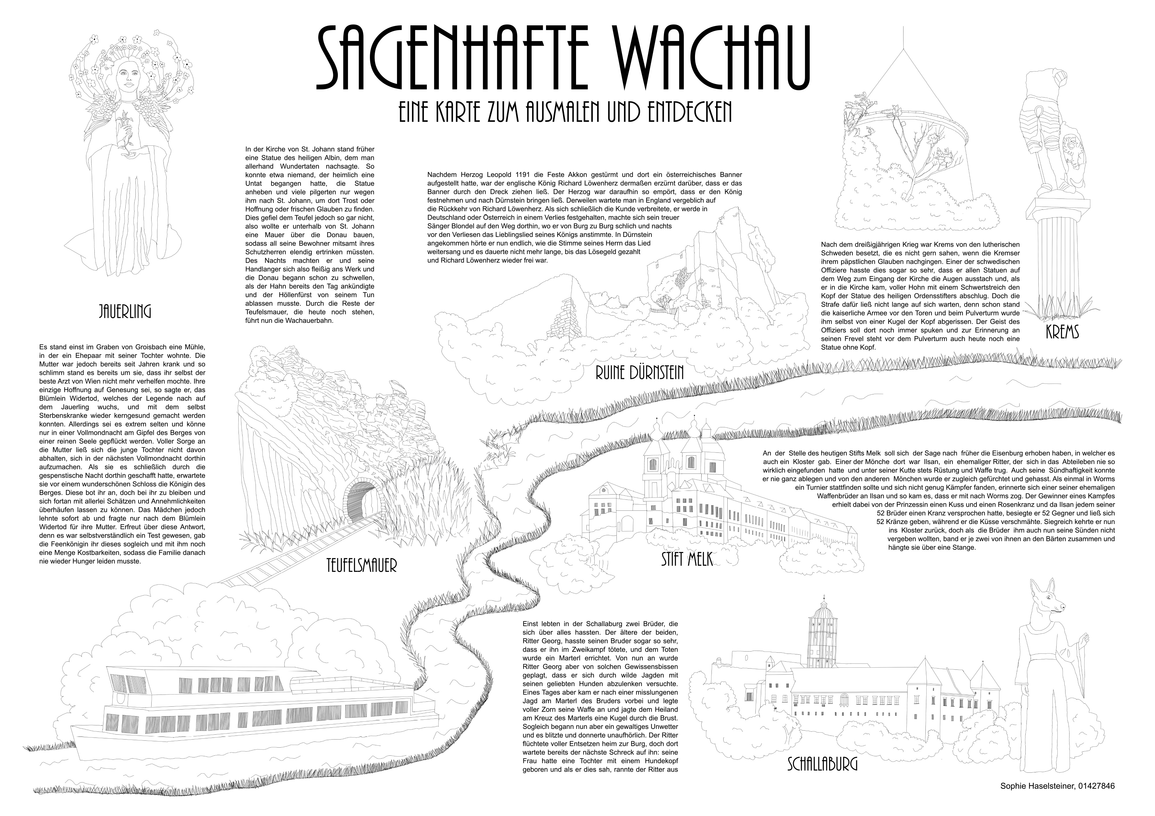
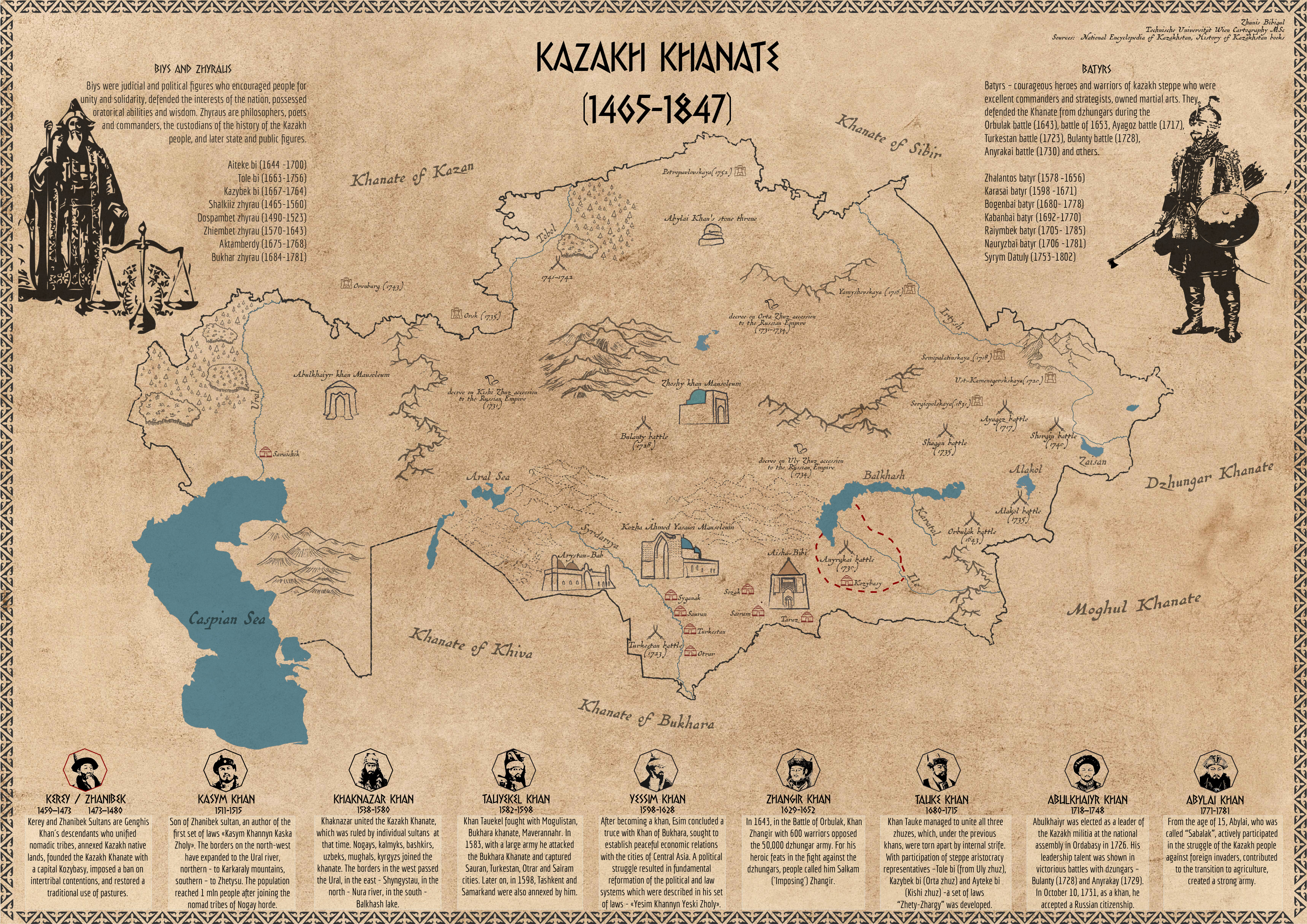
 by Bibigul Zhunis")